R18 NT Alice Springs to Tennant Creek

This route was brought to you by:
RouteXpert Hans van de Ven (Mr.MRA)
Last edit: 17-04-2020
 Route Summary
 Australia is very large; 8 million km2, which is more than 226 times larger than the Netherlands! Has a diversity of flora and fauna; the most diverse types of plants, trees and animals, especially birds and a lot of typical Australian marsupials, which you will not find anywhere else in the world!
Enjoy all the beauty immensely: From the evergreen tropical rainforests, to the vast Outback; from the desert to the countless and peaceful idyllic palm beaches; from the winter sports areas in the southeast to the vibrant and impressive metropolis of Melbourne, Sydney and Perth.
You will see it all and experience it in this amazing tour through Australia, a tour to remember!
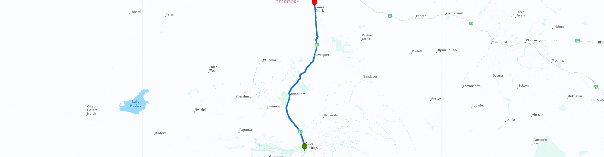
Starting point: Alice Springs, DoubleTree by Hilton Hotel
End Point: Tennant Creek, Goldfields Hotel
The route has been created for TomTom, Garmin and MyRoute-app Navigation users.
ATTENTION: DRIVE LEFT!
 Share this route


Animation

Verdict


Duration
4h 43m

Mode of travel
Car or motorcycle

Distance
511.95 km

Countries

 RouteXpert Review
 Tennant Creek (Warumungu: Jurnkkurakurr) is the seventh largest city in the Northern Territory and is located on the Stuart Highway. At the 2016 census, Tennant Creek had approximately 3,000 residents. Named after a nearby watercourse of the same name, the city is the centerpiece of the vast Barkly Tableland expanses of black earth plains covered in golden Mitchell grass, covering more than 150,000 square miles. Tennant Creek is also close to well-known attractions including the Devils Marbles, Mary Ann Dam, the Battery Hill Mining Center and the Nyinkka Nyunyu Culture Center.
The Warumungu people have lived in the Tennant Creek region for thousands of years. The traditional name for the creek north of where it is now is Jurnkkurakurr. The first European explorer to pass through the region was John McDouall Stuart in 1860, during his failed first attempt to traverse the continent from south to north. He named a creek in the north of the city after John Tennant, a financier of his Port Lincoln expedition, in gratitude for the financial aid that Tennant had provided for Stuart's expeditions across Australia.
The Overland Telegraph that once connected Melbourne to London was built in the 1870s. This is one of the four surviving original telegraph stations in Australia. Tennant Creek was the site of Australia's last gold rush in the 1930s and was the third largest gold producer in Australia at the time. The Tennant Creek Telegraph Station remained an isolated outpost until then.
Cecil Armstrong was a man who contributed to the early development of Tennant Creek. He arrived in April 1935 and started baking bread the next day. In 1937 he built Armstrong's bakery and café, where he lived and worked as a baker and café owner for over twenty years. The building is still there, albeit under a different form. Cecil's phone number was simply number 1, and his mailbox was also number 1.
Gold mining was virtually shut down in Tennant Creek in 1942. The only mine that remained operational was a large mine with its own crushing plant. During World War II, the Australian Army established the 55th Australian Camp Hospital near Tennant Creek. The Royal Australian Air Force used Tennant Creek Airfield as an emergency landing site.
Aboriginal businesses and organizations generate economic activity for Tennant Creek by providing a range of services to the city's urban and rural communities. Nyinkka Nyunyu Arts and Cultural Center opened in July 2003 and offers visitors and the community the opportunity to learn more about Aboriginal life, history and culture.
This route also goes through the outback, these are the regions that are far from civilization. The outback covers nearly three-quarters of Australia and extends mainly across the Northern Territory and Western Australia, and parts of the states of Queensland, New South Wales and South Australia.
The term outback includes various landscapes and climatic zones. Large parts of the outback in Western Australia are inaccessible: sometimes there is no rain here in years, while in summer the temperature rises above 50 ° C. The Queensland outback, on the other hand, consists partly of tropical rainforest.
The characteristics of the outback are:
- Only a few paved roads are present. Farms (stations) are often located on sandy paths that can only be driven with off-road vehicles. It is no exception when a farm is 80 kilometers from the paved road.
- Farms are self-catering. It is no problem if a supermarket cannot be visited for weeks.
- Settlements with several houses, a gas station, a supermarket, a garage, a bank and catering facilities are hundreds of kilometers apart.
- Children receive remote education via radio (School of the Air) and the Internet.
- In the event of serious illness and accident, the Royal Flying Doctor Service (RFDS) is called upon.
Camels were imported from the Middle East in 1870. They live partly on farms, partly in the wild.
- Of the approximately 300,000 Aborigines (approximately 1.5% of Australia's total population), approximately 20% live in the outback, most of them in reservations.
This 4-star rated route is all about the Stuart Highway, making a day of miles so to speak. Take your time at the various stops along the way to refuel, eat or drink. And of course to take some pictures.
General info:
The Northern Territory consists of the originally northern part of the state of South Australia. However, this is again contested by the state of Western Australia, as the heir to New Holland. It is now an area with limited self-government, has an area of 1,349,129 km² and a quarter of a million inhabitants. The population density is extremely low with one inhabitant on five square kilometers. The capital is Darwin, the northernmost city in the country.
The Territory, has the image of a large nature reserve and the few inhabitants like to describe themselves as tough, hardy nature people. Two of the most visited natural areas in Australia are located in the Northern Territory: the tropical Kakadu National Park in the north and the world-famous Uluṟu-Kata Tjuṯa National Park in the south (Uluṟu used to be known as Ayers Rock). The province is also home to the wonderful Devils Marbles Conservation Reserve.
Most of the Simpson Desert is in the southeast corner, while the Tanami Desert is in the west. The MacDonnell Mountains extend east and west from Alice Springs. Arnhemland, a large area belonging to the Aboriginal population, is located to the north of the territory, and the Barkly Plateau to the northeast.
The entire Northern Territory has only two cities: Darwin and Palmerston. Other places include Alice Springs, Katherine, Tennant Creek, and Jabiru.
The Northern Territory is home to only 1% of Australia's total population, more than half of whom live in the capital, Darwin. 32.5% of these are Aborigines.


 Links
Links  Usage
Usage Want to download this route?
You can download the route for free without MyRoute-app account. To do so, open the route and click 'save as'. Want to edit this route?
No problem, start by opening the route. Follow the tutorial and create your personal MyRoute-app account. After registration, your trial starts automatically.  Disclaimer
Use of this GPS route is at your own expense and risk. The route has been carefully composed and checked by a MyRoute-app accredited RouteXpert for use on TomTom, Garmin and MyRoute-app Navigation.
Changes may nevertheless have occurred due to changed circumstances, road diversions or seasonal closures. We therefore recommend checking each route before use.
Preferably use the route track in your navigation system. More information about the use of MyRoute-app can be found on the website under 'Community' or 'Academy'.