R21 NT Tumbling Waters to Red Lily

This route was brought to you by:
RouteXpert Hans van de Ven (Mr.MRA)
Last edit: 02-05-2020
 Route Summary
 Australia is very large; 8 million km2, which is more than 226 times larger than the Netherlands! Has a diversity of flora and fauna; the most diverse types of plants, trees and animals, especially birds and a lot of typical Australian marsupials, which you will not find anywhere else in the world!
Enjoy all the beauty immensely: From the evergreen tropical rainforests, to the vast Outback; from the desert to the countless and peaceful idyllic palm beaches; from the winter sports areas in the southeast to the vibrant and impressive metropolis of Melbourne, Sydney and Perth.
You will see it all and experience it in this amazing tour through Australia, a tour to remember!
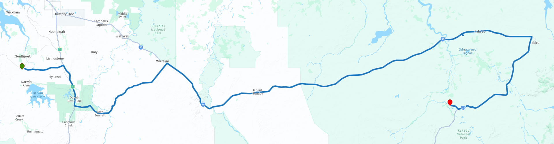
Starting point: Tumbling Waters, Holiday Park
End point: Kakadu, Gagudju Lodge Cooinda
The route has been created for TomTom, Garmin and MyRoute-app Navigation users.
ATTENTION: DRIVE LEFT!
 Share this route


Animation

Verdict


Duration
3h 29m

Mode of travel
Car or motorcycle

Distance
307.72 km

Countries

 RouteXpert Review
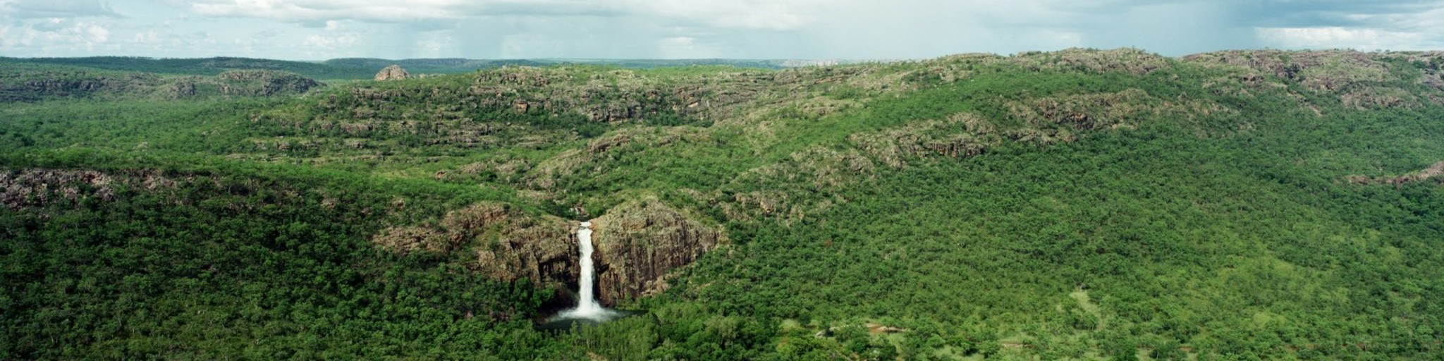
 Kakadu is best known for wetlands, although tree savannas cover approximately eighty percent of the park's area. The wetlands are located every three Alligator Rivers. The name "alligator" erroneously refers to the sea crocodile and was given by English settlers who had previously come into contact with real alligators in the United States. The West Alligator River is the smallest of the three rivers. The East Alligator River forms the boundary between Kakadu and Arnhemland. The South Alligator River is located in the middle of Kakadu and with a length of 200 km it is the largest river in the world, which lies entirely in one national park. In the rainy season, the rivers increase in size and surrounding areas flood. Large parts of Kakadu become impassable during this period. In the dry season, Kakadu is best visited because the roads become passable and the animals retreat to permanent wetlands such as the Yellow Waters Billabong and the Mamukala Wetlands and are thus more visible. In addition to the wetlands and tree savannas, there are also rocky areas in the south and east of Kakadu, which are part of the Arnhemland plateau. You can get to know Kakadu with its nature and cultural background through various walking routes and organized (boat) trips.
This route also goes through the outback, these are the regions that are far from civilization. The outback covers nearly three-quarters of Australia and mainly covers the Northern Territory and Western Australia, and parts of the states of Queensland, New South Wales and South Australia.
The term outback includes various landscapes and climatic zones. Large parts of the outback in Western Australia are inaccessible: sometimes there is no rain here in years, while in summer the temperature rises above 50 ° C. The Queensland outback, on the other hand, consists partly of tropical rainforest.
The characteristics of the outback are:
- Only a few paved roads are present. Farms (stations) are often located on sandy paths that can only be driven with off-road vehicles. It is no exception when a farm is 80 kilometers from the paved road.
- Farms are self-catering. It is no problem if a supermarket cannot be visited for weeks.
- Settlements with several houses, a gas station, a supermarket, a garage, a bank and catering facilities are hundreds of kilometers apart.
- Children receive remote education via radio (School of the Air) and the Internet.
- In the event of serious illness and accident, the Royal Flying Doctor Service (RFDS) is called upon.
Camels were imported from the Middle East in 1870. They live partly on farms, partly in the wild.
- Of the approximately 300,000 Aborigines (approximately 1.5% of Australia's total population), approximately 20% live in the outback, most of them in reservations.
This 4-star rated route is on both paved and unpaved roads, again a slightly shorter route, so it is nice to have more time to visit the Bowali visitor center and the Warradjan Culture Center to learn more about the area and their inhabitants.
General info:
The Northern Territory consists of the originally northern part of the state of South Australia. However, this is again contested by the state of Western Australia, as the heir to New Holland. It is now an area with limited self-government, has an area of 1,349,129 km² and a quarter of a million inhabitants. The population density is extremely low with one inhabitant on five square kilometers. The capital is Darwin, the northernmost city in the country.
The Territory, has the image of a large nature reserve and the few inhabitants like to describe themselves as tough, hardy nature people. Two of the most visited natural areas in Australia are located in the Northern Territory: the tropical Kakadu National Park in the north and the world-famous Uluṟu-Kata Tjuṯa National Park in the south (Uluṟu used to be known as Ayers Rock). The province is also home to the wonderful Devils Marbles Conservation Reserve.
Most of the Simpson Desert is in the southeast corner, while the Tanami Desert is in the west. The MacDonnell Mountains extend east and west from Alice Springs. Arnhemland, a large area belonging to the Aboriginal population, is located to the north of the territory, and the Barkly Plateau to the northeast.
The entire Northern Territory has only two cities: Darwin and Palmerston. Other places include Alice Springs, Katherine, Tennant Creek, and Jabiru.
The Northern Territory is home to only 1% of Australia's total population, more than half of whom live in the capital, Darwin. 32.5% of these are Aborigines.


 Links
Links  Usage
Usage Want to download this route?
You can download the route for free without MyRoute-app account. To do so, open the route and click 'save as'. Want to edit this route?
No problem, start by opening the route. Follow the tutorial and create your personal MyRoute-app account. After registration, your trial starts automatically.  Disclaimer
Use of this GPS route is at your own expense and risk. The route has been carefully composed and checked by a MyRoute-app accredited RouteXpert for use on TomTom, Garmin and MyRoute-app Navigation.
Changes may nevertheless have occurred due to changed circumstances, road diversions or seasonal closures. We therefore recommend checking each route before use.
Preferably use the route track in your navigation system. More information about the use of MyRoute-app can be found on the website under 'Community' or 'Academy'.