R22 NT Red Lily to Darwin

This route was brought to you by:
RouteXpert Hans van de Ven (Mr.MRA)
Last edit: 09-05-2020
 Route Summary
 Australia is very large; 8 million km2, which is more than 226 times larger than the Netherlands! Has a diversity of flora and fauna; the most diverse types of plants, trees and animals, especially birds and a lot of typical Australian marsupials, which you will not find anywhere else in the world!
Enjoy all the beauty immensely: From the evergreen tropical rainforests, to the vast Outback; from the desert to the countless and peaceful idyllic palm beaches; from the winter sports areas in the southeast to the vibrant and impressive metropolis of Melbourne, Sydney and Perth.
You will see it all and experience it in this amazing tour through Australia, a tour to remember!
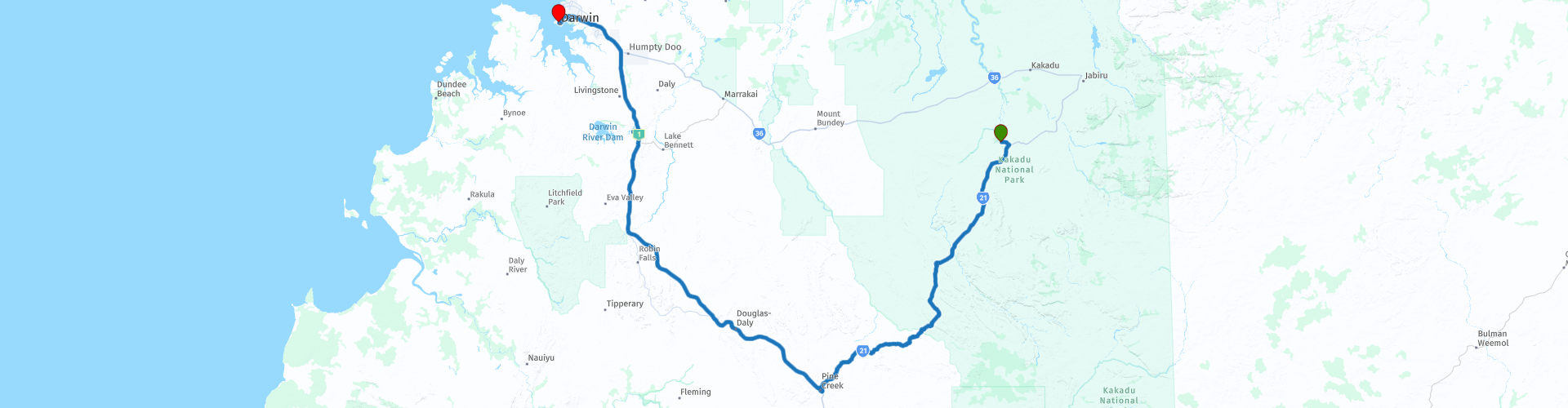
Starting point: Kakadu, Gagudju Lodge Cooinda
End point: Darwin, DoubleTree by Hilton Hotel Esplanade
The route has been created for TomTom, Garmin and MyRoute-app Navigation users.
ATTENTION: DRIVE LEFT!
 Share this route


Animation

Verdict


Duration
4h 26m

Mode of travel
Car or motorcycle

Distance
402.21 km

Countries

 RouteXpert Review
 The Darwin region, like much of the Top End, experiences a tropical climate with a wet and dry season. A period known locally as "the build-up" leading up to Darwin's wet season sees temperatures and humidity rise. Darwin's wet season usually arrives in late November to early December, bringing heavy monsoon rains, spectacular lightnings, and increased cyclone activity. During the dry season, the city has clear skies and a mild sea breeze from the harbor.
The greater Darwin area is the ancestral home of the Larrakia people. On September 9, 1839, the HMS Beagle entered the port of Darwin while exploring the area. John Clements Wickham named the region "Port Darwin" in honor of their former shipmate Charles Darwin, who had sailed with them on the ship's previous voyage, which ended in October 1836. The settlement there became the town of Palmerston in 1869, but it was renamed Darwin in 1911. The city has been almost completely rebuilt four times, after the destruction caused by Cyclone 1897, Cyclone 1937, Japanese air raids during World War II, and Cyclone Tracy in 1974.
Darwin was home to Australian and American pilots during the war, with airstrips built in and around Darwin. Today Darwin offers a stage for military exercises. Darwin was a mandatory stopover / checkpoint in the 1934 London to Melbourne Centenary Air Race. The race's official name was the MacRobertson Air Race. Winners of the big race were Tom Campbell Black and CWA Scott.
The Australian Aviation Heritage Center is located about 5 miles (8 km) from the city center on the Stuart Highway and is one of only two places outside the United States where a B-52 bomber can be seen in public.
Darwin has a tropical savanna climate with pronounced wet and dry seasons and the average maximum temperature is comparable all year round. The dry season runs from about May to September, in which almost every day is sunny and the relative humidity in the afternoon averages about 30%. The wet season is associated with tropical cyclones and monsoon rains. Most rain falls between December and March (summer in the Southern Hemisphere), when thunderstorms are common and afternoon relative humidity averages over 70 percent during the wettest months. Darwin is located in one of the most lightning sensitive areas of Australia.
This route also goes through the outback, these are the regions that are far from civilization. The outback covers nearly three-quarters of Australia and mainly covers the Northern Territory and Western Australia, and parts of the states of Queensland, New South Wales and South Australia.
The term outback includes various landscapes and climatic zones. Large parts of the outback in Western Australia are inaccessible: sometimes there is no rain here in years, while in summer the temperature rises above 50 ° C. The Queensland outback, on the other hand, consists partly of tropical rainforest.
The characteristics of the outback are:
- Only a few paved roads are present. Farms (stations) are often located on sandy paths that can only be driven with off-road vehicles. It is no exception when a farm is 80 kilometers from the paved road.
- Farms are self-catering. It is no problem if a supermarket cannot be visited for weeks.
- Settlements with several houses, a gas station, a supermarket, a garage, a bank and catering facilities are hundreds of kilometers apart.
- Children receive remote education via radio (School of the Air) and the Internet.
- In the event of serious illness and accident, the Royal Flying Doctor Service (RFDS) is called upon.
Camels were imported from the Middle East in 1870. They live partly on farms, partly in the wild.
- Of the approximately 300,000 Aborigines (approximately 1.5% of Australia's total population), approximately 20% live in the outback, most of them in reservations.
This 4-star rated route is about scenic roads, and even a bit of Stuart Highway you've already driven. Another longer route through the southern part of the Kakadu National Park, where the road runs through the green of the trees, so enjoy nature again. You can also take a trip to the Manton Dam, where you can have a picnic while enjoying the view. Once in Dawin, have a photo stop in the Charles Darwin National Park before you arrive at the hotel and possibly stay in Darwin for a few days so that you can also explore this area.
General info:
The Northern Territory consists of the originally northern part of the state of South Australia. However, this is again contested by the state of Western Australia, as the heir to New Holland. It is now an area with limited self-government, has an area of 1,349,129 km² and a quarter of a million inhabitants. The population density is extremely low with one inhabitant on five square kilometers. The capital is Darwin, the northernmost city in the country.
The Territory, has the image of a large nature reserve and the few inhabitants like to describe themselves as tough, hardy nature people. Two of the most visited natural areas in Australia are located in the Northern Territory: the tropical Kakadu National Park in the north and the world-famous Uluṟu-Kata Tjuṯa National Park in the south (Uluṟu used to be known as Ayers Rock). The province is also home to the wonderful Devils Marbles Conservation Reserve.
Most of the Simpson Desert is in the southeast corner, while the Tanami Desert is in the west. The MacDonnell Mountains extend east and west from Alice Springs. Arnhemland, a large area belonging to the Aboriginal population, is located to the north of the territory, and the Barkly Plateau to the northeast.
The entire Northern Territory has only two cities: Darwin and Palmerston. Other places include Alice Springs, Katherine, Tennant Creek, and Jabiru.
The Northern Territory is home to only 1% of Australia's total population, more than half of whom live in the capital, Darwin. 32.5% of these are Aborigines.


 Links
Links  Usage
Usage Want to download this route?
You can download the route for free without MyRoute-app account. To do so, open the route and click 'save as'. Want to edit this route?
No problem, start by opening the route. Follow the tutorial and create your personal MyRoute-app account. After registration, your trial starts automatically.  Disclaimer
Use of this GPS route is at your own expense and risk. The route has been carefully composed and checked by a MyRoute-app accredited RouteXpert for use on TomTom, Garmin and MyRoute-app Navigation.
Changes may nevertheless have occurred due to changed circumstances, road diversions or seasonal closures. We therefore recommend checking each route before use.
Preferably use the route track in your navigation system. More information about the use of MyRoute-app can be found on the website under 'Community' or 'Academy'.