Chiemgau naar Oost Tirol

This route was brought to you by:
RouteXpert Hans van de Ven (Mr.MRA)
Last edit: 11-02-2023
 Route Summary
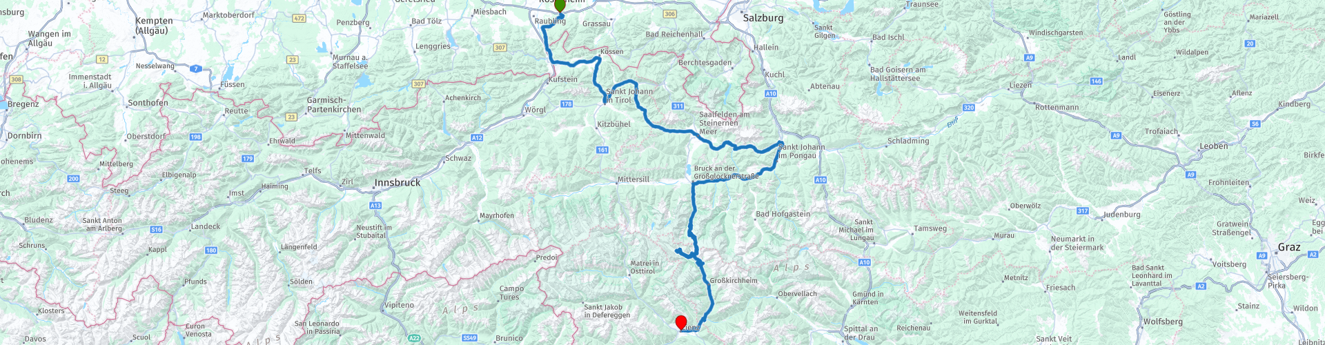
 Start: Rosenheim
Finish: Lienz
The route made the same for TomTom, Garmin and MyRoute-app Navigation users.
If you want to ride this TT, keep the info below in mind:
- No mountain experience
- Tour ride from A to B
- Tol
Source: Promoter 07, September / October 2018.
 Share this route


Animation

Verdict


Duration
5h 22m

Mode of travel
Car or motorcycle

Distance
290.53 km

Countries


 RouteXpert Review
 The TT starts in Rosenheim and takes you along the following passes and mountain roads to the end point in Lienz:
Pas Grießen (967 m), Filzensattel (1291 m), Dientner Sattel (1357 m), Grossglockner-Hochalpenstraße, Edelweißspitze (2577 m), Iselsberg (1204 m).
This 5-star route is one of the 24 most beautiful Alpine routes in recent years!
Colored route points:
rp 1 - Starting point for Trattoria Il Castagno
rp 7 - Coffee stop at BIRNBACHER
rp 10 - Pass Grießen
rp 12 - Filzensattel
rp 13 - Dientner Sattel
rp 16 - Lunch stop at Abtsdorfer Wirtshaus, beware turn left here to go to the restaurant. Follow this road after lunch to get back on the route.
rp 18 - Fuel stop at Eni
rp 21 - Photo point at Hochmaiß
rp 22 - Viewpoint Blick zum Fuscher Törl
rp 23 - Tauernfenster viewpoint
rp 25 - Kaiser-Franz-Josefs-Höhe
rp 27 - Tank stop at ENI Tankstelle
rp 28 - End point at Sporthotel Lienz
Route details:
- Winter closure: the Filzen- and Dientner Sattel are all closed during snowfall. The Großglockner-Hochalpenstraße is closed from November to May.
- Toll: Kaiserbachtalstraße, Großglockner-Hochalpenstraße
- Alternative routes: Toll roads in the Kaiserbachtal with great views of the Wilden Kaiser mountain walls.
- Ideal months: May to July, September / October
- Riding pleasure: Filzensattel, Dientner Sattel, Mühlbachtal, Großglockner- Hochalpenstraße
- Landscape: Samerberg, Walchsee, Kaiserbachtal, Pillersee, Großglockner-Hochalpenstraße
 Links
Links  Usage
Usage Want to download this route?
You can download the route for free without MyRoute-app account. To do so, open the route and click 'save as'. Want to edit this route?
No problem, start by opening the route. Follow the tutorial and create your personal MyRoute-app account. After registration, your trial starts automatically.  Disclaimer
Use of this GPS route is at your own expense and risk. The route has been carefully composed and checked by a MyRoute-app accredited RouteXpert for use on TomTom, Garmin and MyRoute-app Navigation.
Changes may nevertheless have occurred due to changed circumstances, road diversions or seasonal closures. We therefore recommend checking each route before use.
Preferably use the route track in your navigation system. More information about the use of MyRoute-app can be found on the website under 'Community' or 'Academy'.