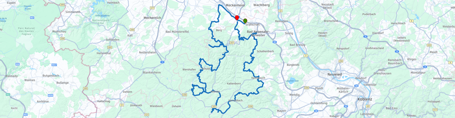
Eifel Grafschaft Fuchshofen Nuerburgring

This route was brought to you by:
RouteXpert Stefan Otten - RouteXpert
Last edit: 19-02-2019
 Route Summary
  Share this route


Animation

Verdict


Duration
4h 0m

Mode of travel
Car or motorcycle

Distance
194.23 km

Countries

 RouteXpert Review
 We start in Vettelhoven at the gas station.
From there you go through Altendorf in the direction of Ahrbrück.
This route takes you through the typical Eifel roads. The condition of the roads is very variable ;-)
A driving technical highlight are certainly the serpentines of Fuchshofen (waypoint 10)
Here, the bigger the bike, the more focus on the driving technique.
Continue in the direction of the Nürburgring.
Here you can experience on many days of the year at waypoint 16 action on the track.
At waypoint 17 there is everything about food, which you need on a motorcycle day.
There is always a lot to see here. Car fans should keep the camera ready, often camouflaged prototypes come by.
Strengthened it goes now to the vertex of the route at waypoint 18
You can expect many fast and slow bends on the way to Bad Neuenahr Ahrweiler.
Here is worth a look behind the city wall.
In the further course, just before the end of the route, you come through Dernau.
An old wine village. Here you can stay for a coffee or snack, either down in the village, or go up the mountain to the Krausberg hut. In waypoint 27, I've put a link, so you can watch the opening times of the hut.
The cake is baked here by volunteers, just great. In addition, the view from up here is great.
You can also omit waypoint 29 and stay on the highway. Depending on which direction you drive home .....
I wish you a lot of fun on the tour!
Keep the black always down ;-)


 Usage
Usage Want to download this route?
You can download the route for free without MyRoute-app account. To do so, open the route and click 'save as'. Want to edit this route?
No problem, start by opening the route. Follow the tutorial and create your personal MyRoute-app account. After registration, your trial starts automatically.  Disclaimer
Use of this GPS route is at your own expense and risk. The route has been carefully composed and checked by a MyRoute-app accredited RouteXpert for use on TomTom, Garmin and MyRoute-app Navigation.
Changes may nevertheless have occurred due to changed circumstances, road diversions or seasonal closures. We therefore recommend checking each route before use.
Preferably use the route track in your navigation system. More information about the use of MyRoute-app can be found on the website under 'Community' or 'Academy'.