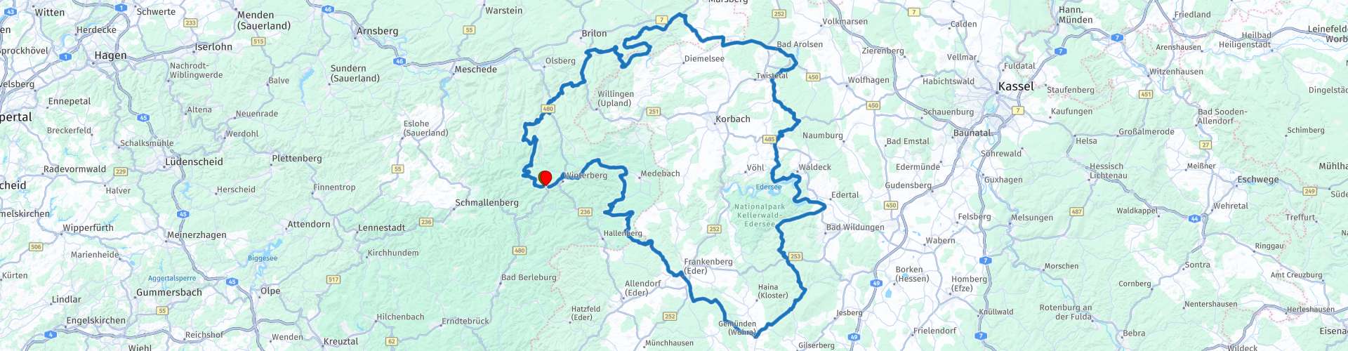
Rondje Sauerland Winterberg Edersee Winterberg

This route was brought to you by:
RouteXpert Stijn Claus
Last edit: 08-07-2020
 Route Summary
  Share this route


Animation

Verdict


Duration
4h 31m

Mode of travel
Car or motorcycle

Distance
241.43 km

Countries

 RouteXpert Review
 Along the way we pass numerous reservoirs including the Diemelsee. Just before the Twistestausee it is certainly worth stopping at the Schloss Arolsen, an 18th century castle in Baroque style. The road meanders along the banks of another reservoir, the Edersee.
On the Edersee it is significantly busier and more touristy. The 27 km long Edersee, one of the largest reservoirs in Europe is located in the middle of the Kellerwald-Edersee nature park, this jungle is on the list of Unesco heritage. The impressive overflow of the dam in the spring gives a true spectacle. In the autumn, the ruins of the three flooded villages that disappeared more than a hundred years ago in the water during the construction of the dam would then become visible again.
After the afternoon tour the route goes back to Winterberg. The mountains are getting higher again and the turns follow each other more, which makes for even more driving pleasure. Here and there a ski station rises on top of a mountain. The roads are very good which makes that we can drive smoothly.


 Usage
Usage Want to download this route?
You can download the route for free without MyRoute-app account. To do so, open the route and click 'save as'. Want to edit this route?
No problem, start by opening the route. Follow the tutorial and create your personal MyRoute-app account. After registration, your trial starts automatically.  Disclaimer
Use of this GPS route is at your own expense and risk. The route has been carefully composed and checked by a MyRoute-app accredited RouteXpert for use on TomTom, Garmin and MyRoute-app Navigation.
Changes may nevertheless have occurred due to changed circumstances, road diversions or seasonal closures. We therefore recommend checking each route before use.
Preferably use the route track in your navigation system. More information about the use of MyRoute-app can be found on the website under 'Community' or 'Academy'.