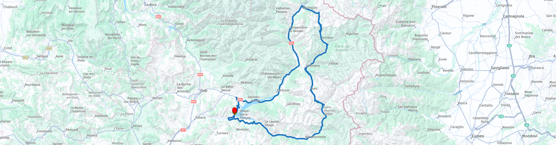
French Alps round trip Espinasses Lake Serre Poncon

This route was brought to you by:
RouteXpert Sandro Linden
Last edit: 09-05-2019
 Route Summary
  Share this route


Animation

Verdict


Duration
3h 52m

Mode of travel
Car or motorcycle

Distance
225.60 km

Countries

 RouteXpert Review
 After the Col d'Izoard we arrive in Briancon. The city is surrounded by fortifications and forts and is definitely worth stopping for enthusiasts. From Briancon we drive back to Espinasses. This road is a lot less exciting but ideal for a moment to relax after all the strenuous driving on the mountain passes. Eventually we come back to the Lac de Serre poncon where you drive to the other side of the lake through a long bridge. From this bridge you have a great view over the lake. Once back you can still enjoy a refreshing dip in the lake and a snack and drink.


 Links
Links  Usage
Usage Want to download this route?
You can download the route for free without MyRoute-app account. To do so, open the route and click 'save as'. Want to edit this route?
No problem, start by opening the route. Follow the tutorial and create your personal MyRoute-app account. After registration, your trial starts automatically.  Disclaimer
Use of this GPS route is at your own expense and risk. The route has been carefully composed and checked by a MyRoute-app accredited RouteXpert for use on TomTom, Garmin and MyRoute-app Navigation.
Changes may nevertheless have occurred due to changed circumstances, road diversions or seasonal closures. We therefore recommend checking each route before use.
Preferably use the route track in your navigation system. More information about the use of MyRoute-app can be found on the website under 'Community' or 'Academy'.