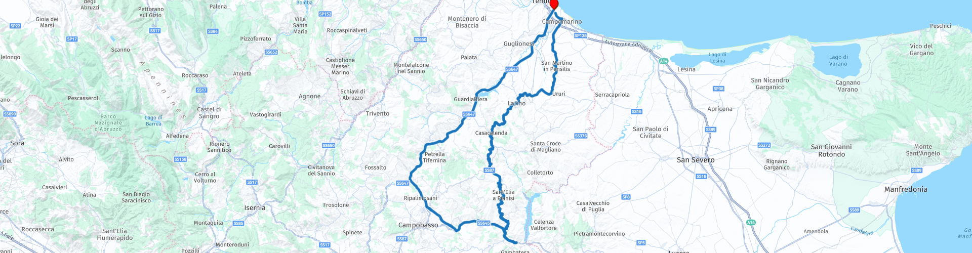
Round trip from Termoli

This route was brought to you by:
RouteXpert Nick Carthew - (MRA Master)
Last edit: 23-12-2020
 Route Summary
  Share this route


Animation

Verdict


Duration
3h 25m

Mode of travel
Car or motorcycle

Distance
168.51 km

Countries

 RouteXpert Review
 This route has two halves, the first half leading to the planned lunch stop at RP 23 follows mainly rural twisty roads passing through some small towns and villages. At RP 7 in the town of Larino, the route passes directly next to a Roman amphitheater giving you a good view on the left. There are other historic sites in Larino including Roman mosaics if you wanted to stop a while for a visit.
You are in the foothills of the Central Apennines mountains now and the roads climb and fall as they twist and turn through the beautiful rural landscape. A lot of the hillsides have been ploughed and cultivated for crops giving this area a slightly strange look compared to the normal grass or forested hillsides. The highest point of the route is at RP 15, the Valico di Cerro Secco at 820 m. You'll have nice views all the way to the lunch stop now catching the occasional glimpse of the Occhito Reservoir in the distance to your left. The reservoir is 12 kms long and forms a border with the neighbouring region of Puglia.
You have a choice of a nice restaurant or pizzeria for lunch at RP 23 or just a coffee. There is fuel here too if required.
After lunch you will head for the regions capital city, Campobasso on somewhat straighter and faster roads. This route avoids the city but if you follow the signs for the city centre after RP 24 you can visit some of the many historic sites including a magnificent castle. I have added a POI for the castle Castello Monforte. The city is renowned for the craftsmanship of blades, a fact well documented since the 14th century. The hillside village of Ripalimosani with it's prominent church tower can be seen at RP 25 before joining the the state road SS647 "Fondo Valle del Biferno" it is the arterial route connecting Campobasso to the Adriatic coast and is commonly called Bifernina. It follows the river Biferno crisscrossing it countless times as it makes its way through valleys all the way to Termoli. There is a spectacular section near the ancient town of Guardialfiera. Here, the valley was dammed in the 70s and two long elevated sections (viaducts) were created to pass through the flooded valley. The Liscione Dam can be seen holding back the water at RP 30 and 20 mins later and you will arrive back at the start.
I have awarded 3*** stars for this route. The roads, scenery and attractions are all good and worthy of 3***.


 Usage
Usage Want to download this route?
You can download the route for free without MyRoute-app account. To do so, open the route and click 'save as'. Want to edit this route?
No problem, start by opening the route. Follow the tutorial and create your personal MyRoute-app account. After registration, your trial starts automatically.  Disclaimer
Use of this GPS route is at your own expense and risk. The route has been carefully composed and checked by a MyRoute-app accredited RouteXpert for use on TomTom, Garmin and MyRoute-app Navigation.
Changes may nevertheless have occurred due to changed circumstances, road diversions or seasonal closures. We therefore recommend checking each route before use.
Preferably use the route track in your navigation system. More information about the use of MyRoute-app can be found on the website under 'Community' or 'Academy'.