TTT 2006 03 Tour de France

This route was brought to you by:
RouteXpert Hans van de Ven (Mr.MRA)
Last edit: 03-03-2019
 Route Summary
 The 173 ANWB Promoter TankTasTochten (TTT) were scanned by Henry ten Dam and signed by Leon Stolk in Mapsource and later placed as a Track in a .gpx file. These have been made available with the approval of ANWB Promotor via the website of MrGPS so that everyone can enjoy it. The 1st TTT is from 1992, so the route may be slightly different from the original.
I checked all route points and placed them neatly on the road. Also, if necessary, I have put the start point and end point of the route a bit further apart to avoid navigating directly to the end point and I have added the POI files from the start and end point just like a possible stopping point.
Finally, I created the route for TomTom, Garmin and MyRoute-app Navigation users.
With thanks to Henry, Leon, MrGPS and Promoter.
 Share this route


Animation

Verdict


Duration
4h 25m

Mode of travel
Car or motorcycle

Distance
221.12 km

Countries


 RouteXpert Review
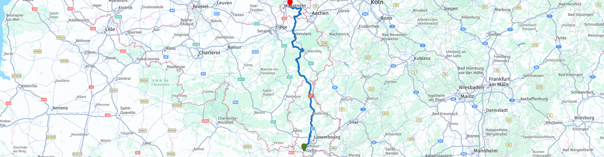
 * The Tour de France is a multi-day cycling race that for the most part runs through France. Together with the rounds of Italy and Spain it is one of the three Grand Tours. The Tour de France originated in 1903 and was organized by Henri Desgrange, editor in chief of the magazine L'Auto. (Source: Wikipedia).
The route is mainly about beautiful roads and between route 3 and 5 you drive through the outskirts of the city of Luxembourg, so it can be busy there. Then you continue to swing around the main road (A7) to Ettelbruck **
** Ettelbruck, is a town and municipality in the Luxembourg district of Diekirch. Ettelbruck is located at the point where the rivers Sûre and Alzette meet; it is also a railway junction. (Source: Wikipedia).
Then you continue to drive to Verviers on this main road with just before the Belgian border a stop for some food and refueling.
On this route you cross the Luxembourg Ardennes *** and the Belgian Ardennes ****.
*** The Luxembourg Ardennes consist mainly of forest-covered hills and river valleys. The most important river is the Sauer. The Kneiff in Huldingen is at 559 meters the highest point of the Grand Duchy. In this part of the Ardennes are some small historic towns such as Vianden, Clervaux, Wiltz and Esch-sur-Sûre.
**** Belgium is divided into three parts namely Flanders, Wallonia and the Brussels-Capital Region. The largest part of Wallonia is occupied by the Belgian Ardennes, a wooded low mountain range.
After the Ardennes you can still eat a French fries in Verviers, before you get to know the Limburg hills, not to mention the delicious Limburg pie on the finish in Berg en Terblijt.
Because I have driven large parts of this route myself, this route gets 4 stars.
Route details:
rp 14 - Food and refueling at Weiswampach.
rp 22 - Eating French fries in Verviers.


 Links
Links  Usage
Usage Want to download this route?
You can download the route for free without MyRoute-app account. To do so, open the route and click 'save as'. Want to edit this route?
No problem, start by opening the route. Follow the tutorial and create your personal MyRoute-app account. After registration, your trial starts automatically.  Disclaimer
Use of this GPS route is at your own expense and risk. The route has been carefully composed and checked by a MyRoute-app accredited RouteXpert for use on TomTom, Garmin and MyRoute-app Navigation.
Changes may nevertheless have occurred due to changed circumstances, road diversions or seasonal closures. We therefore recommend checking each route before use.
Preferably use the route track in your navigation system. More information about the use of MyRoute-app can be found on the website under 'Community' or 'Academy'.