TTT 2010 05 Groningen Drenthe

This route was brought to you by:
RouteXpert Hans van de Ven (Mr.MRA)
Last edit: 20-07-2020
 Route Summary
 The 173 ANWB Promoter TankTasTocht (TTT) were scanned by Henry ten Dam and signed by Leon Stolk in Mapsource and later placed as a Track in a .gpx file. These are made available through the MrGPS website with the approval of the ANWB Promoter so that everyone can enjoy them. The 1st TTT is from 1992, so the route may differ slightly from the original.
I have checked all route points and, where necessary, placed them neatly on the road. Also, if necessary, I have further spaced the start point and end point of the route to avoid navigating directly to the end point, and I added the POI files from the start and end point just like a possible stop.
Finally, I made the route the same for TomTom, Garmin and MyRoute-app Navigation users.
Thanks to Henry, Leon, MrGPS and Promoter.
 Share this route


Animation

Verdict


Duration
3h 40m

Mode of travel
Car or motorcycle

Distance
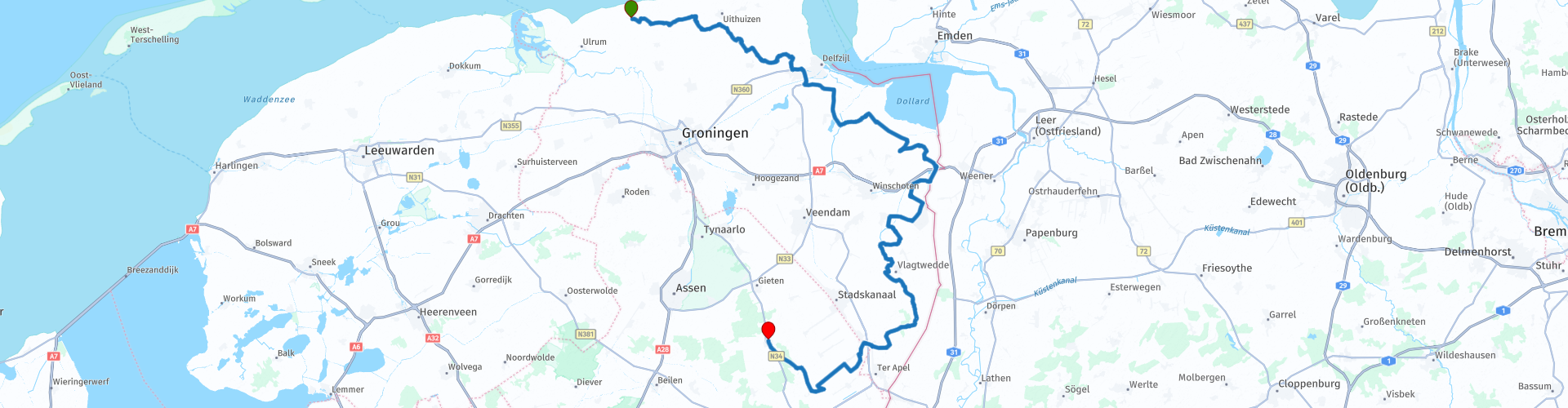
162.07 km

Countries


 RouteXpert Review
 * The Pieterburen Seal Center, formerly Pieterburen Seal Sanctuary, is a seal sanctuary in the Netherlands, located in the Groningen village of Pieterburen. It was once called seal sanctuary because it mainly caught young orphaned seals. (Source: Wikipedia).
From Pieterburen you first drive to Delfzijl and you stay close to the border with Germany until you reach Valthe. You will also visit Ter Apel, where a POMS Site ** was established for years. From Valthe you head north again to the end point in Borger.
** The POMS sites were five locations in the south and east of the Netherlands where storage and maintenance of American defense equipment took place between 1984 and 2006. POMS stands for Prepositioned Organizational Material Storage. The locations were in Brunssum, Eygelshoven, Vriezenveen, Coevorden and Ter Apel. POMS NL was a strategic project to be able to quickly fly in American troops in the event of a war in the German lowlands, who could then use the equipment from the POMS sites 'combat ready and safe'. It was also an employment project that from 1984 offered work to people from the east and south of our country where there was then high unemployment. Organically, the POMS fell under the American army, but the personnel were employed by the Royal Netherlands Army or were temporary workers. (Source: RIVM).
Because I have not (yet) driven this route myself, this route gets 3 stars.
Route details:
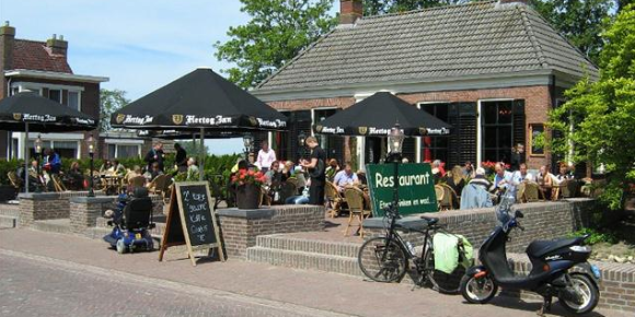
rp 23 - Lunch stop at the Piekenier in Oudeschans
 Links
Links  Usage
Usage Want to download this route?
You can download the route for free without MyRoute-app account. To do so, open the route and click 'save as'. Want to edit this route?
No problem, start by opening the route. Follow the tutorial and create your personal MyRoute-app account. After registration, your trial starts automatically.  Disclaimer
Use of this GPS route is at your own expense and risk. The route has been carefully composed and checked by a MyRoute-app accredited RouteXpert for use on TomTom, Garmin and MyRoute-app Navigation.
Changes may nevertheless have occurred due to changed circumstances, road diversions or seasonal closures. We therefore recommend checking each route before use.
Preferably use the route track in your navigation system. More information about the use of MyRoute-app can be found on the website under 'Community' or 'Academy'.