TTT 2011 02 Nijkerk Voorthuizen

This route was brought to you by:
RouteXpert Hans van de Ven (Mr.MRA)
Last edit: 04-05-2019
 Route Summary
 The 173 ANWB Promoter TankTasTocht (TTT) were scanned by Henry ten Dam and signed by Leon Stolk in Mapsource and later placed as a Track in a .gpx file. These have been made available through the MrGPS website with the approval of the ANWB Promoter so that everyone can enjoy it. The 1st TTT is from 1992, so the route may differ slightly from the original.
I have checked all route points and, where necessary, placed them neatly on the road. Also, if necessary, I have further spaced the start point and end point of the route to avoid navigating directly to the end point and I added the POI files from the start and end point just like a possible stop point.
Finally, I made the route the same for TomTom, Garmin and MyRoute-app Navigation users.
Thanks to Henry, Leon, MrGPS and Promoter.
 Share this route


Animation

Verdict


Duration
3h 53m

Mode of travel
Car or motorcycle

Distance
144.40 km

Countries

 RouteXpert Review
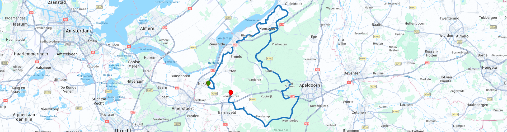
 * Lake Veluwe is an elongated lake between the northern Veluwe and Eastern Flevoland. It is one of the Veluwe Lakes that were created after the reclamation of the IJsselmeer. In the southwest, past the Veluwemeer Aqueduct near Harderwijk, the Veluwemeer borders on Wolderwijd. (Source: Wikipedia).
But you can also ignore 't-Harde and continue to Nunspeet where you can stop for lunch at' t Eiland cafeteria. After lunch you continue in the Veluwe ** towards Uddel and via Hoog Soeren to Hoenderloo, where you also ignore Apeldoorn.
** The Veluwe is a predominantly wooded region in the Dutch province of Gelderland and a former quarter of the Duchy of Gelre. The Veluwe measures around 1000 km². In contrast to the old quarter, the Veluwe has no clearly defined fixed boundaries. (Source: Wikipedia).
Then a little National Park De Hoge Veluwe to Otterloo to drive via Kootwijkerbroek to the endpoint in Voorthuizen.
Because I have driven large parts of this route myself, this route gets 4 stars.
Route details:
rp 28 - Lunch stop at cafeteria 't-Eiland in Nunspeet


 Links
Links  Usage
Usage Want to download this route?
You can download the route for free without MyRoute-app account. To do so, open the route and click 'save as'. Want to edit this route?
No problem, start by opening the route. Follow the tutorial and create your personal MyRoute-app account. After registration, your trial starts automatically.  Disclaimer
Use of this GPS route is at your own expense and risk. The route has been carefully composed and checked by a MyRoute-app accredited RouteXpert for use on TomTom, Garmin and MyRoute-app Navigation.
Changes may nevertheless have occurred due to changed circumstances, road diversions or seasonal closures. We therefore recommend checking each route before use.
Preferably use the route track in your navigation system. More information about the use of MyRoute-app can be found on the website under 'Community' or 'Academy'.