TTT 2009 06 Grensroute

This route was brought to you by:
RouteXpert Hans van de Ven (Mr.MRA)
Last edit: 27-03-2019
 Route Summary
 The 173 ANWB Promoter TankTasTocht (TTT) were scanned by Henry ten Dam and signed by Leon Stolk in Mapsource and later placed as a Track in a .gpx file. These have been made available through the MrGPS website with the approval of the ANWB Promoter so that everyone can enjoy it. The 1st TTT is from 1992, so the route may differ slightly from the original.
I have checked all route points and, where necessary, placed them neatly on the road. Also, if necessary, I have further spaced the start point and end point of the route to avoid navigating directly to the end point and I added the POI files from the start and end point just like a possible stopping point.
Finally, I made the route the same for TomTom, Garmin and MyRoute-app Navigation users.
Thanks to Henry, Leon, MrGPS and Promoter.
 Share this route


Animation

Verdict


Duration
3h 30m

Mode of travel
Car or motorcycle

Distance
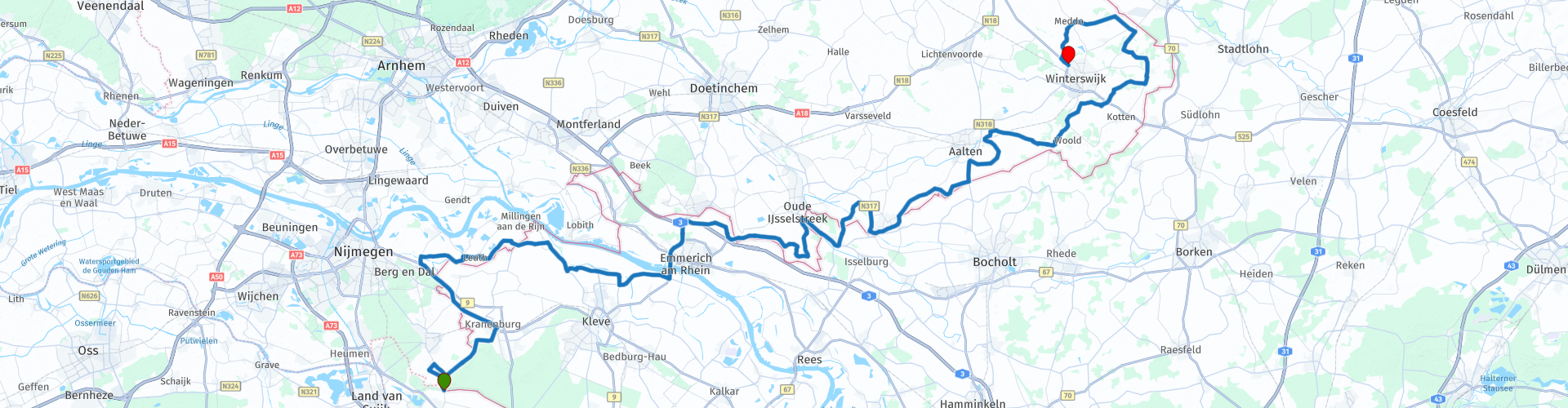
134.26 km

Countries


 RouteXpert Review
 * The Reichswald or Rijkswoud is a rolling forest area between Kranenburg, Kleve, Goch and Bedburg-Hau in North Rhine-Westphalia along the Dutch border with the 95 m high Rupenberg as its highest peak. (Source: Wikipedia).
The large forest has a special history, also as the northernmost part of the Siegfried line **. Regular residents are deer, red deer and wild boar.
** The Westwall (or Siegfried line among the Allies) was a German line of defense that was built just before and during the Second World War and runs from Kleve, on the Dutch border, to the Swiss border. The Westwall has a length of more than 630 km. The Westwall was a succession of (underground) bunkers (also known as pill boxes), concrete tank barriers (also known as dragon teeth), machine gun nests, barbed wire barriers and minefields. (Source: Wikipedia).
After the Reichswald you drive towards Berg en Dal and then along the Rhine that you cross at Emmerich to have lunch in Megchelen, you are now about halfway along the route. After lunch you will swing along and occasionally across the border after the end point in Winterswijk.
Because I have driven large parts of this route myself, this route gets 4 stars.
Route details:
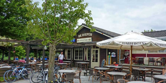
rp 21 - Lunch possibility at Ter Voert
 Links
Links  Usage
Usage Want to download this route?
You can download the route for free without MyRoute-app account. To do so, open the route and click 'save as'. Want to edit this route?
No problem, start by opening the route. Follow the tutorial and create your personal MyRoute-app account. After registration, your trial starts automatically.  Disclaimer
Use of this GPS route is at your own expense and risk. The route has been carefully composed and checked by a MyRoute-app accredited RouteXpert for use on TomTom, Garmin and MyRoute-app Navigation.
Changes may nevertheless have occurred due to changed circumstances, road diversions or seasonal closures. We therefore recommend checking each route before use.
Preferably use the route track in your navigation system. More information about the use of MyRoute-app can be found on the website under 'Community' or 'Academy'.