Karlshamm Ronneby Karlskrona Oland

This route was brought to you by:
RouteXpert Evert Kuiken
Last edit: 22-12-2020
 Route Summary
  Share this route


Animation

Verdict


Duration
4h 35m

Mode of travel
Car or motorcycle

Distance
254.97 km

Countries

 RouteXpert Review
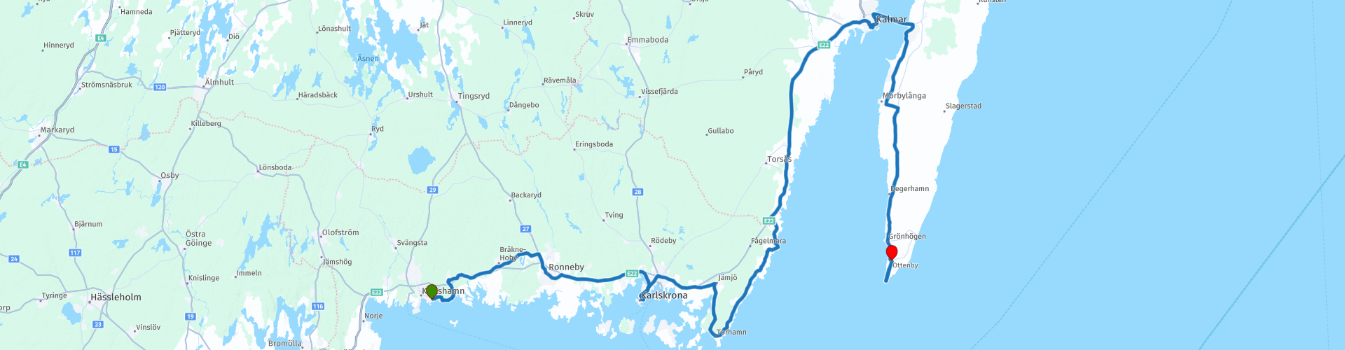
 We first drive a short short distance along the sea. Then we take the main road 27 to Ronneby and Karlskrona. First through Ronneby (RP3), a picturesque town in a beautiful spot. Then to Karlskrona, a beautiful old place, on an island in the sea (RP4). There is much to experience. For example, go to the naval museum (Marinmuseum) or take a look in the center at the two churches Trefaldighetskyrkan and Fredrikskyrkan. You can also stop here for something to eat or drink.
Beyond Karlskrona are many nature parks on islands in the sea. We skip Sturkö and T Jurkö (and many more islands). The route does run over Torhamn (RP5), a nature reserve where many migratory birds pass. There are some small harbors where you can possibly drink or eat something (Cafe Måsen, Sail Inn).
We drive along Kristianopel (RP7), where you can enjoy the sea and admire kite surfers. At Kalmar (RP10) you can visit the castle (very beautiful!). It is therefore time to have lunch. For that it is best to walk into the old center (also beautiful!). For example, you can eat at the water at Ölandskajens Fisk & Mat or inside at Gröna Stugan. That will take you at least an hour here.
Via the bridge at Kalmar we drive to Öland and immediately turn right to Mörbylänga. The town itself is not much. The route there and along is beautiful. A little further you will find another kind of Stonehenge: Gettlinge gravfält (RP12), a burial place of the Vikings in the shape of a ship, just like at Käseberga. Then we go to the southernmost tip of the island to see the lighthouse Långe Jan (RP13). We go up again on the island and stop at the camping Ottenby (RP14).
The route gets 4 points from me, although it is almost 5. There is a lot to see and do, the roads are fine and sometimes very beautiful.


 Links
Links  Usage
Usage Want to download this route?
You can download the route for free without MyRoute-app account. To do so, open the route and click 'save as'. Want to edit this route?
No problem, start by opening the route. Follow the tutorial and create your personal MyRoute-app account. After registration, your trial starts automatically.  Disclaimer
Use of this GPS route is at your own expense and risk. The route has been carefully composed and checked by a MyRoute-app accredited RouteXpert for use on TomTom, Garmin and MyRoute-app Navigation.
Changes may nevertheless have occurred due to changed circumstances, road diversions or seasonal closures. We therefore recommend checking each route before use.
Preferably use the route track in your navigation system. More information about the use of MyRoute-app can be found on the website under 'Community' or 'Academy'.