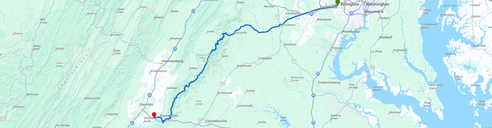
Washington DC to Waynesboro through the Shenandoah National Park

This route was brought to you by:
RouteXpert René Plücken (MRA Master)
Last edit: 07-04-2021
 Route Summary
  Share this route


Animation

Verdict


Duration
4h 19m

Mode of travel
Car or motorcycle

Distance
236.84 km

Countries

 RouteXpert Review
 In the hilly landscape you will find many wooded areas, and numerous lookout points from where you have a view of the 240-kilometer-long Shenandoah Valley and the nearby Massanutten Mountain mountain range.
We from Washington DC to Sperryville where we take the Skyline Drive. This is a paved two-lane road, which cuts through the park from north to south, meandering over the tops of the Blue Ridge Mountains.
The height of the road is between 180 and 1160 meters, but there are no steep road sections. There are some sharp curves, and the verges are often missing. In general, the road with a maximum speed of 35 miles per hour is easily accessible for all vehicles.
Along the way you will come across more than 70 viewpoints, from where you can enjoy the beautiful views. I have marked a number with route points.
In principle, the Skyline Drive is open 365 days a year. But from October to March it can happen that the road is closed for a few days, sometimes even a few weeks, due to snowfall.
On the south side, the road connects directly to the Blue Ridge Parkway, a beautiful route of 469 miles (754 km) that ends at Great Smoky Mountains National Park. (Link to route included).
I have not been able to drive this route yet, but given the many responses to various motorcycle forums, this is certainly a 5 star route.


 Links
Links  Usage
Usage Want to download this route?
You can download the route for free without MyRoute-app account. To do so, open the route and click 'save as'. Want to edit this route?
No problem, start by opening the route. Follow the tutorial and create your personal MyRoute-app account. After registration, your trial starts automatically.  Disclaimer
Use of this GPS route is at your own expense and risk. The route has been carefully composed and checked by a MyRoute-app accredited RouteXpert for use on TomTom, Garmin and MyRoute-app Navigation.
Changes may nevertheless have occurred due to changed circumstances, road diversions or seasonal closures. We therefore recommend checking each route before use.
Preferably use the route track in your navigation system. More information about the use of MyRoute-app can be found on the website under 'Community' or 'Academy'.