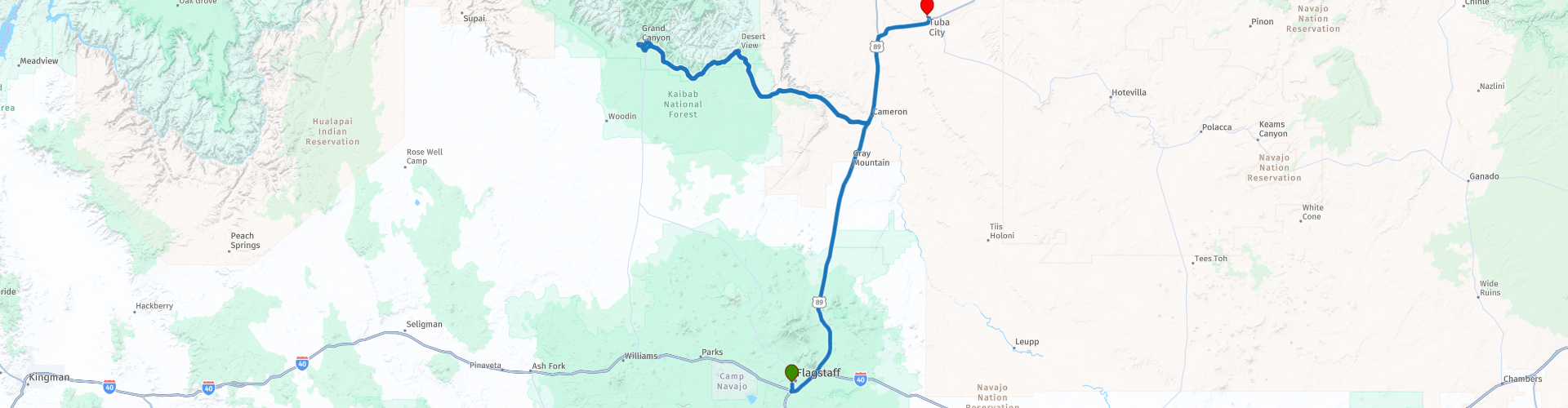
R04 Flagstaff Tuba City

This route was brought to you by:
RouteXpert Hans van de Ven (Mr.MRA)
Last edit: 08-04-2021
 Route Summary
 Today you will spend a little less time on your motorcycle because you are going to the Grand Canyon National Park, and of course you should not miss that if you are in the area.
You can stop at different viewpoints to view this unique park, or explore the park on foot. Make sure the batteries for the camera are charged. A warning for those with fear of heights; don't get too close to the edge. When you have viewed this wonder of the world, whether or not by taking a short walk, it continues to the end point in Tuba City.
During this journey you will travel through the following states: California, Arizona, Utah & Nevada.
The roads are good, the stop in the Grand Canyon National Park unforgettable! And don't forget your camera!
Starting point: Hotel Days Inn Flagstaff.
End point: Quality Inn Navajo Nation.
The route has been made the same for TomTom, Garmin and MyRoute-app Navigation users.
Thanks to Richard & Lisa for the information!
 Share this route


Animation

Verdict


Duration
4h 8m

Mode of travel
Car or motorcycle

Distance
307.24 km

Countries

 RouteXpert Review
 You first drive north on the 89 and then turn left onto the 64 into the National Park. Also bring enough water again!
In this 4 star route you mainly drive over the US Highways until the exit in Cameron where you drive into the Grand Canyon National Park. Make sure you ENJOY this wonder of the world!
General information:
The Grand Canyon, created by the Colorado River, is a beautiful area with the world's largest system of deep and wide canyons and gorges. Beautiful colors, whimsical and fantastic shapes are the hallmarks of the Grand Canyon. The Grand Canyon is part of the Colorado Plateau. The Grand Canyon has a length of 466 km and an average width of 16 km. The depth of the Canyon is 160 to 2000 meters.
Since 1919, Grand Canyon National Park has been a fact. The park covers the entire course of the Colorado River through the Grand Canyon and the adjacent hill country, from the southern border of the Glen Canyon National Recreation Area to the eastern border of Lake Mead National Recreation Area. The total length of the Colorado River is 2334 km. The Colorado River rises in the Rocky Mountains (in the north of the state of Colorado) and runs through several American states and a piece of Mexico. Eventually the Colorado River flows into the California Gulf. The water of the
river is used for irrigation and power generation. The part that runs through the Grand Canyon is approximately 90 meters wide and 4 to 13 meters deep. The Colorado River divides the Grand Canyon into a North Rim and South Rim.
These two park sections are just 16 km apart as the crow flies but are two completely different worlds. The height of the North Rim is around 2400 meters, that of the South Rim is around 300 meters lower. If you think that the 16 km between the two parts is also so short by car, then you are wrong. If you want to go from the North Rim to the South Rim by car, you have to travel 345 km to reach your goal. The South Rim is the most accessible and therefore, among other things, is preferred by most visitors. On the South Rim you will find the best facilities for visitors and you can book tours there.
For example, descending into the Canyon with a donkey or a flight over the Canyon by helicopter or plane. Almost all activities start in Grand Canyon Village. The North Rim is not accessible out of season, this season runs from mid-May to about mid-October. Despite the fact that the North Rim does not have as many visitors, including the almost non-existent commerce, the scenery is certainly just as beautiful as on the South Rim.
The Grand Canyon is one of the most visited parks in the United States with three million visitors a year.
About 2 billion years ago it was tectonic forces that caused huge mountains to rise where the Grand Canyon is now. Due to the high temperatures and the enormous pressure associated with the formation of this mountain range, the rock then turned into dark rock formations that can be found in the Inner Gorge (the bottom of the deepest part of the Grand Canyon). Because of the erosion, these mountains broke down to their base. These gigantic mountains gave way to huge basins in which huge amounts of volcanic rock and sediments collected.
This entire process was repeated again around 800 million years ago. Between the 575 and 225 million years ago, the Grand Canyon was a gigantic inland sea. The horizontal layers of sandstone, slate and limestone that make up the current walls of the Grand Canyon were the material that collected at the bottom of this basin. The building blocks for the current appearance were therefore already present.
About 65 million years ago, the earth's crust began to rise above sea level in this area, and with that the birth of the Rocky Mountains was a fact. The snow and the rain that fell over the Rocky Mountains had to make its way to the sea, and so the birth of the Colorado River began.
About 6 million years ago, the Grand Canyon river began to grind. The relatively soft walls offered no resistance to the Colorado River, so that the Canyon became deeper and wider due to eroding forces of water, wind, sun and frost. Currently, the water has reached the harder and more resistant layers of granite and slate at the bottom of the Canyon. Due to the abrasive effect of the sludge and the rock parts taken along, the river eats itself deeper and deeper into the rock. This process will continue until the bed of the river is as high as the sea level.


 Links
Links  Usage
Usage Want to download this route?
You can download the route for free without MyRoute-app account. To do so, open the route and click 'save as'. Want to edit this route?
No problem, start by opening the route. Follow the tutorial and create your personal MyRoute-app account. After registration, your trial starts automatically.  Disclaimer
Use of this GPS route is at your own expense and risk. The route has been carefully composed and checked by a MyRoute-app accredited RouteXpert for use on TomTom, Garmin and MyRoute-app Navigation.
Changes may nevertheless have occurred due to changed circumstances, road diversions or seasonal closures. We therefore recommend checking each route before use.
Preferably use the route track in your navigation system. More information about the use of MyRoute-app can be found on the website under 'Community' or 'Academy'.