TTT 2010 06 Belgie D3 Waimes Asten

Questo percorso è stato creato da:
RouteXpert Hans van de Ven (Mr.MRA)
Ultima modifica: 21-04-2019
 Riepilogo percorso
 Il 173 ANWB Promoter TankTasTocht (TTT) è stato scansionato da Henry ten Dam e firmato da Leon Stolk in Mapsource e successivamente inserito come traccia in un file .gpx. Questi sono stati resi disponibili attraverso il sito web MrGPS con l'approvazione del Promotore ANWB in modo che tutti possano goderne. Il 1 ° TTT è del 1992, quindi il percorso potrebbe differire leggermente dall'originale.
Ho controllato tutti i punti di percorso e, se necessario, li ho sistemati ordinatamente sulla strada. Inoltre, se necessario, ho distanziato ulteriormente il punto iniziale e il punto finale del percorso per evitare di navigare direttamente verso il punto finale e ho aggiunto i file POI dal punto iniziale e finale proprio come un possibile punto di arresto.
Infine, ho reso lo stesso percorso per gli utenti di TomTom, Garmin e MyRoute-app Navigation.
Grazie a Henry, Leon, MrGPS e Promoter.
 Condividi questo percorso


Animation

Verdetto


Durata
3h 33m

Modalità di viaggio
Auto o moto

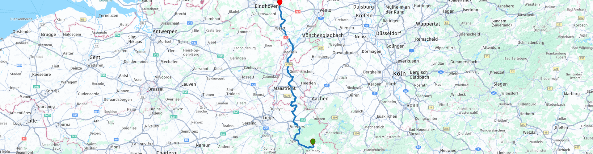
Distanza
161.54 km

Paesi


 Revisione RouteXpert
 * La diga Gileppe (francese: barrage de la Gileppe) è una diga nella provincia belga di Liegi, nei comuni di Jalhay e Baelen. La fornitura di acqua è assicurata dalla Gileppe che ha origine nelle High Fens. La caratteristica più importante della diga è un leone di arenaria di 13,5 metri e 300 tonnellate di arenaria. Il leone si trova in cima al muro della diga ed è stato posizionato in modo tale da guardare con orgoglio verso il confine che era a soli 5 chilometri di distanza con quello che allora era la Prussia (Lontzen ed Eupen). (Fonte: Wikipedia).
Il 2 ° luogo di interesse in cui devi fermarti e lasciare che le statue lavorino su di te è: Henri-Chapelle American Cemetery and Memorial **
** Gli oltre 20 ettari del cimitero militare americano Henri-Chapelle ospitano i resti di 7,992 soldati americani. La maggior parte di questi uomini perse la vita durante l'avanzata delle forze americane in Germania. La prima divisione di fanteria americana liberò questo luogo l'11 settembre 1944. Un cimitero di guerra provvisorio fu istituito il 28 settembre 1944.
Dopo queste 2 possibilità di fermarsi un po ', proseguiamo in direzione dei Paesi Bassi e nel Limburgo meridionale ci fermiamo per un caffè con la torta del Limburg a Partij / Witten al Café Herberg De Remise. Dopo il caffè, continuiamo a serpeggiare attraverso il paese di Limburg per fermarci a pranzare al Café Geraats di Grathem. Dopo pranzo è più di mezz'ora prima di raggiungere il punto finale ad Asten, dove si può bere un'altra tazza di caffè per chiudere le 3 Ardenne.
Poiché io stesso ho guidato grandi parti di questa rotta, questa rotta ottiene 4 stelle.
Dettagli del percorso:
rp 5 - Lac de la Gileppe
rp 8 - Cimitero e memoriale americano Henri-Chapelle
rp 14 - Coffee stop al Café-Herbergh de Remise
rp 23 - Fermata pranzo al Café Geraats


 Collegamenti
  Utilizzo
 Vuoi scaricare questo percorso?
Puoi scaricare il percorso gratuitamente senza un account MyRoute-app. Per farlo, apri il percorso e fai clic su 'Salva con nome'. Vuoi modificare questa rotta?
Nessun problema, inizia aprendo il percorso. Segui il tutorial e crea il tuo account MyRoute-app personale. Dopo la registrazione, la tua prova inizia automaticamente.  Disclaimer
L'utilizzo di questo percorso GPS è a tue spese e rischio. Il percorso è stato accuratamente composto e controllato da un RouteXpert accreditato dall'app MyRoute per l'utilizzo su TomTom, Garmin e navigazione dell'app MyRoute.
Ciononostante potrebbero essersi verificati cambiamenti a causa di mutate circostanze, deviazioni stradali o chiusure stagionali. Si consiglia pertanto di controllare ciascun percorso prima dell'uso.
Utilizzare preferibilmente la tracklog del percorso nel sistema di navigazione. Maggiori informazioni sul l'uso dell'app MyRoute può essere trovato sul sito Web in 'Community' o 'Academy'.