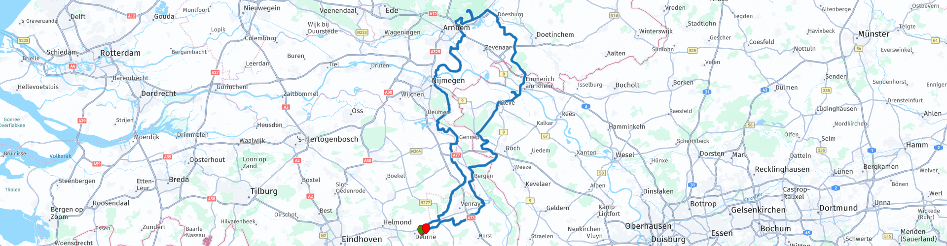
Deurne Posbank Deurne

Deze route is gemaakt door:
RouteXpert Hans van de Ven (Mr.MRA)
Laatst gewijzigd: 03-03-2019
 Route Samenvatting
 Start- en eindpunt: 't-Vertierke Deurne (Zeilberg).
 Deel deze route


Animation

Beoordeling


Duur
5h 40m

Transportmodus
Auto of motor

Afstand
233.80 km

Landen


 RouteXpert Review
 De Posbank bij Rheden is de naam van een monumentale bank en van een naastgelegen theehuis, op de rand van het Herikhuizerveld, een begroeide stuwwal op de zuidelijke Veluwe. De plek heeft een hoogte van 90 meter boven NAP met uitzicht over het IJsseldal, Arnhem, de Achterhoek en de Liemers tot in Duitsland.
!!Let op: Er zitten 2 wateroversteken met een pontje in de route, hier heb ik de optie "overslaan" gebruikt om te voorkomen dat de Here kaart de route over een vaste waterovergang wil laten lopen. (punt 25 & 26 en punt 62 & 63).


 Links
Links  Gebruik
 Deze route downloaden?
Je kan de route gratis, zonder MyRoute-app account downloaden. Om dit te doen, open de route en klik op 'opslaan als'. Deze route wijzigen?
Geen probleem, open eerst de route. Volg de tutorial en maak je eigen MyRoute-app account aan. Na registratie, start je trial automatisch.  Disclaimer
Gebruik van deze gps-route is voor eigen rekening en risico. De route is met zorg samengesteld en door een MyRoute-app geaccrediteerde RouteXpert gecontroleerd voor gebruik op zowel TomTom, Garmin als MyRoute-app Navigation.
Door gewijzigde omstandigheden, wegomleidingen of seizoensafsluitingen kunnen er toch veranderingen zijn ontstaan. Daarom adviseren wij iedere route voor gebruik te controleren.
Gebruik bij voorkeur de routetrack in je navigatiesysteem. Meer uitleg over het gebruik van MyRoute-app kun je vinden op de website bij ‘Community’ of ‘Webinars’.