Hasta la Vista from Eersel

Questo percorso è stato creato da:
RouteXpert Jan Koelstra (jan cabrio)
Ultima modifica: 21-12-2024
 Riepilogo percorso
 I percorsi sotto questo ombrello hanno in comune il fatto di avvicinarsi tutti al sole spagnolo, con il ricongiungimento di impressioni e ricordi (quasi) dimenticati lungo il percorso.
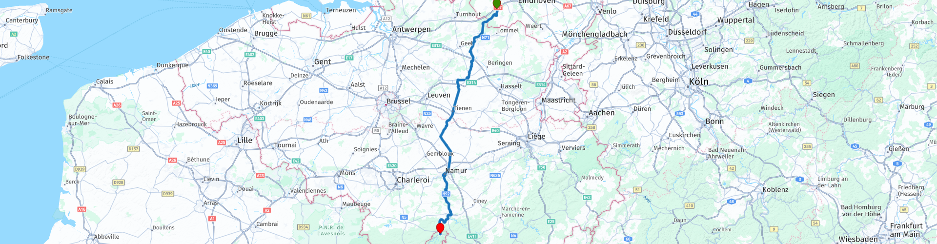
Questa volta il viaggio va da Eersel a Givet
Il percorso attraversa direttamente il Belgio. Si passa prima attraverso il Kempen, dove le città e i villaggi espongono i loro monumenti e si scopre tanto verde. Segue Haspengouw, con estesi frutteti in un paesaggio collinare ondulato. Visiterai la storica Namur con la cittadella e la funivia per arrivare alla valle della Mosa con molti castelli.
Successivamente proverete quella sensazione di "deja" e il graduale passaggio nello stile architettonico dal mattone alla pietra naturale, che è anche il modo in cui il Belgio "vive" di nuovo. E questo vale sicuramente 5 stelle.
 Condividi questo percorso


Animation

Verdetto


Durata
9h 13m

Modalità di viaggio
Auto o moto

Distanza
186.10 km

Paesi


 Revisione RouteXpert
 Eersel, il luogo da cui si parte, appartiene ad una serie di altri villaggi della zona delle Otto Beatitudini, nome collettivo per otto località che partono da -sel della provincia olandese del Brabante Settentrionale, situata nel Kempen. Nel museo De Acht Zailgheden scoprirete come vivevano, lavoravano e vivevano i Kempen, in un'epoca in cui i contadini riuscivano a malapena a sopravvivere nella povera brughiera.
A Postel, oltre il confine belga, si trova un'imponente abbazia norbertina fondata nel XII secolo. A causa del loro abito bianco vengono chiamati "uomini bianchi". Si occupano di silvicoltura, agricoltura e allevamento. Per mantenersi producono birra e producono formaggio.
Fai rifornimento a Mol e poi guidi verso Diest. La prima tappa è il Beghinaggio, nel cuore di Diest. Dietro le antiche mura si trova un'oasi di pace e bellezza. La Chiesa di Santa Caterina e le case con i santi patroni sopra la porta regalano una sensazione rilassante che fa sparire dalla mente tutto il trambusto. Il beghinaggio fu fondato nel 1253 da Arnoldo IV, signore di Diest e soppresso nel 1796 dal governo francese. La maggior parte delle 90 case e conventi risalgono al XVII e XVIII secolo. La bella porta barocca del beghinaggio risale al 1671. Il tutto è patrimonio mondiale dell'UNESCO.
A prima vista, Diest stessa è una città affascinante con un centro piacevole, ma quando si approfondisce il passato, si scopre che è una città speciale piena di storie. Le mura della città e la cittadella dell'epoca della guerra, vecchi edifici, strade strette, un fiume che scorreva dritto attraverso la città, vecchie birrerie e così via. Diest deve il titolo di Oranjestad al fatto che nel 1499 entrò in possesso di Engelbrecht II di Nassau. Uno dei suoi successori portava il titolo di "Principe d'Orange". Philips Willem, il figlio maggiore di Guglielmo d'Orange, che conquistò la città nel 1572, è sepolto nella chiesa di San Sulpizio a Diest. Dato che qui c'è molto da vedere, è una buona idea combinare la sosta per il caffè con una passeggiata in città.
Dopo il caffè si riprende la strada per Namur. Ma prima visiti la città dello zucchero di Tienen. Questa antichissima città, già decantata negli almanacchi romani, è ancora oggi molto interessante. Il centro storico in particolare ha molto da offrire. L'Haspengouw, dove si trova Tienen, è famoso per la frutticoltura ed è per questo che qui si trova una raffineria di zucchero, da qui il soprannome.
Il confine linguistico corre appena a sud di Tienen. Una delle differenze più note tra Vallonia e Fiandre di cui possiamo parlare è il fatto che si parla una lingua diversa. Nel 1963, il Belgio decise di implementare un confine linguistico ufficiale in cui furono nominate ufficialmente le principali lingue delle regioni. Per la Vallonia la lingua principale divenne il francese, mentre la lingua principale nelle Fiandre divenne l'olandese. In quel momento fu anche deciso che entrambe le lingue sarebbero state mantenute come lingue principali a Bruxelles. Ciò significa, infatti, che le aziende nelle Fiandre hanno principalmente dipendenti di lingua olandese, mentre in Vallonia hanno principalmente dipendenti di lingua francese.
In questo ambiente si nota subito che il carattere della regione cambia. La zona che segue fino a Namur è chiaramente meno popolata e il paesaggio è collinare. Qui troverete molti castelli vicino ai villaggi.
Namur, dove pranzerai, è, secondo gli addetti ai lavori, la città più bella delle Ardenne belghe. Non devi fare alcuno sforzo per sperimentarlo. Passeggiate per il centro storico sulla riva sinistra della Sambre e sarete automaticamente abbracciati dai caffè, dalle facciate, dalle piazze, dai piccoli negozi e sempre e ovunque all'improvviso quella vista fenomenale dell'attrazione principale della città: la cittadella. Potete raggiungere questa fortezza sulla cresta dello Champeau anche con la funivia, ma questa volta passate di persona. La cittadella è un buon posto per concludere la visita della città. Offre una panoramica della città.
Dopo Namur segue l'Alta Valle della Mosa. Questa valle di fortezze e castelli scavata dalla Mosa ti trasporta indietro nel tempo! Per prima cosa passi il villaggio dimenticato di Poilvache. Questo sito storico, situato vicino alla città di Dinant, porta la testimonianza silenziosa di un ricco passato. Le rovine del castello Poilvache non solo offrono viste spettacolari sui dintorni, ma danno anche un'idea dell'epoca cavalleresca. E così potrai sperimentare la grandiosità e il mistero di questo castello, un tempo così imponente.
Segue poi Dinant, la "Figlia della Mosa", che prende il soprannome dalla sua posizione speciale tra le scogliere e il fiume. Ci sono pochi posti nelle Ardenne con un aspetto così caratteristico come Dinant. Solo quello skyline: alti palazzi, chiesa più alta, pareti rocciose ancora più alte e soprattutto la cittadella. E poi c'è quel figlio famoso: Antoine Joseph 'Adolphe' Sax, il geniale inventore del sassofono che nacque qui, conobbe il successo ma morì povero e indigente a Parigi. Basta guardare il ponte sulla Mosa. Qui ha sede anche il birrificio della birra Leffe. Puoi visitare il Museo Leffe appena fuori Dinant.
La Mosa è qui nella sua forma più bella. Bella vista sulle numerose rovine di castelli sui pendii, intervallate da abbazie come quella di Waulsort e possedimenti come il castello di Freyr a Hastière lungo il fiume che scorre tranquillo.
Ti stai avvicinando al punto finale, appena oltre il confine francese a Givet. E si vede. Il castello, chiamato anche Cittadella di Givet, fu costruito sotto Carlo V nel 1555. Carlo V aveva bisogno di una posizione strategica e la città di Givet era perfettamente situata lungo la Mosa. Nel 1680 la cittadella entrò in possesso di Luigi XIV di Francia. Durante la visita alla cittadella è possibile vedere tutti i tunnel, i magazzini e le altre camere sotterranee. Allora è il momento di trovare un posto vicino alla Mosa per rilassarsi dopo.


 Collegamenti
  Utilizzo
 Vuoi scaricare questo percorso?
Puoi scaricare il percorso gratuitamente senza un account MyRoute-app. Per farlo, apri il percorso e fai clic su 'Salva con nome'. Vuoi modificare questa rotta?
Nessun problema, inizia aprendo il percorso. Segui il tutorial e crea il tuo account MyRoute-app personale. Dopo la registrazione, la tua prova inizia automaticamente.  Disclaimer
L'utilizzo di questo percorso GPS è a tue spese e rischio. Il percorso è stato accuratamente composto e controllato da un RouteXpert accreditato dall'app MyRoute per l'utilizzo su TomTom, Garmin e navigazione dell'app MyRoute.
Ciononostante potrebbero essersi verificati cambiamenti a causa di mutate circostanze, deviazioni stradali o chiusure stagionali. Si consiglia pertanto di controllare ciascun percorso prima dell'uso.
Utilizzare preferibilmente la tracklog del percorso nel sistema di navigazione. Maggiori informazioni sul l'uso dell'app MyRoute può essere trovato sul sito Web in 'Community' o 'Academy'.