Cabot Trail Nova Scotia

This route was brought to you by:
RouteXpert René Plücken (MRA Master)
Last edit: 11-10-2025
 Route Summary
 The panoramas are beautiful and seem endless.
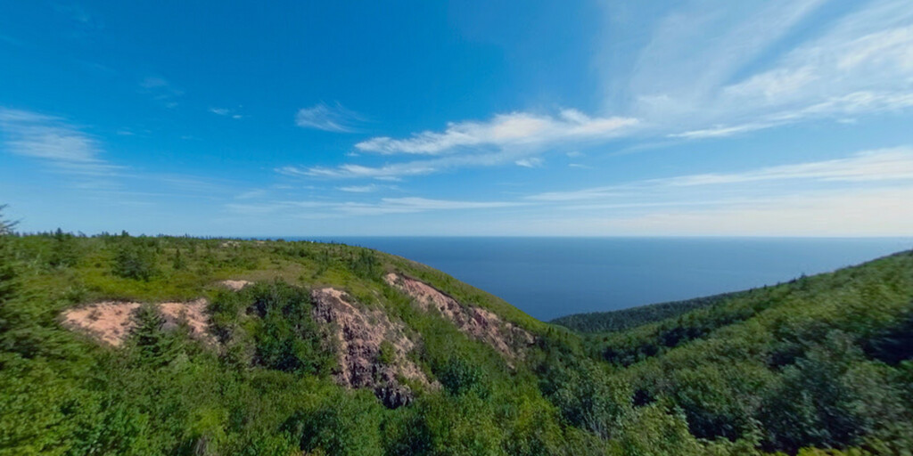
The roads are excellent and well-maintained, mostly two-lane and with plenty of curves.
There are several options for motorcycle tours through Canada, individually or organized.
Be surprised by this beautiful country.
Plan your trip well and take the climate into account.
Route rating: ★★★★★
This tour offers it all: impressive vistas, rich culture, wildlife, hiking opportunities, beaches, and charming villages. An absolute must for nature lovers and adventurers.
 Share this route


Animation

Verdict


Duration
10h 11m

Mode of travel
Car or motorcycle

Distance
309.49 km

Countries

 RouteXpert Review
 The route loops around the northern tip of the island, passing through the Breton Highlands of the Cape. It is named after the explorer John Cabot, who landed in Atlantic Canada in 1497.
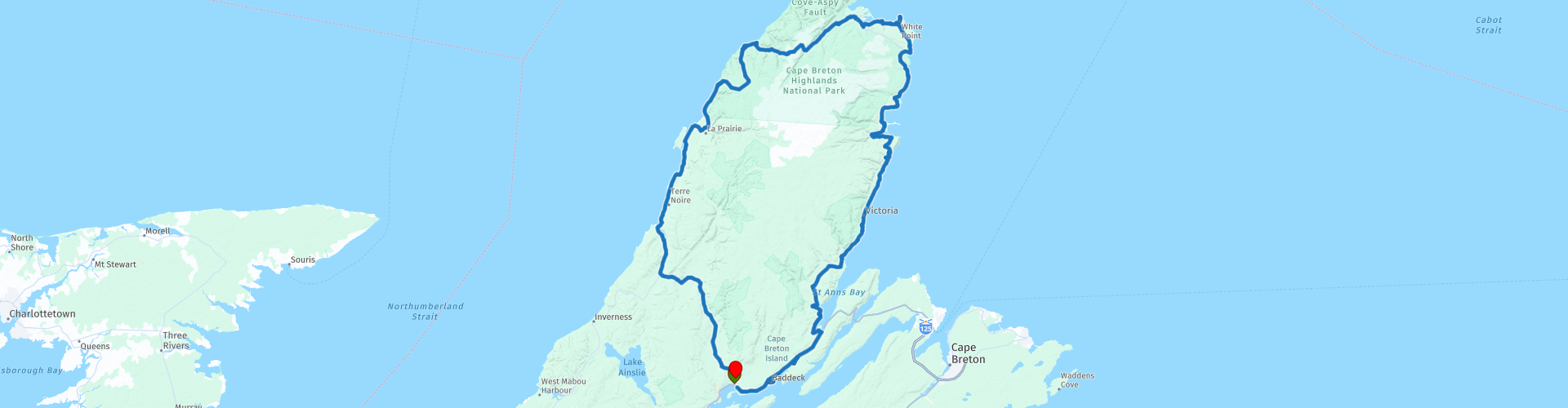
The northern section of the Cabot Trail runs through Cape Breton Highlands National Park. The western and eastern sections follow the rugged coastline, offering ocean views. The southwestern section passes through the Margaree River Valley before skirting Bras d'Or Lake.
The Cabot Trail is designated Trunk 30 by the Ministry of Transport and Public Works. The route is open year-round.
You'll drive through stunning landscapes, charming villages, and the rugged Canadian wilderness with its vast forests. The route largely follows the coast, and you can spot whales and seals at several locations.
The route is just under 300 km and can easily be done in a day, but because of all the beauty, it's definitely recommended to extend it into a multi-day trip. There are several hotels, campgrounds, and B&Bs on the island. The start and finish are just after Wagmatcook 1, where the Trans Canada Highway merges into the Cabot Trail. Some sections of this road are uneventful and straight, so we occasionally take a more rural route.
The first stop, just seven miles in, is the Alexander Graham Bell Museum. This museum houses items donated in 1955 from the Bell family's personal museum. There are also memorabilia from Bell's experiments, including the original hull of a hydrofoil, the HD-4, which set a world maritime speed record in Baddeck by reaching speeds of over 70 mph (112 km/h) in 1919.
The next stop along the route is Iron Art & Photographs Gallery. In this eclectic "Roadside Attraction," artists Gordon and Dominique showcase their unique work. Intriguing metal sculptures are crafted on-site; colorful knitwear and striking photographs are also on offer.
There's an opportunity to grab a bite to eat at "The Dancing Moose Cafe." Enjoy the view at Cape Smokey Provincial Park. If you enjoy hiking, you can turn right, drive to the parking lot, and hike (part of) the Cape Smokey Trailhead. Although this trail is not maintained, it's still easy to follow. The views are magnificent and worth the effort, especially if you hike here on a foggy morning before the sunny, clear day arrives. Long pants are a must due to the overgrowth of shrubs and the frequent detours caused by fallen trees.
As we drive through Cape Breton National Park, be sure to stop at the Ingonish Visitor Centre. The staff will be happy to provide information about the park and surrounding area, help you get oriented, purchase park passes and program tickets, and provide the latest updates on park facilities and activities. Official Parks Canada merchandise is also available for purchase here, including hats, t-shirts, hoodies, and umbrellas. Across the road, you can take a quick hike up to the Freshwater Lake Lookout via a hiking trail, offering stunning views of Freshwater Lake.
Along the Cabot Trail, there are several hiking trails where you can enjoy Cape Breton National Park while walking. These are clearly marked. Several are included in the review as waypoints and points of interest. There are also several viewpoints along the route, so there are plenty of opportunities to stop and enjoy this beautiful nature park. For those who enjoy hiking, there are also several beautiful beaches along the coast, so bring your swimsuit and a towel.
You can hike the Green Cove Trail, and while it's a short walk (a good way to stretch your legs), it's definitely worth it, as the views are mesmerizing. From this rocky granite headland jutting out into the sea, you can watch the waves crash against the rocks and perhaps even catch a glimpse of whales offshore. Look out for the twisted trees, known as "krummholz." Plants here have adapted to this windy, salt-sprayed coastal environment and have leathery leaves.
Stop at the Neil's Harbour Lighthouse, one of many typical lighthouses in Nova Scotia, often made of wood in red and white. There's also a small restaurant near the lighthouse. Afterward, deviate from the Cabot Trail and drive along a narrow, winding road toward White Point, where you can hike to the very tip via a trail, offering beautiful views.
We'll stop at the North Highlands Community Museum & Culture Centre, which showcases the history and heritage of Northern Cape Breton and serves as a local community meeting place to share the stories and talents of our people.
The Lone Shieling is a Scottish-style hut built in 1942. You can see the hut from the road, but to visit it you have to drive about 100 metres and park, and then it's a short walk through the park.
The next stop is Pleasent Bay where whale watching enthusiasts can enjoy the opportunity, with several cruise companies to choose from.
We'll drive along the coast, with beautiful views of the sea, to Margaree Bay. Afterward, we'll follow the course of the Margaree River and continue along the Middle River Wilderness Area to the end of this scenic drive.
This tour offers stunning vistas, interesting sights, and beautiful, diverse scenery. You'll ride through mountains, valleys, along the coast, through forests, and through small fishing villages. Along the route are many small restaurants where you can enjoy a delicious meal, especially if you enjoy fish.
 Links
Links  Usage
Usage Want to download this route?
You can download the route for free without MyRoute-app account. To do so, open the route and click 'save as'. Want to edit this route?
No problem, start by opening the route. Follow the tutorial and create your personal MyRoute-app account. After registration, your trial starts automatically.  Disclaimer
Use of this GPS route is at your own expense and risk. The route has been carefully composed and checked by a MyRoute-app accredited RouteXpert for use on TomTom, Garmin and MyRoute-app Navigation.
Changes may nevertheless have occurred due to changed circumstances, road diversions or seasonal closures. We therefore recommend checking each route before use.
Preferably use the route track in your navigation system. More information about the use of MyRoute-app can be found on the website under 'Community' or 'Academy'.