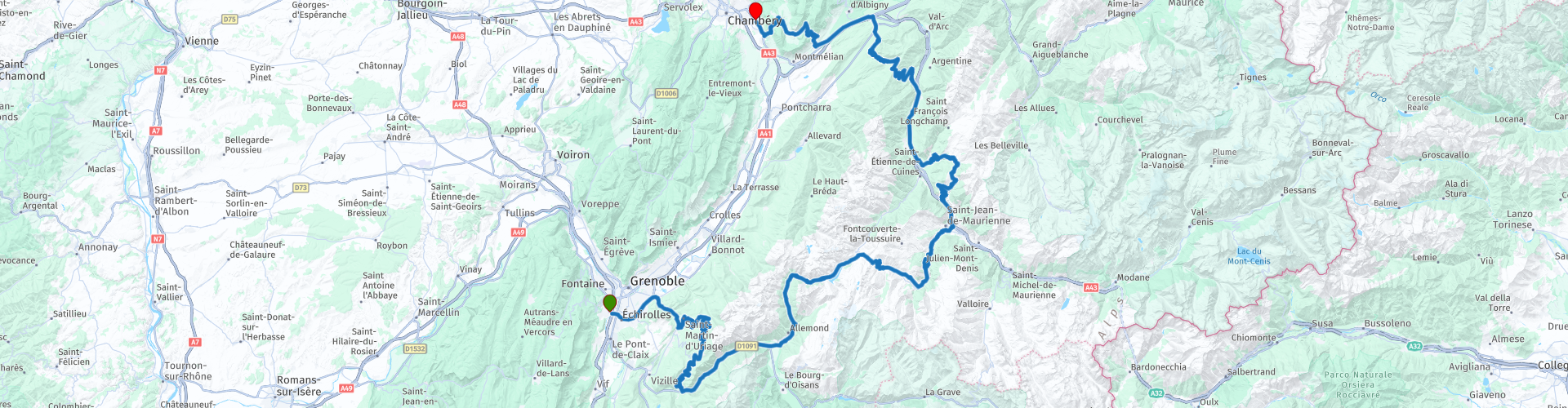
05 Grenoble to Chambery via the Lacets de Montvernier

Questo percorso è stato creato da:
RouteXpert Nick Carthew - (MRA Master)
Ultima modifica: 22-05-2025
 Riepilogo percorso
  Condividi questo percorso


Animation

Verdetto


Durata
7h 50m

Modalità di viaggio
Auto o moto

Distanza
247.40 km

Paesi

 Revisione RouteXpert
 Il percorso si snoda su un mix di strade, da superstrade a piccole strade rurali, ma tutte sono piacevoli da percorrere. Il paesaggio è tipicamente alpino, con prati, cime montuose e fitti boschi. Attraverserete piccoli centri abitati e villaggi, ma la maggior parte del percorso sarà in salita e discesa, con circa 120 tornanti. Il più spettacolare è il Lacets de Montvernier, con 17 tornanti stretti.
La strada è stata costruita per sostituire un'antica mulattiera e migliorare l'accesso ai villaggi. Il percorso è uno dei preferiti dai nostri cugini ciclisti su due ruote, in lycra, quindi teneteli d'occhio.
La costruzione iniziò nel 1931. La prima impresa edile abbandonò presto il progetto; tuttavia, una seconda azienda completò il lavoro in soli 11 mesi, tra maggio 1932 e aprile 1933. 36 operai eseguirono il lavoro, interamente a mano, creando un gioiello che da allora ha deliziato gli utenti di tutto il mondo.
Il percorso prosegue in salita e con tornanti e un tratto di strada a gradoni fino alla cima del Col de Chaussy, 1533 m. Ho suggerito una sosta pranzo al ristorante locale, da cui si gode di una splendida vista.
Dopo pranzo, altri tornanti e viste alpine vi accompagneranno fino all'hotel alla periferia di Chambery.
Questo itinerario è l'ultimo giorno di un tour dai Pirenei alle Alpi. Partenza e arrivo presso gli iBis Budget Hotels, i cui link si trovano in fondo a questa recensione.
È disponibile anche un collegamento per la raccolta di tutti e 5 i percorsi MRA RouteXpert.
Godere


 Collegamenti
  Utilizzo
 Vuoi scaricare questo percorso?
Puoi scaricare il percorso gratuitamente senza un account MyRoute-app. Per farlo, apri il percorso e fai clic su 'Salva con nome'. Vuoi modificare questa rotta?
Nessun problema, inizia aprendo il percorso. Segui il tutorial e crea il tuo account MyRoute-app personale. Dopo la registrazione, la tua prova inizia automaticamente.  Disclaimer
L'utilizzo di questo percorso GPS è a tue spese e rischio. Il percorso è stato accuratamente composto e controllato da un RouteXpert accreditato dall'app MyRoute per l'utilizzo su TomTom, Garmin e navigazione dell'app MyRoute.
Ciononostante potrebbero essersi verificati cambiamenti a causa di mutate circostanze, deviazioni stradali o chiusure stagionali. Si consiglia pertanto di controllare ciascun percorso prima dell'uso.
Utilizzare preferibilmente la tracklog del percorso nel sistema di navigazione. Maggiori informazioni sul l'uso dell'app MyRoute può essere trovato sul sito Web in 'Community' o 'Academy'.