MTG1 21 Souillac Lacave Rocamadour Marcillac la Croisille

This route was brought to you by:
RouteXpert René Plücken (MRA Master)
Last edit: 20-08-2025
 Route Summary
 You drive through beautiful landscapes with large rock formations, valleys, past old bridges, castles and through beautiful villages and towns.
This beautiful route is worth 4 stars because of the beautiful sights along the way and the wonderful roads through the Dordogne.
 Share this route


Animation

Verdict


Duration
7h 21m

Mode of travel
Car or motorcycle

Distance
145.21 km

Countries


Château de Castelnau-de-Bretenoux
 RouteXpert Review
 Bert Loorbach, the author, is an avid motorcyclist himself and lived in France for a year and a half. During that time, he dedicated himself to mapping France's lesser-known and beautiful back roads specifically for motorcyclists. Hotels, campsites, sights, parking lots, and restaurants are included as points of interest.
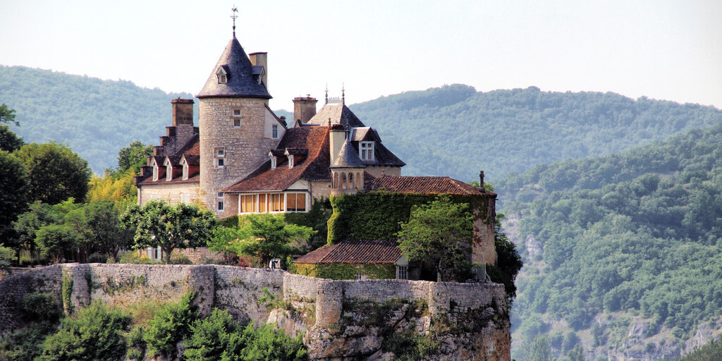
The tour begins in Souillac and continues through the valley along the banks of the Dordogne River to Lacave. In Lacave, you can stop at the Château de Belcastel; admission costs €25, and a guided tour costs €1 extra.
Also visit the Lacave Caves, discovered in 1905 and classified as a UNESCO Global Geopark. Access is by small electric train, which takes you 400 meters underground to discover the wondrous world of the center of the Earth. For an hour and fifteen minutes, over 150 million years of history, crystals, fairytale worlds, and legendary animals unfold. Your visit ends in the Hall of Wonders. Admission costs €9.50.
The route continues through a beautiful landscape with large rock formations. You'll pass the famous houses in the pilgrimage site of Rocamadour. You can stop at various spots along the way for a nice photo.
We continue our journey along the D673 towards Alvignac and Montal, where cave enthusiasts can once again indulge in the Gouffre de Padirac, a magnificent underground world with large lakes. The Gouffre de Padirac (Padirac gorge), undoubtedly the most beautiful in France, boasts a shaft with a diameter of 35 meters and a depth of 103 meters, offering breathtaking views. A guided tour of the 42 km-long underground network is provided by a boatman in a small boat, who will take you to admire the enormous limestone formations, underground lakes, and impressive stalactites and stalagmites. Admission costs €17.
We continue along beautiful narrow and winding roads, passing several ancient castles, such as Château de Castelnau-de-Bretenoux, built from the 12th to the 17th century on a hill overlooking several valleys. It's an imposing medieval fortress of red stone with a keep and ramparts. The castle is clearly visible from the road, and you can visit the fortress. It's a short walk from the parking lot at the edge of the village. Admission costs €9.
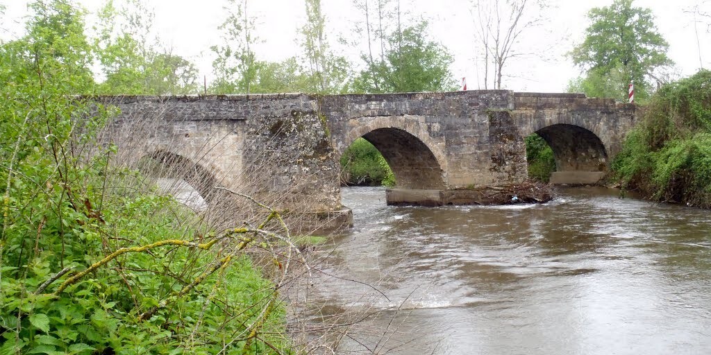
Along the way, we'll also pass over and past beautiful old bridges and the "Barrage du Chatstang" dam, a hydroelectric power station on the Dordogne River. Dating back to 1951, it is 79 meters high and 300 meters wide, and operates with three large turbines. It's an impressive structure that can be visited (call ahead to arrange your visit). Located in the municipality of Saint-Martin-la-Méanne, the reservoir is almost 30 km long. Just before and after the dam, there's an opportunity to stop for photos.
The last stretch takes us through a wooded and rolling landscape to our destination, Marcillac-la-Croisille. There's a lovely campsite by the lake where you can also rent chalets and mobile homes.

Pont de Maday

Château de Belcastel
 Links
Links  Usage
Usage Want to download this route?
You can download the route for free without MyRoute-app account. To do so, open the route and click 'save as'. Want to edit this route?
No problem, start by opening the route. Follow the tutorial and create your personal MyRoute-app account. After registration, your trial starts automatically.  Disclaimer
Use of this GPS route is at your own expense and risk. The route has been carefully composed and checked by a MyRoute-app accredited RouteXpert for use on TomTom, Garmin and MyRoute-app Navigation.
Changes may nevertheless have occurred due to changed circumstances, road diversions or seasonal closures. We therefore recommend checking each route before use.
Preferably use the route track in your navigation system. More information about the use of MyRoute-app can be found on the website under 'Community' or 'Academy'.
