Day 24 TCH Riviere du Loup to Grand Falls

This route was brought to you by:
RouteXpert René Plücken (MRA Master)
Last edit: 16-11-2025
 Route Summary
 This is section 24 which runs from Rivière du loup to Grand Falls.
The Trans-Canada Highway passes through all of the country's southern provinces. The route can be driven in various ways, as there are several alternative routes that also belong to the Trans-Canada Highway. The total distance is around 8,000 km. We won't be driving solely the Trans-Canada Highway, but will be taking as much of the country's back roads as possible, as highway driving alone is too boring, and Canada boasts many beautiful roads through its stunning landscape.
You'll drive through all the provinces and through very diverse and picturesque landscapes, from the Rockies in the west, the Central Prairies to the eastern Maritimes and the northern forest.
The riding season is generally from April to October with longer seasons on the west coast and southern Ontario.
Make sure you have good all-season clothing or bring rain gear. Depending on the province and the season, the weather can change suddenly and you might be surprised by a rain shower, or even a snow or hail shower, so be prepared.
In Canada, the metric system is used, so speeds are indicated in km/h. Helmets are mandatory throughout Canada (DOT approved).
Throughout Canada, you'll see plenty of wildlife. Similar animals vary from province to province, including deer, buffalo, moose, caribou, wolves, cougars, bears, mountain goats, sheep, lynx, coyotes, foxes, raccoons, badgers, various rodents, and a variety of birds.
Even though it is very tempting to stop for a photo, don't do it, it can be very dangerous.
This tour is worth 4**** stars because of the beautiful roads, nice villages, sights and beautiful views.
 Share this route


Animation

Verdict


Duration
6h 4m

Mode of travel
Car or motorcycle

Distance
245.02 km

Countries


 RouteXpert Review
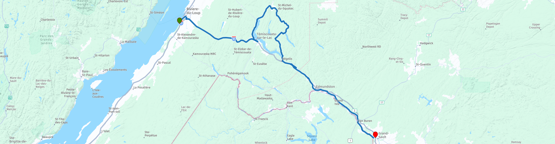
 Today we're driving from Rivière-du-Loup to Grand Falls. The fastest option is the Trans-Canada Highway (QC-20/NB-2), but we're choosing a route that winds along lakes, rivers, and through charming villages. This is a day full of nature and surprises.
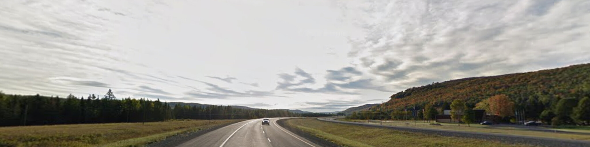
From Rivière-du-Loup, we ride 65 km on the TCH to Témiscouata-sur-le-Lac. Here you have a choice: continue quickly or, like us, turn off onto QC-295 and enjoy the Lac-Témiscouata National Park.
This park is a harmonious blend of water and forests, shaped by glaciers. Hiking trails, cycling routes, and canoeing opportunities make it a paradise for nature lovers. Take the time to snap a photo of the majestic lake.
After the park, we drive along Avenue de la Madawaska towards Dégelis and follow the Madawaska River to Edmunston Airport, where we briefly take the TCH towards Saint-Jacques. Here we visit the New Brunswick Botanical Garden, with its 7 hectares of flowers, plants, and artwork. Next to the garden is the Antique Auto Museum d'Autrefois, a must-see for classic car enthusiasts. Saint-Jacques is also an ideal place for lunch in one of the many small restaurants serving local cuisine.
We continue our journey along National Highway 144, which runs parallel to the Saint John River, the natural border between Canada and the United States. In Saint-Léonard, we cross the river and ride along the water for about 25 km on American soil. A unique experience to briefly cross the border.
Grand Falls, our final destination, lies on the border between the United States and Canada, and its name is derived from a waterfall formed by a series of rocks over which the river's water plunges 75 feet (23 meters).
My rating: ★★★★, A route full of variety: from sparkling lakes to botanical gardens, from quiet country roads to a short trip to the US. Perfect for those who love nature and charm.

 Links
Links  Usage
Usage Want to download this route?
You can download the route for free without MyRoute-app account. To do so, open the route and click 'save as'. Want to edit this route?
No problem, start by opening the route. Follow the tutorial and create your personal MyRoute-app account. After registration, your trial starts automatically.  Disclaimer
Use of this GPS route is at your own expense and risk. The route has been carefully composed and checked by a MyRoute-app accredited RouteXpert for use on TomTom, Garmin and MyRoute-app Navigation.
Changes may nevertheless have occurred due to changed circumstances, road diversions or seasonal closures. We therefore recommend checking each route before use.
Preferably use the route track in your navigation system. More information about the use of MyRoute-app can be found on the website under 'Community' or 'Academy'.

Maine
About this region
Maine is a state in the New England region of the United States, bordered by New Hampshire to the west; the Atlantic Ocean to the southeast; and the Canadian provinces of New Brunswick and Quebec to the northeast and northwest, respectively. Maine is the 12th-smallest by area, the 9th-least populous, the 13th-least densely populated, and the most rural of the 50 U.S. states. It is also the northeasternmost among the contiguous United States, the northernmost state east of the Great Lakes, the only state whose name consists of a single syllable, and the only state to border only one other state. The most populous city in Maine is Portland, while its capital is Augusta.
Maine has traditionally been known for its jagged, rocky Atlantic oceanic and bayshore coastlines; smoothly-contoured mountains; heavily forested interior; picturesque waterways; and its wild lowbush blueberries and seafood cuisine, especially lobster and clams. In more recent years, coastal and Down East Maine, especially in the vicinity of Portland, have emerged as an important center for the creative economy, which is also bringing gentrification.For thousands of years after the glaciers retreated during the last Ice Age, indigenous peoples were the only inhabitants of the territory that is now Maine. At the time of European arrival, several Algonquian-speaking peoples inhabited the area. The first European settlement in the area was by the French in 1604 on Saint Croix Island, founded by Pierre Dugua, Sieur de Mons. The first English settlement was the short-lived Popham Colony, established by the Plymouth Company in 1607. A number of English settlements were established along the coast of Maine in the 1620s, although the rugged climate and conflict with the local indigenous people caused many to fail.
As Maine entered the 18th century, only a half dozen European settlements had survived. Loyalist and Patriot forces contended for Maine's territory during the American Revolution. During the War of 1812, the largely undefended eastern region of Maine was occupied by British forces with the goal of annexing it to Canada via the Colony of New Ireland, but returned to the United States following failed British offensives on the northern border, mid-Atlantic and south which produced a peace treaty that restored the pre-war boundaries. Maine was part of the Commonwealth of Massachusetts until 1820 when it voted to secede from Massachusetts to become a separate state. On March 15, 1820, under the Missouri Compromise, it was admitted to the Union as the 23rd state.
Read more on Wikipedia
Maine has traditionally been known for its jagged, rocky Atlantic oceanic and bayshore coastlines; smoothly-contoured mountains; heavily forested interior; picturesque waterways; and its wild lowbush blueberries and seafood cuisine, especially lobster and clams. In more recent years, coastal and Down East Maine, especially in the vicinity of Portland, have emerged as an important center for the creative economy, which is also bringing gentrification.For thousands of years after the glaciers retreated during the last Ice Age, indigenous peoples were the only inhabitants of the territory that is now Maine. At the time of European arrival, several Algonquian-speaking peoples inhabited the area. The first European settlement in the area was by the French in 1604 on Saint Croix Island, founded by Pierre Dugua, Sieur de Mons. The first English settlement was the short-lived Popham Colony, established by the Plymouth Company in 1607. A number of English settlements were established along the coast of Maine in the 1620s, although the rugged climate and conflict with the local indigenous people caused many to fail.
As Maine entered the 18th century, only a half dozen European settlements had survived. Loyalist and Patriot forces contended for Maine's territory during the American Revolution. During the War of 1812, the largely undefended eastern region of Maine was occupied by British forces with the goal of annexing it to Canada via the Colony of New Ireland, but returned to the United States following failed British offensives on the northern border, mid-Atlantic and south which produced a peace treaty that restored the pre-war boundaries. Maine was part of the Commonwealth of Massachusetts until 1820 when it voted to secede from Massachusetts to become a separate state. On March 15, 1820, under the Missouri Compromise, it was admitted to the Union as the 23rd state.
View region
 Statistics
  7
7Amount of RX reviews (Maine)
 20791
20791Amount of visitors (Maine)
 167
167Amount of downloads (Maine)
 Route Collections in this region
 Trans Canada Highway
The Trans-Canada Highway (TCH) or Trans-Canadian Highway is a system of highways that cover all 10 provinces of Canada.
The Federal and Provincial Highways System that now forms the TCH were authorized by the Trans-Canada Highway Act of 1948 and opened in 1962. It was completed in 1971. The total length of the TCH is 7821 km.
Contrary to the American Interstate Highway System, the TCH does not consist of an unambiguous network of motorways, but forms a network of restricted access highways and other main routes that are more akin to the Dutch provincial roads. The route is indicated by a green shield with a white maple leaf.
The numbering of the roads that are part of the TCH is the domain of the provinces. Only the western provinces have aligned their numbering and the TCH has the designation Highway 1 there.
The main route of the TCH starts in Victoria in British Columbia and runs via Calgary and Regina to Winnipeg. From Winnipeg the route leads to Kenora in Ontario, after which several branches pass through Ontario to Ottawa.
Further east, the route passes through the province of Quebec via Montreal and Quebec, among others, to Moncton, New Brunswick. Then the TCH continues east through Nova Scotia, where a branch (via the Confederation Bridge) leads to Prince Edward Island. Another section runs down to the sea in the port city of Sydney, where a ferry service leaves for Channel-Port aux Basques on the island of Newfoundland. From there the route continues for more than 900 km to the provincial capital of St. John's, in the extreme southeast of the island.
We not only drive the TCH, but will take the rural roads as much as possible, because only Highway driving is too boring and Canada has many beautiful roads through its beautiful landscape. You drive through all provinces and through very varied and scenic landscapes, from the Rockies in the West, the Central Prairies to the Eastern Maritimes and the Northern Forest.
The riding season is generally April through October with longer seasons on the west coast and southern Ontario. Provide good all season clothing or bring rain gear, depending on the province and the season the weather can change and you may be surprised by a rain or even a snow or hail shower, so be prepared.
In Canada the metric system is used, so speeds are indicated in Km / h. A helmet requirement (DOT approved) applies throughout Canada.
You will see many wildlife throughout Canada. This varies from province to province, such as deer, buffalos, moose, caribou, wolves, pumas, bears, mountain goats, sheep, lynx, coyotes, foxes, raccoons, badgers, various rodents and all kinds of birds. Even if it is very tempting to stop for a photo, don't do it, it can be very dangerous.
The routes described in this review sometimes deviate from the Trans Canada Highway, bringing the total length to 9,300 kilometers. The routes are made so that you drive through the beautiful parts of Canada with truly beautiful panoramas and beautiful sights to visit, this differs from museums, parks to historical points. The routes are not too long so there is time to stop for photos and sights along the way. You can also choose to arrange and combine the stages differently or to add other routes to shorten or extend your journey. The routes are marked with a rating in stars, some routes are less challenging or interesting but are necessary to drive to the next point, which is why they often have a lower rating.
In the route description you will find more details about the routes and the points of interest along the way. These points and also hotels, restaurants, petrol stations etc. are indicated with a POI and sometimes also with a Route point. In the description you will also find links to interesting sites and to the routes that connect to that day.
The described routes are;
Day 01 TCH Victory to Nanaimo
Day 02 TCH Nanaimo to Hope
Day 03 TCH Hope to Kamloops
Day 04 TCH Kamloops to Revelstoke
Day 05 TCH Revelstoke to Lake Louise
Day 06 TCH Lake Louise to Calgary
Day 07 TCH Calgary to Medicine Hat
Day 08 TCH Medicine Hat to Moose Jaw
Day 09 TCH Moose Jaw to Regina
Day 10 TCH Regina to Brandon
Day 11 TCH Brandon to Winnipeg
Day 12 TCH Winnipeg to Kenora
Day 13 TCH Kenora to Ignace
Day 14 TCH Ignace to Thunder Bay
Day 15 TCH Thunder Bay to Marathon
Day 16 Thunder Bay to Wawa
Day 17 TCH Wawa to Sault Ste Marie
Day 18 TCH Sault Ste Marie to Espanola
Day 19 TCH Espanola to Mattawa
Day 20 TCH Mattawa to Ottawa
Day 21 TCH Ottawa to Montreal
Day 22 TCH Montreal to Quebec
Day 23 TCH Quebec to Riviere du Loup
Day 24 TCH Riviere du Loup to Grand Falls
Day 25 TCH Grand Falls to Fredericton
Day 26 TCH Fredericton to Moncton
Day 27 TCH Moncton to Charlottetown
Day 28 TCH Charlottetown to Truro
Day 29 TCH Truro to North Sydney
Day 30 TCH North Sydney to Corner Brook
Day 31 TCH Corner Brook to Grand Falls
Day 32 TCH Grand Falls to Clarenville
Day 33 TCH Clarenville to St John.
Have fun reading the reviews and planning your next road trip.
If you have driven this trip, I am very curious about your feedback!
View Route Collection
Ultimate USA road trip part 07
Michel van Hagen challenged me to follow the Roadtrip of Dr. Randy Olsen as a basis to create the Ultimate USA Road Trip for the MyRoute app RouteXpert Library. I took up that challenge and started in February 2022.
The scientist Dr. Randy Olsen, who became known for using his knowledge of algorithms to find 'Waldo' in the well-known American 'Where's Waldo' book series, has been challenged by Tracy Staedter, from Discovery News, to use the same algorithm to create the perfect Road Trip by creating the US, which will visit almost every state in the US. Alaska and Hawaii are not included in this Road Trip due to their geographical location.
The following three requirements formed the basis of the route: In all 48 countries there must be at least one stop at famous points, monuments, historical sites, national parks, etc. I have added additional interesting points, beautiful tours and routes.
After more than 26 months, the job is finished and, with a lot of support from Nick Carthew, I have created 129 routes that run through the 48 states of the USA and part of Canada. This is the seventh collection that takes you from Salem in ten days through Massachusetts, Maine, New Hampshire, Vermont, New York, Canada, Pennsylvania and Ohio to Mackinaw City, Michigan.
View Route Collection