TTT 2006 06 Noord Brabant

This route was brought to you by:
RouteXpert Hans van de Ven (Mr.MRA)
Last edit: 03-03-2019
 Route Summary
 The 173 ANWB Promoter TankTasTochten (TTT) were scanned by Henry ten Dam and signed by Leon Stolk in Mapsource and later placed as a Track in a .gpx file. These have been made available with the approval of ANWB Promotor via the website of MrGPS so that everyone can enjoy it. The 1st TTT is from 1992, so the route may be slightly different from the original.
I checked all route points and placed them neatly on the road. Also, if necessary, I have put the start point and end point of the route a bit further apart to avoid navigating directly to the end point and I have added the POI files from the start and end point just like a possible stopping point.
Finally, I created the route for TomTom, Garmin and MyRoute-app Navigation users.
With thanks to Henry, Leon, MrGPS and Promoter.
 Share this route


Animation

Verdict


Duration
2h 30m

Mode of travel
Car or motorcycle

Distance
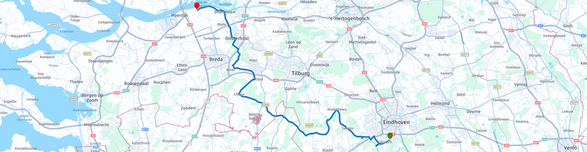
103.82 km

Countries


 RouteXpert Review
 * The Amer is a river in the Dutch province of Noord-Brabant, which is the continuation of the Bergsche Maas. De Amer starts at Geertruidenberg where the water of the Donge and the Spijkerboor merge with the water of the Bergsche Maas. (Source: Wikipedia).
From Waalre you go through the Kempen ** to Poppel. In Poppel you are about halfway the route, so time to have something to eat, in Poppel you have several options on the route, so plenty of choice.
** De Kempen is a diluvial sandy area in the northeast of Belgium and the southeast of the Dutch province of Noord-Brabant, south of the line Eindhoven-Tilburg. (Source: Wikipedia).
After the stop in Poppel you continue to Breda, Oosterhout to drive to the terminus in Lage Zwaluwe via Drimmelen, where you can see the Amercentrale *** in clear weather, where you are at "Here is" this TTT can close.
*** The Amercentrale is a coal-fired power station in the municipality of Geertruidenberg. The plant is named after the Amer, at whose starting point it is located. In 1952, units 1, 2 and 3 of the Amer power plant supplied electricity for the first time. (Source: Wikipedia).
Because I have not driven this route (yet) myself, this route gets 3 stars.
Route details:
rp 7 - Lunch options in Poppel (Belgium).
rp 16 - In clear weather view of the Amer power station.


 Links
Links  Usage
Usage Want to download this route?
You can download the route for free without MyRoute-app account. To do so, open the route and click 'save as'. Want to edit this route?
No problem, start by opening the route. Follow the tutorial and create your personal MyRoute-app account. After registration, your trial starts automatically.  Disclaimer
Use of this GPS route is at your own expense and risk. The route has been carefully composed and checked by a MyRoute-app accredited RouteXpert for use on TomTom, Garmin and MyRoute-app Navigation.
Changes may nevertheless have occurred due to changed circumstances, road diversions or seasonal closures. We therefore recommend checking each route before use.
Preferably use the route track in your navigation system. More information about the use of MyRoute-app can be found on the website under 'Community' or 'Academy'.