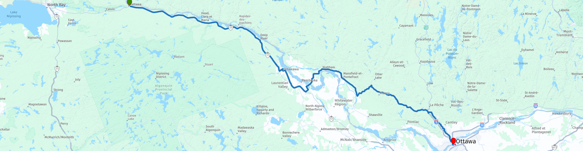
Day 20 TCH Mattawa to Ottawa

This route was brought to you by:
RouteXpert René Plücken (MRA Master)
Last edit: 12-02-2021
 Route Summary
 This is part 20 that runs from Mattawa to Ottawa.
The Trans Canada Highway passes through all the southern provinces of the country. The route can be driven in different ways. There are namely in various alternative routes that also belong to the TCH. The total distance is around 8,000 km. We not only drive the TCH, but will take the rural roads as much as possible, because only highway driving is too boring and Canada has many beautiful roads through its beautiful landscape.
You drive through all provinces and through very varied and scenic landscapes, from the Rockies in the West, the Central Prairies to the Eastern Maritimes and the Northern Forest.
The riding season is generally April through October with longer seasons on the west coast and southern Ontario.
Provide good all season clothing or bring rain gear, depending on the province and the season the weather can change and you may be surprised by a rain or even a snow or hail shower, so be prepared.
In Canada the metric system is used, so speeds are indicated in Km / h. A helmet requirement (DOT approved) applies throughout Canada.
You will see many wildlife throughout Canada. your similar animals from province to province, such as deer, buffalos, moose, caribou, wolves, pumas, bears, mountain goats, sheep, lynx, coyotes, foxes, raccoons, badgers, various rodents and all kinds of birds.
Even if it is very tempting to stop for a photo, don't do it, it can be very dangerous.
 Share this route


Animation

Verdict


Duration
4h 58m

Mode of travel
Car or motorcycle

Distance
329.28 km

Countries

 RouteXpert Review
 Along the way there are many interesting sights and beautiful places to stop for a photo, some of which are described in this review.
The first part of the route we follow the Trans Canada Highway that runs south of the Ottawa River. The first photo stop is a small parking lot with a lookout point (RP8) on a dam with a nuclear energy reactor, Nuclear Power Demonstration (or NPD). NPD was the first Canadian nuclear power reactor and the prototype for the design of the CANDU reactor. Built by Canadian General Electric (now GE Canada), in conjunction with Atomic Energy of Canada Limited (AECL), Ontario Hydro (now Ontario Power Generation) and the US Atomic Energy Commission (AEC), it consisted of a single 22 MWe heavy pressure water reactor (PHWR).
We drive on to the town of Petawawa where we stop longer to visit the CFB Petawawa Military Museum & Canadian Airborne Forces Museum (RP10). In this museum they have uniforms, medals, patches, photos and other memorabilia. The museum collects, preserves and displays documents, artifacts, photographs illustrating the military life of our base in the city of Petawawa in all aspects of living in peace and war. The Garrison Petawawa Military Museums are dedicated to commemorating our military past and recognizing the service of the Canadian Armed Forces to humanity, educating our youth, nurturing identity and nurturing understanding, fostering the spirit of corps and preservation of our collective community heritage.
Lunch is also planned in Petawawa, here are several restaurants and snack bars to choose from.
After lunch we drive to the Petawawa Heritage Village (RP14), which is a pioneer life museum and houses original and replica buildings on 5 acres. Petawawa Heritage Village tells the story of rural communities in the former borough of Bucannon & Wyllie and in Petawawa from 1880 to 1920, and the founding and development of the town of Petawawa in 1865.
Managed by the Petawawa Heritage Society, the pioneer village is a must for anyone visiting the area.
The Village hosts a host of events, including hosting a Christmas Village, Halloween Haunted Village, A Medieval Revival, and a slew of other special activities. Be sure to check out their website (link in review) for more.
We then drive another 16 kilometers on the TCH to RP17 where we turn left and follow the road to Highway 148 via the bridges between the islands of Cotnam and Île Morrison. Hwy 148 is a beautiful 2 lane north of the Ottawa River in Quebec.
At RP21 you can stop to take a picture of the beautiful George Bryson Heritage House. George Bryson was a Scottish-born businessman and political figure in Quebec. He came to Upper Canada with his parents in 1821. He entered the timber trade, was mayor of Mansfield-et-Pontefract. He also served as a justice of the peace, postmaster of Fort Coulonge and director of Pontiac County. In 1867, he was appointed to the Legislative Council of the county for Inkerman division. He helped found the Bank of Ottawa, later as director, and promoted the development of rail connections in the region. Bryson retired from politics in 1887 and died at Fort-Coulonge at the age of 86.
A little further at RP22 you can stop for a photo of the beautiful old wooden bridge, Félix-Gabriel-Marchand bridge over the Coulonge River was built in 1898, this 148.66 meters (487.7 ft) long bridge is the longest covered bridge in Quebec.
We continue to Campbell's Bay where we turn left and continue on the QC-301 a beautiful road through the green landscape. After about 14 kilometers we turn right and take Route 366, this is a beautiful winding road along the Natural Park “Parq de la Gatineau”.
At Rockhurst we drive to the bank of the Gatineau River where we take the Chemin Riverside Road that meanders along the river to Ottawa. A wonderful ending to this day.
Although Ottawa is not known for its beautiful beaches, RP27 has a hidden Quarry with clear blue water. Located in Wakefield, Quebec, Morrison's Quarry has the clearest water you can find near Ottawa. The water is so clear that you can look down anywhere from 25 feet to 100 feet! Morrison's Quarry is mostly used for scuba lessons and Great Canadian Bungee, the highest bungee jump in Canada, but it is also a fantastic place for swimming. Snorkel, dive and try the water slide.
After this relaxing closure we drive the last 30 kilometers to Ottawa, this city has a lot to offer and it is certainly worth planning an extra (rest) day here.
This route is worth 5 ***** Stars, beautiful roads, beautiful nature and sights along the way, with the beautiful Morrison's Quarry as the icing on the cake.


 Links
Links  Usage
Usage Want to download this route?
You can download the route for free without MyRoute-app account. To do so, open the route and click 'save as'. Want to edit this route?
No problem, start by opening the route. Follow the tutorial and create your personal MyRoute-app account. After registration, your trial starts automatically.  Disclaimer
Use of this GPS route is at your own expense and risk. The route has been carefully composed and checked by a MyRoute-app accredited RouteXpert for use on TomTom, Garmin and MyRoute-app Navigation.
Changes may nevertheless have occurred due to changed circumstances, road diversions or seasonal closures. We therefore recommend checking each route before use.
Preferably use the route track in your navigation system. More information about the use of MyRoute-app can be found on the website under 'Community' or 'Academy'.