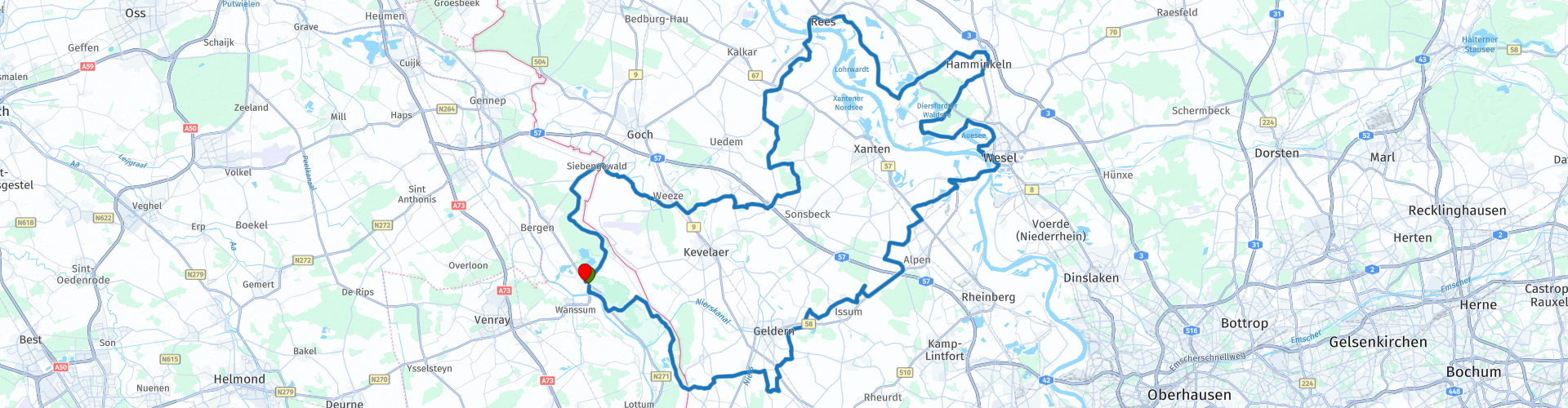
Rondrit Well Hamminkeln Weeze 175km

This route was brought to you by:
RouteXpert Bas Brauer
Last edit: 28-06-2021
 Route Summary
 www.thunderbike-roadhouse.de
 Share this route


Animation

Verdict


Duration
3h 58m

Mode of travel
Car or motorcycle

Distance
177.03 km

Countries


 RouteXpert Review
 At Wesel you can still see the remains of the old railway (RP 29) that used to be part of the railway line between Hamburg and Venlo.
Later in the route there is a possibility, by turning left, to just leave the route (RP 31) and enjoy the view of the harbor that is part of the Rhine. For a cup of coffee you can visit the Cafe zum Yachthafen located on site. At the rear of this is the airport of Wesel and the Auesee. A little further (RP 35) from the route is a nice view of a 200-hectare gravel hole. Adjacent to this there is a large peat landscape, ideal for a nice walk.
The route is now approaching Hamminkeln. Thunderbike Roadhouse is located here (RP 37). An excellent opportunity to drink a cup of coffee or something to eat after a 90 km drive. A Harley museum is also located here.
The route continues its way along the Rhine, and then crosses it at Rees via the bridge. After a few kilometers the route is ashamed along the Üedmer Hochwald and then goes straight through the Tüschenwald (RP 46). Enthusiasts can take a nice walk here.
At the end of the route you can catch another view of the castle of Weeze (RP 52).
After about 20 km the route ends again in Well in Limburg. The entire route is approximately 175 km.
route rating:
landscape: 4 points
roads: 4 points
attractions: 2 points
the route is thus rated at 4 stars


 Links
Links  Usage
Usage Want to download this route?
You can download the route for free without MyRoute-app account. To do so, open the route and click 'save as'. Want to edit this route?
No problem, start by opening the route. Follow the tutorial and create your personal MyRoute-app account. After registration, your trial starts automatically.  Disclaimer
Use of this GPS route is at your own expense and risk. The route has been carefully composed and checked by a MyRoute-app accredited RouteXpert for use on TomTom, Garmin and MyRoute-app Navigation.
Changes may nevertheless have occurred due to changed circumstances, road diversions or seasonal closures. We therefore recommend checking each route before use.
Preferably use the route track in your navigation system. More information about the use of MyRoute-app can be found on the website under 'Community' or 'Academy'.