Day 04 of 12 Day Roadtrip Iceland Hoefn Seydisfjoerdur

This route was brought to you by:
RouteXpert René Plücken (MRA Master)
Last edit: 05-04-2021
 Route Summary
 Driving in Iceland is a great experience whether you travel by car or as described in this review by motorcycle.
These routes are based on information about Iceland that you can find on the Internet, especially from the Guide to Iceland, where you can find a wealth of information to prepare you well for your trip. The material on this site has been compiled with great care, the link can be found in the review of the first route in this series.
You drive through landscapes that are varied and beautiful, you see glacier tongues, volcanic mountains, geothermal areas with active geysers, lava fields, craters, forests, waterfalls and incredibly rugged stretches of coast.
The routes in the north are part of the 'Arctic Coast Way'
The main roads are of good quality but you also drive a lot on gravel roads, so not suitable for road motorcycles. Some of these roads are sometimes closed due to the weather. It is therefore important that you check the weather forecasts and the situation of the roads every day before you leave, this information can be found on the website of "Icelandic Meteorological Office" and for the roads on the website of "The Icelandic Road and Coastal Administration" " The links are in the review.
Due to the Icelandic climate, this trip can only be made in the summer.
 Share this route


Animation

Verdict


Duration
4h 8m

Mode of travel
Car or motorcycle

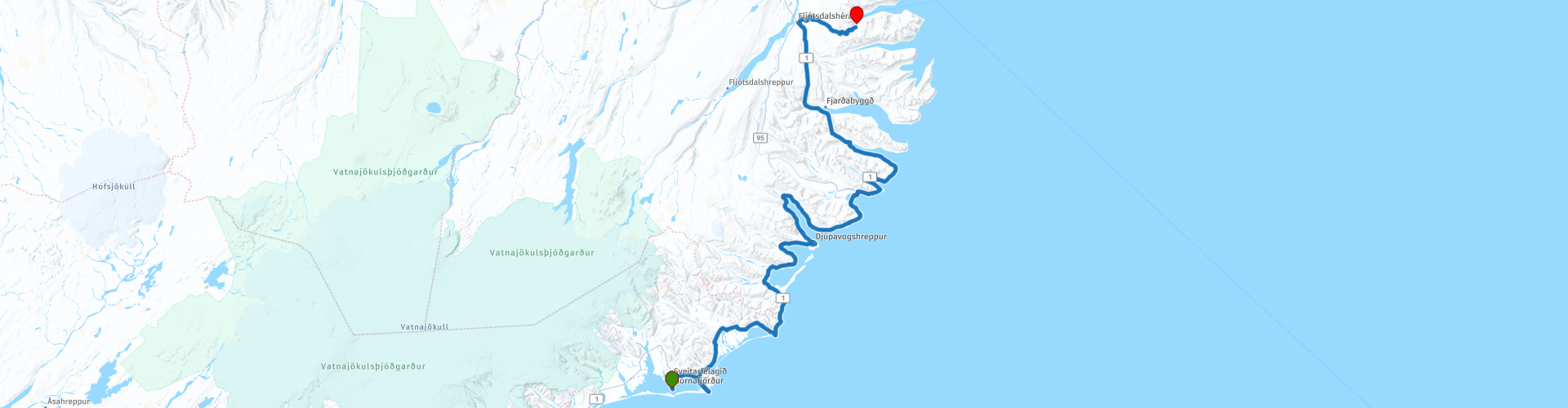
Distance
294.52 km

Countries

 RouteXpert Review
 The Eastern fjords are spectacular in themselves; the mountains in the east are monumental and the bays sparkling and beautiful. The fishing villages that you pass through are sleepy and idyllic and nature is spectacular.
The majority of the route follows the coast line and you have a good chance to spot whales and dolphins; on the coast you see seals; many seabirds, including puffins nesting in the rocks. Wild reindeer also roam in this part of East Iceland.
Traveling along Route 1 will expose you to a wealth of incredible vistas and the beautiful nature of Iceland.
The first stop is at Vestrahorn (RP2), also known as Vesturhorn, is a dramatic place where dazzling cliffs meet on a flat black sandy beach. It is 454 m (1490 ft) high and is sometimes called Batman Mountain. It is one of the highlights of South Iceland.
The next stop is at the coast at the lighthouse "Hvalnes Lighthouse" (RP3), from here you have a beautiful view.
At RP4 you can visit the small waterfall Barkinafoss.
The first settlement where you stop is the village of Djúpivogur (RP5). Although fewer than five hundred people live, it is known for its art and ethos. Djúpivogur is a small coastal town on the Búlandsnes peninsula, located on the scenic Hamarsfjörður fjord in Eastern Iceland. The city has approximately 400 inhabitants. Fishing has been the main driver of Djúpivogur's economy for centuries. The tourism industry has recently blossomed and a hotel, restaurants, cafes and shops can all be found in and around the city. So here you can take a break to have lunch.
At RP6 you can stop to see The Eggs of Merry Bay. In 2009 the Icelandic artist Sigurður Guðmundsson created the 34 enormous eggs in honor of the 34 species of birds that nest in the area. Each stone specimen accurately reflects the shape, patterns and colors of the individual bird's egg that it represents. The eggs, although somewhat different in appearance, are all around the same size. Except, that is, for one. The statue in honor of the red-throated diver, the official bird of Djúpivogur, is larger than the rest.
The eggs are all accompanied by a sign with the name of the bird (both sex and species) in Latin and the common name in Icelandic, making this beautiful piece of art a fun science lesson and language exercise.
A little further is a small waterfall Nykurhylsfoss, for this you have to turn left at RP7 just after the bridge and drive about 400 meters along a gravel road, definitely worth it.
At RP8 is a new bridge and way to the other side of the fjord, this is not in the TomTom map. So turn right here.
At RP9 is the small town of Breiðdalsvík with 139 inhabitants. The charming village is on the coast with great seascapes and black sandy beaches. This remote corner of the world offers a refreshing escape where you can still discover the undiscovered.
At RP10 you can visit Petra's Stone Collection, this wonderful assembly was the lifelong love work for Petra Sveinsdóttir (1922–2012). In her house, stones and minerals are piled from floor to ceiling - 70% of which comes from the environment. They include beautiful cubes of jasper, polished agate, purple amethyst, glowing creamy 'ghost stone', glittering quartz crystals ... it's like opening a treasure chest.
You can stop for a drink a kilometer away.
We drive via a beautiful winding road to our hotel in Seyðisfjörður.
I appreciate this route with 4 stars because of the beautiful nature and sights.


 Links
Links  Usage
Usage Want to download this route?
You can download the route for free without MyRoute-app account. To do so, open the route and click 'save as'. Want to edit this route?
No problem, start by opening the route. Follow the tutorial and create your personal MyRoute-app account. After registration, your trial starts automatically.  Disclaimer
Use of this GPS route is at your own expense and risk. The route has been carefully composed and checked by a MyRoute-app accredited RouteXpert for use on TomTom, Garmin and MyRoute-app Navigation.
Changes may nevertheless have occurred due to changed circumstances, road diversions or seasonal closures. We therefore recommend checking each route before use.
Preferably use the route track in your navigation system. More information about the use of MyRoute-app can be found on the website under 'Community' or 'Academy'.