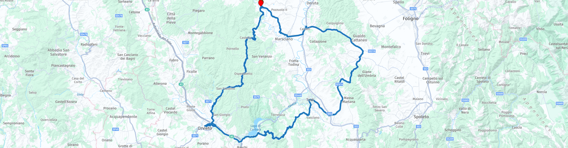
Roundtrip from Spina to Orvieto and Todi

This route was brought to you by:
RouteXpert Catherine De Groote RouteXpert
Last edit: 26-02-2023
 Route Summary
 No motorized traffic is allowed in the historic towns. It is best to park your motorcycle on the edge parking. We received the following tip from the police: if you do not park your motorcycle within the blue-lined parking spaces, you can park for free. At no parking lot was it a problem to place the motorcycle outside the blue markings.
The local roads are in bad condition. Different speed limits apply to this. This varies from 30 km/h to 70 km/h.
The highlight of this route is a visit to Orvieto with its beautiful cathedral. The town is located on a plateau that rises amidst the green landscape of vineyards, cypresses and olive trees. Lake Corbara is an artificial basin that, together with the adjacent areas, forms part of the protected natural area 'Parco fluviale del Tevere'. A visit to Todi is also definitely worth it. The rustic landscape, artistic culture and traditional influences are the common thread during this ride. Unfortunately, the secondary roads are not in the best condition. Still, this ride deserves 5 stars.
 Share this route


Animation

Verdict


Duration
9h 28m

Mode of travel
Car or motorcycle

Distance
166.24 km

Countries

 RouteXpert Review
 Attention: the first gas station is after about 60 km when leaving Orvieto.
A winding road through the forest leads you to Monte Peglia (837 m.) which is located on the territory of the municipality of San Venanzo. The mountain is recognizable from a distance due to the presence on the top of numerous antennas for radio, television (RAI) and telephone. In addition to the presence of fauna and flora, the nature reserve of Monte Peglia is also characterized by the presence of prehistoric fossils and by the three extinct volcanoes near the municipality of San Venanzo.
The river Paglia rises on the eastern slopes of Mount Amiata and after 86 kilometers flows into the Tiber near Orvieto. It is one of the protagonists of a transition area, on the border between Lazio, Tuscany and Umbria, where the gentle Sienese hills are interrupted by the rugged relief of the typical high Lazio landscape of volcanic origin. In the valley, the river has formed an alluvial plain made up of sand and pebbles. The Paglia is very rich in fish and has an abundant fish fauna.
On the outskirts of Orvieto is the Etruscan necropolis of Crocifisso del Tufo. The place takes its name from a sixteenth-century crucifix carved in tuff and preserved in a chapel below the area of San Giovenale. The first news of finds in the area dates back to the late eighteenth century, but more consistent information points to the years 1830-31, on the occasion of the works for the Via Cassia Nuova. A notable feature of the necropolis is its urban organization, with a regular plan and roads on orthogonal axes. The typical tombs of the necropolis, grouped in 'blocks', consist of rectangular rooms, mostly single. The entrance door was closed by a slab of tuff and a cladding of tuff blocks aligned with the outer walls of the tomb; between the slab and the wall was a filling of earth. The slab usually rests on the third step that descends to the entrance. Characteristic of the necropolis is the presence of a large number of inscriptions that bear witness to the distinguished inhabitants and nobility of Orvieto.
To visit Orvieto it is recommended to park in the large parking opposite the fortress Albornoz. From this parking you are quickly in the center.
Orvieto is one of the most beautiful places in Umbria. It is not large, but very attractive. Of course you will first marvel at the beautiful facade of the cathedral and the colorful frescoes in this church, but Orvieto is much more than just this imposing church.
In addition to the cathedral, there are also other interesting buildings on the large and cozy square. To the right of the cathedral is the 13th-century Palazzo dei Papi. This palace houses the Cathedral Museum. To the left of the church is the Museo Faina. It contains an important collection of Etruscan artworks by the Count Faino. At the corner of Piazza Duomo and via del Duomo, there is a 14th-century tower, the torre di san Maurizio, topped by a bronze statue that chimes the hours on the bells.
Less than a hundred meters from the cathedral is the Parco delle Grotte, a lovely piece of greenery in the middle of the city, where you can also enjoy a picnic. It is named after a cave complex that you can visit on a guided tour of Orvieto Underground (Piazza del Duomo 23). This organization is happy to introduce you to the labyrinth of caves carved into the tuff plateau on which Orvieto is built.
The Pozzo di San Patrizio provides another special underground visit. Although this well dates back to 1527, it is a technical tour de force that today's engineers can indulge in. The well is no less than 62 meters deep. Around the well, 72 arched windows provide natural light. There are two wide, separate spiral staircases with 248 steps each. One set of stairs was for traffic going down and the other for traffic going up, because the donkeys that supplied the city with water were not allowed to collide with each other. At the very bottom there is a bridge that makes the transition from one staircase to the other.
On the square overlooking the cathedral, there are some restaurants. The restaurant Hescanas is housed in a characteristic building made of tuff stone that was once a medieval palace. It has a large covered terrace. It is open all day from early in the morning until late at night. You can opt for a quick bite, but delicious gastronomic specialties are also served there.
Corbara Lake is an artificial basin built in the 1960s and used as a hydroelectric power station on the Tiber River. Together with the neighboring areas, it is part of the Tiber River Park, a protected nature reserve. The lake is characterized by its steep banks that extend into a deep and narrow natural gorge as far as Todi.
Civitella del Lago is a small but charming village. The village has its origins in the Roman period. During the Middle Ages, it grew as part of the Massa Bindi, a group of castles that defended the territory around Todi. It was then called Civitella di Massa. From the thirteenth century, the castle was in the possession of different families. During the Napoleonic era, the area was separated from Todi and Civitella di Massa came under the protection of the municipality of Baschi. It only became Civitella del Lago, 'of the lake', when the Lago di Corbara was built in 1962.
Fiore Castle is also known as Old Flower. Legend has it that it is connected to the other castles in the area by a tunnel. The mighty castle is now under renovation.
The castle of Belforte, a 15th century fortress, stands on a small hill 6 km from the center of Todi, in open countryside, surrounded by oak and holm oak forests, overlooking a unique and unspoilt landscape. The fortress, heavy and massive, was enlarged over time and became a farm owned by the Congregation of Charity of the Nuns of Todi.
Since 1972, the largely renovated castle has been a B&B.
Todi has a few important sights, cozy terraces - good for a coffee stop, a soft drink or Italian ice cream - and a great view of the Umbrian hinterland. After all, the historic center of Todi is located on top of a hill.
An important attraction is the large cathedral of Todi in Piazza del Popolo. The cathedral dates from the twelfth century and is built on top of the ruins of an ancient Roman building. You will also find the ancient Palazzo dei Priori with its characteristic dungeon on this square. This town hall is still in service and is one of the oldest public buildings in Italy! On the facade of the palazzo you will find a bronze eagle by Giovanni di Gigliaccio from 1339. This eagle refers to a myth about Todi.
The most impressive sight of Todi is undoubtedly the Santa Maria della Consolazione. It is a beautiful church, not only because of its many works of art, but also architecturally. Its symmetrical layout (Greek cross) and its five domes are not very common in Italy. Built between 1508 and 1607, the Santa Maria della Consolazione is one of the most important Renaissance buildings in Umbria.
The Sanctuary of Merciful Charity is located in Collevalenza, a few kilometers from Todi.
It was built by the architect Julio Lafuente (1951) at the behest of Mother Speranza as a place where he incessantly announced and lived that God is Merciful Love to sinners who return to him. The building consists of three separate prayer rooms, two above each other and a smaller chapel at the back. The architecture is particularly striking because of its structure with many special details. All walls are curved. Only the floors and ceiling are straight. In the upper church, the side chapels consist of semicircular walls, which give the impression of large pillars on the outside. The materials consist of stone, many types of marble and wood. Next to the church is a high bell tower, which can be seen from afar.
The open landscape, with wheat fields interspersed with olive trees, offers beautiful views of the surrounding Monti Martani.
The Monti Martani massif runs for about 45 km from north to south. The high permeability of the limestone rocks and the presence of the fault system have allowed the formation of a deep and complex groundwater flow. In some cases, water erosion has created very deep canyons, with sinkholes resulting from the dissolution of limestone; there are also cavities and caves. The peaks of Martani are mostly round and grassy.
Those who want to refuel will have the opportunity to do so when entering Marsciano. This is also the last gas station before you reach the holiday home.


 Links
Links  Usage
Usage Want to download this route?
You can download the route for free without MyRoute-app account. To do so, open the route and click 'save as'. Want to edit this route?
No problem, start by opening the route. Follow the tutorial and create your personal MyRoute-app account. After registration, your trial starts automatically.  Disclaimer
Use of this GPS route is at your own expense and risk. The route has been carefully composed and checked by a MyRoute-app accredited RouteXpert for use on TomTom, Garmin and MyRoute-app Navigation.
Changes may nevertheless have occurred due to changed circumstances, road diversions or seasonal closures. We therefore recommend checking each route before use.
Preferably use the route track in your navigation system. More information about the use of MyRoute-app can be found on the website under 'Community' or 'Academy'.

Umbria
About this region
Umbria ( UM-bree-ə, Italian: [ˈumbrja]) is a region of central Italy. It includes Lake Trasimeno and Marmore Falls, and is crossed by the River Tiber. It is the only landlocked region on the Apennine Peninsula. The regional capital is Perugia.
The region is characterized by hills, mountains, valleys and historical towns such as the university centre of Perugia, Assisi, a World Heritage Site associated with St. Francis of Assisi, Terni, Norcia, Città di Castello, Gubbio, Spoleto, Orvieto, Todi, Castiglione del Lago, Narni, Amelia, Spello and other small cities.
Read more on Wikipedia
The region is characterized by hills, mountains, valleys and historical towns such as the university centre of Perugia, Assisi, a World Heritage Site associated with St. Francis of Assisi, Terni, Norcia, Città di Castello, Gubbio, Spoleto, Orvieto, Todi, Castiglione del Lago, Narni, Amelia, Spello and other small cities.
View region
 Statistics
  9
9Amount of RX reviews (Umbria)
 13892
13892Amount of visitors (Umbria)
 267
267Amount of downloads (Umbria)
 Route Collections in this region
 8 tours in the Umbria holiday region
Umbria is a region with green, gently rolling hills, mainly covered with vineyards and olive groves, but there are also many fields of wheat, sugar beet, tobacco and sunflowers. This region is also called the green heart of Italy, has a mild Mediterranean climate so that the summers are dry and sunny. Umbria is characterized by ancient walled hill towns with steep streets that bear witness to a rich cultural history. Be pleasantly surprised by this region, where culture and nature are in perfect balance.
Highlights of Umbria are undoubtedly Assisi, Spoleto, Orvieto, Perugia, Gubbio, Todi, Cortona, Umbertide. There are also numerous fortresses in the region such as Montefiascone, Tentennano, Radicofani, Rocca del Leone and Gualdo Cattaneo, which can be seen from afar due to their high location. Civita di Bagnoregio is one of the most beautiful villages in Italy and the parks of Monte Subasi and Monte Cucco offer fantastic views of the beautiful surroundings. Very nice to drive along is Lake Trasimeno, the fourth largest lake in Italy.
Highlights of Umbria are undoubtedly Assisi, Spoleto, Orvieto, Perugia, Gubbio, Todi, Cortona, Umbertide. There are also numerous fortresses in the region such as Montefiascone, Tentennano, Radicofani, Rocca del Leone and Gualdo Cattaneo, which can be seen from afar due to their high location. Civita di Bagnoregio is one of the most beautiful villages in Italy and the parks of Monte Subasi and Monte Cucco offer fantastic views of the beautiful surroundings. Very nice to drive along is Lake Trasimeno, the fourth largest lake in Italy.
View Route Collection