Day 6 Gatlinburg Nashville

This route was brought to you by:
RouteXpert René Plücken (MRA Master)
Last edit: 12-02-2021
 Route Summary
 America is pre-eminently a country to explore on a motorcycle. There are many travel organizations that offer organized tours, but the charm is also to map out routes and drive on your own.
Good motorbike rental companies can be found throughout the country and the bikes are often of the latest model and well maintained.
We drive on the beautiful roads in the states of Nashville and North Carolina and this area is characterized by the beautiful idyllic landscape with provincial two-lane roads that wind through the landscape with many curves, you can visit beautiful towns, villages and places of interest.
Be careful though, because the roads are sometimes of very poor quality and hardly or not lit up in the dark.
For each route there is a more detailed description in the review.
The route is suitable for TomTom, Garmin, Harley-Davidson BoomBox 2 (2019 model) and MyRoute-app Navigation.
 Share this route


Animation

Verdict


Duration
6h 28m

Mode of travel
Car or motorcycle

Distance
391.00 km

Countries

 RouteXpert Review
 We continue the drive to RP4 where the Sugarland Visitors Center is located, you can stop here if you are interested in additional information about the Great Smoky Mountain National Park.
At RP5 the last beautiful scenic byway starts in the Great Smokey Mountains, the next 28 kilometers (18 miles) we drive on the Little River Gorge Road, this is one of the most beautiful rides in eastern Tennessee, located in the Great Smoky Mountains National Park. The road follows the contours of the Little River to the town of Townsend (RP) which is the entrance to the Great Smoky Mountains National Park. We leave this beautiful area where we have enjoyed the last 4 days of beautiful roads and beautiful nature.
The Little River Gorge Road is asphalted and in good condition and one of the most popular rides in the Smokies. The road was laid where once the Little River Railroad ran that was used for logging before the park was built. The ride is a wonderful experience in a beautiful setting.
Along the Little River Road there are seven signposts, each numbered to indicate an interesting point. A number of points are marked with a route point and definitely worth stopping for a photo.
This beautiful winding mountain ride with sharp and blind turns and hairpin bends takes you through the mountains and includes views, trailheads, picnic areas, camping access points and even a waterfall that can be seen from the road.
In Townsend you can stop at RP13 to visit the Great Smoky Mountains Heritage Center, whose mission is to preserve, interpret and share the history and culture of the various peoples and Indians who have lived in the Southern Appalachians, including the Great Smoky Mountains National Park, and offers exhibitions and programs for educational and cultural enrichment.
At RP14 you can visit the Little River Railroad and Lumber Company Museum. It is a non-profit company founded in 1982 to preserve the heritage of the Little River Lumber Company and the Little River Railroad. Discover how the Indians and pioneers depended on the Little River and the surrounding forests for survival.
We continue to RP16 where we turn onto the Foothills Parkway, this scenic Parkway will provide a beautiful view of the Great Smoky Mountains National Park from the road just outside the park. Of the seven Congressionally Mandated Parkways, the Foothills Parkway is the only remaining parkway that has yet to be completed. When completed, the Parkway will be a 72-mile road that crosses the western and northern perimeter of the park and extends from Interstate 40 east of Cosby, TN to its western terminus in Chilhowee. There are several parking places along this Parkway and it is recommended to stop briefly once in a while to enjoy the view of the Great Smoky Mountains and to take a photo.
At RP32 we have reached the end of the beautiful Parkway and on the left is the beautiful Chilhowee Lake, it looks more like a river because it is rather narrow. You can stop here in the parking lot if you want to take a photo.
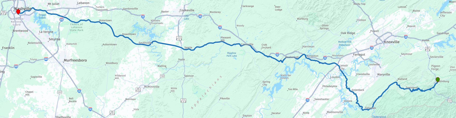
We drive via Kingston to Crossville (RP38), where we stop for lunch, here are several restaurants and fast food chains.
The last 180 kilometers to Nashville we drive on the US-70, a two-lane road (sometimes four lanes) through the green and rolling landscape of Tennessee. Along the way you pass a number of small villages, such as Pleasant Hill, Sparta and Smithville. If you feel like it you can always stop for a short break to have a drink. You also see many small wooden houses and churches that are so typical of this state.
In the evening we arrive at the Motel and can still enjoy bustling Nashville.
This route again has two very beautiful routes and beautiful panoramas, but the last part is sometimes a bit boring, because of the four-lane roads and therefore I rate this route with 4 **** Stars.


 Links
Links  Usage
Usage Want to download this route?
You can download the route for free without MyRoute-app account. To do so, open the route and click 'save as'. Want to edit this route?
No problem, start by opening the route. Follow the tutorial and create your personal MyRoute-app account. After registration, your trial starts automatically.  Disclaimer
Use of this GPS route is at your own expense and risk. The route has been carefully composed and checked by a MyRoute-app accredited RouteXpert for use on TomTom, Garmin and MyRoute-app Navigation.
Changes may nevertheless have occurred due to changed circumstances, road diversions or seasonal closures. We therefore recommend checking each route before use.
Preferably use the route track in your navigation system. More information about the use of MyRoute-app can be found on the website under 'Community' or 'Academy'.