R14 QLD Georgetown to Karumba

This route was brought to you by:
RouteXpert Hans van de Ven (Mr.MRA)
Last edit: 04-04-2020
 Route Summary
 Australia is very large; 8 million km2, which is more than 226 times larger than the Netherlands! Has a diversity of flora and fauna; the most diverse types of plants, trees and animals, especially birds and a lot of typical Australian marsupials, which you will not find anywhere else in the world!
Enjoy all the beauty immensely: From the evergreen tropical rainforests, to the vast Outback; from the desert to the countless and peaceful idyllic palm beaches; from the winter sports areas in the southeast to the vibrant and impressive metropolis of Melbourne, Sydney and Perth.
You will see it all and experience it in this amazing tour through Australia, a tour to remember!
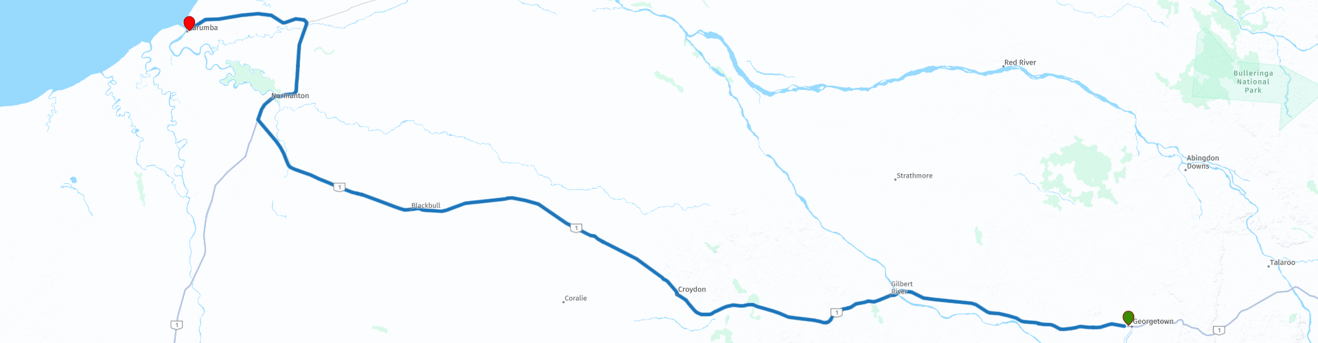
Starting point: Georgetown, Latara Motel
End point: Karumba Lodge Hotel & Motel
The route has been created for TomTom, Garmin and MyRoute-app Navigation users.
ATTENTION: DRIVE LEFT!
 Share this route


Animation

Verdict


Duration
4h 19m

Mode of travel
Car or motorcycle

Distance
372.01 km

Countries

 RouteXpert Review
 Karumba has a tropical savanna climate with two different seasons. The "Wet" usually lasts from December to March and is extremely hot and humid, with temperatures exceeding 27 ° C or 80.6 ° F during the afternoons. Most roads during the "Wet" are usually closed by heavy rain, which can exceed more than 250 millimeters or 9.84 inches per day due to passing tropical cyclones or monsoon depressions that provide the most rain. On occasion, however, as with all of Queensland, the wet season can fail almost completely, producing less than 350 millimeters (13.78 inches) in a full season. The "Dry" usually lasts from April to mid-November and is much more comfortable due to the lower humidity and milder morning temperatures. This time of year is essentially bone-dry and almost completely cloudless: the median rainfall is nil between May and September and more than twenty days a month are perfectly clear.
This route through the outback, these are the regions that are far from civilization. The outback covers nearly three-quarters of Australia and extends mainly across the Northern Territory and Western Australia, and parts of the states of Queensland, New South Wales and South Australia.
The term outback includes various landscapes and climatic zones. Large parts of the outback in Western Australia are inaccessible: sometimes there is no rain here in years, while in summer the temperature rises above 50 ° C. The Queensland outback, on the other hand, consists partly of tropical rainforest.
The characteristics of the outback are:
- Only a few paved roads are present. Farms (stations) are often located on sandy paths that can only be driven with off-road vehicles. It is no exception when a farm is 80 kilometers from the paved road.
- Farms are self-catering. It is no problem if a supermarket cannot be visited for weeks.
- Settlements with several houses, a gas station, a supermarket, a garage, a bank and catering facilities are hundreds of kilometers apart.
- Children receive remote education via radio (School of the Air) and the Internet.
- In the event of serious illness and accident, the Royal Flying Doctor Service (RFDS) is called upon.
Camels were imported from the Middle East in 1870. They live partly on farms, partly in the wild.
- Of the approximately 300,000 Aborigines (approximately 1.5% of Australia's total population), approximately 20% live in the outback, most of them in reservations.
So bring food and drink for the road and stop in the places included in the route along the way such as: Croydon and Normanton, you can refuel here and have some food and drink.
This 4-star rated route is mainly on paved roads. But you also have the choice to drive about 30 Km through the "Outback" on sandy paths. You pass through some nice places, where you can stop for a snack or to refuel.
General info:
Queensland (literally translated: Queensland) is a state in northeastern Australia. Queensland is the second largest in area and Australia's third largest state in terms of population. The state was named after Queen Victoria, the monarch at the time of the settlement of the former colony. The capital and largest city of Queensland is Brisbane, located in the southeast of the state. The northern portion of the state, separated by the Tropic of Capricorn, is tropical. The south is subtropical. Queensland was originally a British crown colony that emerged in 1859 after secession from New South Wales. The city of Brisbane originally started as the Moreton Bay penal colony, which held convicts who again committed errors while serving their sentences in New South Wales.
Brisbane is located about 100 kilometers north of the border between Queensland and New South Wales. Southeast Queensland also has two larger population centers: the Gold Coast south of Brisbane, and the Sunshine Coast north of Brisbane. Along the approx. 2000 km long coast (from south to north) are the following cities: Coolangatta - Gold Coast - Brisbane - Sunshine Coast - Gympie - Maryborough - Hervey Bay - Bundaberg - Gladstone - Rockhampton - Mackay - Townsville - Cairns. The following cities are inland (counterclockwise): Warwick - Toowoomba - Roma - Charters Towers - Mount Isa. The world's largest city by surface, Mount Isa is located in northwestern Queensland. The area of the city is 42,904 km² (approximately the area of the Netherlands!), But the city has a population of approximately 20,000 (2003).
The state is home to five World Heritage Sites: Australian Mammal Fossil Sites (Riversleigh / Naracoorte),
Gondwana rainforests, Fraser Island, The Great Barrier Reef and the Tropical wetlands of Queensland.
Queensland can be roughly divided into three parts:
1.The eastern coastal strip, dominated by the Great Australian Separation Mountains. From north to south there are also the Darling Downs, the Bunya Mountains, the Carnarvon Gorge, the Whitsunday Islands, Hinchinbrook Island and the Atherton Tableland. Off the coast, north of Fraser Island, the Great Barrier Reef begins.
2.The tropical Cape York Peninsula in the north. To the north of this is the Straits Torres with the Straits Torres Islands and to the east most of the Great Barrier Reef.
3 Most of the dry interior, called the Queensland outback, with the Channel Country in the southwest.


 Links
Links  Usage
Usage Want to download this route?
You can download the route for free without MyRoute-app account. To do so, open the route and click 'save as'. Want to edit this route?
No problem, start by opening the route. Follow the tutorial and create your personal MyRoute-app account. After registration, your trial starts automatically.  Disclaimer
Use of this GPS route is at your own expense and risk. The route has been carefully composed and checked by a MyRoute-app accredited RouteXpert for use on TomTom, Garmin and MyRoute-app Navigation.
Changes may nevertheless have occurred due to changed circumstances, road diversions or seasonal closures. We therefore recommend checking each route before use.
Preferably use the route track in your navigation system. More information about the use of MyRoute-app can be found on the website under 'Community' or 'Academy'.