D01 Vancouver Merritt

This route was brought to you by:
RouteXpert Hans van de Ven (Mr.MRA)
Last edit: 05-10-2019
 Route Summary
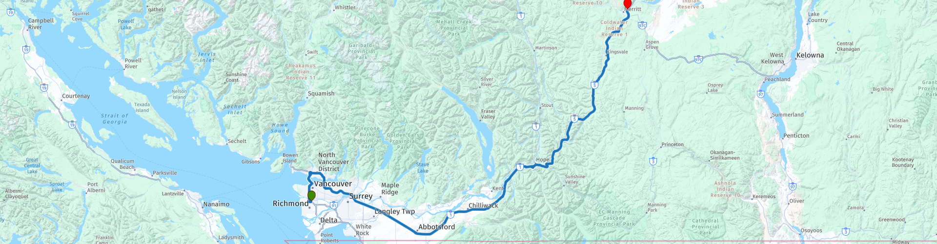
 Starting point: Abercorn Inn Vancouver Airport
End point: Quality Inn Merritt
The route has been made the same for TomTom, Garmin and MyRoute-app Navigation users.
Thanks to Richard & Lisa for the information!
 Share this route


Animation

Verdict


Duration
3h 36m

Mode of travel
Car or motorcycle

Distance
300.88 km

Countries

 RouteXpert Review
 We leave Vancouver via the Lions Gate Bridge and head for Merritt in the province of British Columbia. Merritt is also called 'The Country Capital of Canada'. It lies in the Nicola River Valley, many people passing through the Coquihalla Highway 5 and the Okanagan Connector choose Merritt as a stopover on their passage.
Merritt is a fairly small place and can easily be explored on foot. Every year in July the six-day Merritt Mountain Music Festival is organized and the place is flooded with more than 100,000 visitors, making it one of the larger festivals in Canada. With the country festival and the Walk of Stars, here you will find images of mainly country singers who have performed in Merritt. In addition to the murals, there are also bronze handprints in the pavement, Merritt profiles itself as the Canadian capital of country music.
In this 4 star route you will drive on beautiful good roads, through a breathtaking environment and the stop at Bridal Veil Falls is beautiful.
History
Merritt is located in a valley with a lot of grassland. This drew pioneers to the area in the nineteenth century. These pioneers exploited the grasslands by developing ranches along the rivers. At the beginning of the twentieth century, the way was cleared for mining and the wood industry. In 1906 the place name 'Merritt' was officially taken into use, a name after William Hamilton Merritt, a local mining and railroad worker. As the railways developed, Merritt played a pivotal role and the city flourished. Government buildings and offices settled from nearby Nicola in Merritt. A town hall was built in 1912 and it was given the status of city. A change in the composition of the population took place between 1950 and 1970, with the arrival of foreign migrants to Merritt. Many labor migrants came from India to work in the timber industry. These Indo-Canadians are still part of the population and own restaurants or small businesses in the city.


 Links
Links  Usage
Usage Want to download this route?
You can download the route for free without MyRoute-app account. To do so, open the route and click 'save as'. Want to edit this route?
No problem, start by opening the route. Follow the tutorial and create your personal MyRoute-app account. After registration, your trial starts automatically.  Disclaimer
Use of this GPS route is at your own expense and risk. The route has been carefully composed and checked by a MyRoute-app accredited RouteXpert for use on TomTom, Garmin and MyRoute-app Navigation.
Changes may nevertheless have occurred due to changed circumstances, road diversions or seasonal closures. We therefore recommend checking each route before use.
Preferably use the route track in your navigation system. More information about the use of MyRoute-app can be found on the website under 'Community' or 'Academy'.