D06 Banff Fernie

This route was brought to you by:
RouteXpert Hans van de Ven (Mr.MRA)
Last edit: 12-10-2019
 Route Summary
 The roads are very good, the surroundings breathtakingly beautiful, there is so much to see that you will stop more often than usual to take in everything and record it, too many to list all.
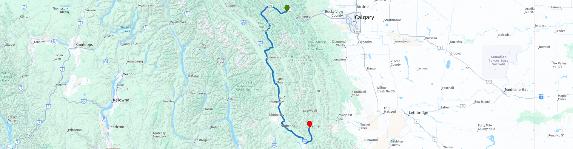
Starting point: Best Western Siding 29 Lodge
End point: Best Western Plus Fernie Mountain Lodge
The route has been made the same for TomTom, Garmin and MyRoute-app Navigation users.
Thanks to Richard & Lisa for the information!
 Share this route


Animation

Verdict


Duration
4h 29m

Mode of travel
Car or motorcycle

Distance
361.28 km

Countries

 RouteXpert Review
 We stay in Fernie. After the great fire in 1908, the center of Fernie was almost completely rebuilt and most buildings date from that time. The City Hall (1905) is one of the buildings that did survive the fire and was used to shelter victims and survivors of the fire. The Holy Family Catholic Church, a brick structure in the shape of a cross, the Court House, a castle-like building and the Fernie Heritage Library, a paradise for book lovers, are special to visit. Guided tours of the mines where Fernie existed are also possible
thanks. It is possible to do a tour through the coal mines all summer long. The tours start from the visitor center of Elkford or Sparwood and last approximately one and a half hours. Before the walk in the underground corridors, an explanation is given about the past of the mine. The trip
ends at a vantage point high above the mines.
In this 4-star route you drive on beautiful good roads, through a breathtaking environment, the Sinclair Pass, a long mountain range, too many to list them all. A coffee tank stop is planned in Invermere, where you will get off Highway 93.
History:
William Fernie, a major player in the coal industry, founded Fernie in 1898. The town still earns income from the mining industry, but after the first ski hill was opened in 1963, Fernie has also become a popular holiday destination.
Fernie was hit by a major fire in 1904 and 1908. The fire of 1908 destroyed the city in 90 minutes. After this, Fernie was completely rebuilt. There is a legend that the city is cursed by an angry Indian and that the fires are the result of his revenge.


 Links
Links  Usage
Usage Want to download this route?
You can download the route for free without MyRoute-app account. To do so, open the route and click 'save as'. Want to edit this route?
No problem, start by opening the route. Follow the tutorial and create your personal MyRoute-app account. After registration, your trial starts automatically.  Disclaimer
Use of this GPS route is at your own expense and risk. The route has been carefully composed and checked by a MyRoute-app accredited RouteXpert for use on TomTom, Garmin and MyRoute-app Navigation.
Changes may nevertheless have occurred due to changed circumstances, road diversions or seasonal closures. We therefore recommend checking each route before use.
Preferably use the route track in your navigation system. More information about the use of MyRoute-app can be found on the website under 'Community' or 'Academy'.