Day 03 TCH Hope to Kamloops

This route was brought to you by:
RouteXpert René Plücken (MRA Master)
Last edit: 16-11-2025
 Route Summary
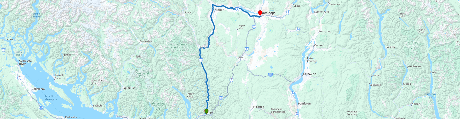
 This is part 3 which runs from Hope to Kamloops.
The Trans-Canada Highway passes through all of the country's southern provinces. The route can be driven in various ways, as there are several alternative routes that also belong to the Trans-Canada Highway. The total distance is around 8,000 km. We won't be driving solely the Trans-Canada Highway, but will be taking as much of the country's back roads as possible, as highway driving alone is too boring, and Canada boasts many beautiful roads through its stunning landscape.
You'll drive through all the provinces and through very diverse and picturesque landscapes, from the Rockies in the west, the Central Prairies to the eastern Maritimes and the northern forest.
The riding season is generally from April to October with longer seasons on the west coast and southern Ontario.
Make sure you have good all-season clothing or bring rain gear. Depending on the province and the season, the weather can change suddenly and you might be surprised by a rain shower, or even a snow or hail shower, so be prepared.
In Canada, the metric system is used, so speeds are indicated in km/h. Helmets are mandatory throughout Canada (DOT approved).
Throughout Canada, you'll see plenty of wildlife. Similar animals vary from province to province, including deer, buffalo, moose, caribou, wolves, cougars, bears, mountain goats, sheep, lynx, coyotes, foxes, raccoons, badgers, various rodents, and a variety of birds.
Even though it is very tempting to stop for a photo, don't do it, it can be very dangerous.
This third leg of the Trans Canada Highway is rated 4**** stars, it's a beautiful drive with stunning views and a good number of activities and sights along the way.
 Share this route


Animation

Verdict


Duration
7h 35m

Mode of travel
Car or motorcycle

Distance
273.81 km

Countries

 RouteXpert Review
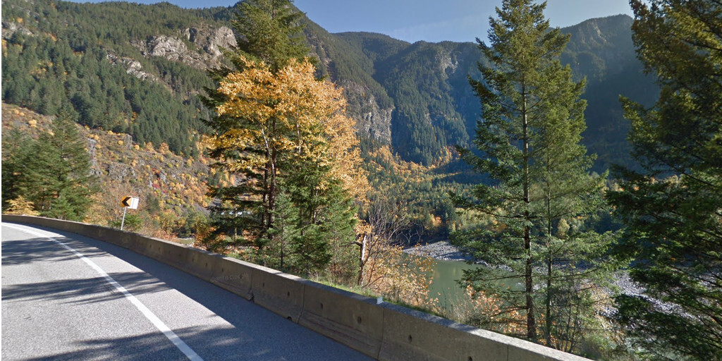
 The morning in Hope dawns crisp, with the scent of pine in the air and the gentle murmur of the Fraser River in the background. Today we'll be driving a stretch that runs entirely along the Trans-Canada Highway—but make no mistake, this is no boring highway. This is a route that winds along rivers, over bridges, and through landscapes that will have you stopping for photos.
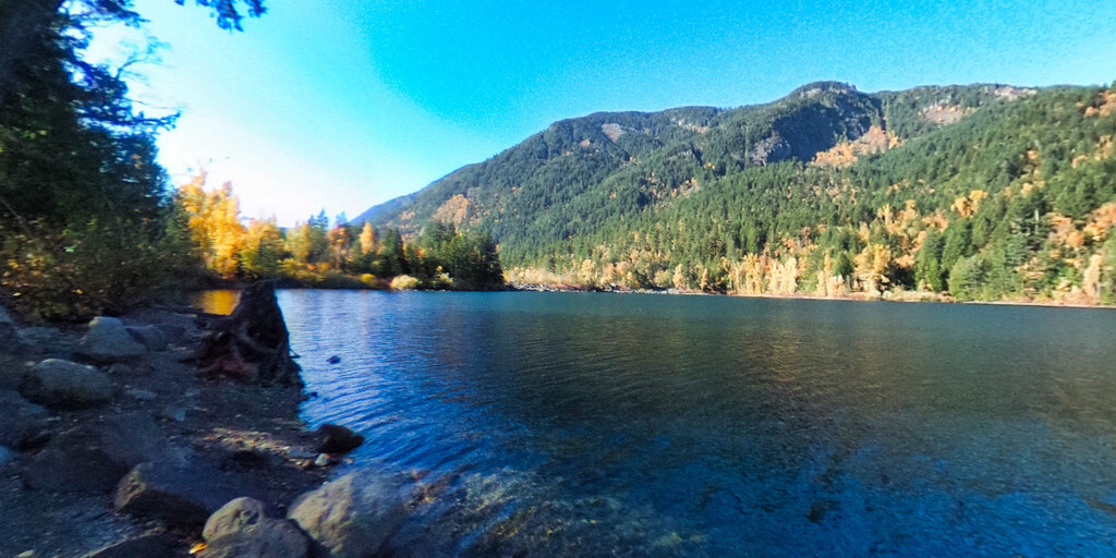
We follow the Fraser River, which winds like a silver ribbon through the valley. The road curves along with it, and behind every bend a new panorama awaits. Sometimes the water glitters between rocks, sometimes it stretches out wide, with mountains standing like sentinels along its banks.
Our first major stop is Yale Historic Site. Here, you'll step back in time to the days of the Fraser River Gold Rush of 1858. We'll stroll along the wooden boardwalk, browse the General Store, and try our luck in the Saloon. In the Chinese Inn, we'll learn how thousands of railroad workers once lived here. And yes, we'll even try our hand at gold panning—who knows, maybe we'll strike it rich today!
Further on awaits the Tuckkwiowhum Heritage Interpretive Village, where the history and culture of the Nlaka'pamux (Thompson) people come to life. It's a place that commands respect and invites you to pause and reflect on the stories of this land.
We stop for lunch in Lytton. The village is situated in a beautiful spot where rivers meet, and the local restaurants serve simple but delicious food. After lunch, we follow the Thompson River, a new winding companion on our journey. The road winds along the water, and we stop at the famous Frog Rock, a rock that actually resembles a crouched frog. A fun photo stop.
The last 30 kilometers to Kamloops are a feast of views, and as the sun slowly sinks behind the hills, we roll into Kamloops. This third leg was pure bliss: rivers, mountains, history, and culture – a ride I rightly give four stars. Tomorrow, the next chapter of our adventure awaits.
 Links
Links  Usage
Usage Want to download this route?
You can download the route for free without MyRoute-app account. To do so, open the route and click 'save as'. Want to edit this route?
No problem, start by opening the route. Follow the tutorial and create your personal MyRoute-app account. After registration, your trial starts automatically.  Disclaimer
Use of this GPS route is at your own expense and risk. The route has been carefully composed and checked by a MyRoute-app accredited RouteXpert for use on TomTom, Garmin and MyRoute-app Navigation.
Changes may nevertheless have occurred due to changed circumstances, road diversions or seasonal closures. We therefore recommend checking each route before use.
Preferably use the route track in your navigation system. More information about the use of MyRoute-app can be found on the website under 'Community' or 'Academy'.