Baiersbronn Hexenlochmuhle

This route was brought to you by:
RouteXpert Hans van de Ven (Mr.MRA)
Last edit: 16-04-2021
 Route Summary
 Route adapted on May 20, in connection with a closure 4 km for the Hexemlochmuhle.
Starting point and end point: Hotel Falken Baiersbronn.
Route made equal for Garmin, TT and MyRoute-app Navigation.
 Share this route


Animation

Verdict


Duration
7h 14m

Mode of travel
Car or motorcycle

Distance
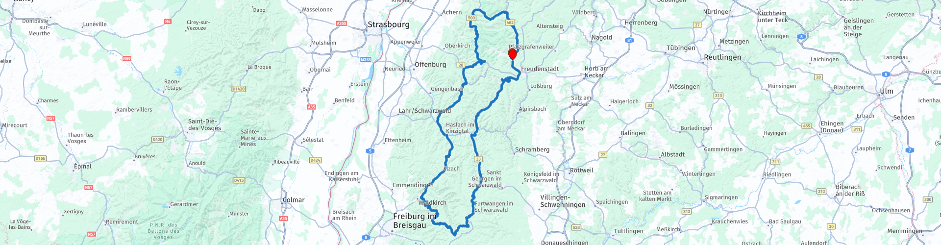
250.10 km

Countries

 RouteXpert Review
 We are surprised with a closure 4 km before the Hexenlochmühle *, we try to get there via a different way, but unfortunately this does not work either. We decide to skip the Hexenlochmühle because further detours will take a lot of time. (I have adjusted the route so that the Hexenlochmühle is included in the route). And because I have been to the Hexenlochmühle before, the pictures of the actual destination of this route.
* The Hexenloch Mill, formerly the Dreistegen Mill, is located in the ravine-like Hexenloch in the Black Forest in Germany between St. Märgen and Furtwangen in the parish of Furtwangen-Neukirch. It was built in 1825 and has been in the same family since 1839. It is the only mill in the Black Forest with two water wheels. (Source: Wikipedia).
In this route, which mainly follows beautiful roads, we stop at the Roßbühl viewpoint for some pictures, at the Imbiss Löcherbergwasen in Oberharmersbach for a cup of coffee and at Rudis Backstüble for coffee with a treat. In this route you will again use the B500, the Schwarzwaldhochstraße **.
** The Schwarzwaldhochstraße is an impressive, wide road that runs right through the Black Forest. Another well-known name for this route is also B500. The winding route goes through the nature park and runs from Baden-Baden to Freudenstadt, at altitudes from 800 meters to one kilometer. The road offers visitors an enchanting view of the Rhine Valley and the Vosges, among other places. Not to be forgotten is that the beautiful nature certainly invites you to walk, take pictures and enjoy the sights along this route.
Just through Freudenstad and refuel in Baiersbronn before we are back at the hotel
Because we drove this route (for the most part) ourselves, we rate it with 5 stars.


 Links
Links  Usage
Usage Want to download this route?
You can download the route for free without MyRoute-app account. To do so, open the route and click 'save as'. Want to edit this route?
No problem, start by opening the route. Follow the tutorial and create your personal MyRoute-app account. After registration, your trial starts automatically.  Disclaimer
Use of this GPS route is at your own expense and risk. The route has been carefully composed and checked by a MyRoute-app accredited RouteXpert for use on TomTom, Garmin and MyRoute-app Navigation.
Changes may nevertheless have occurred due to changed circumstances, road diversions or seasonal closures. We therefore recommend checking each route before use.
Preferably use the route track in your navigation system. More information about the use of MyRoute-app can be found on the website under 'Community' or 'Academy'.