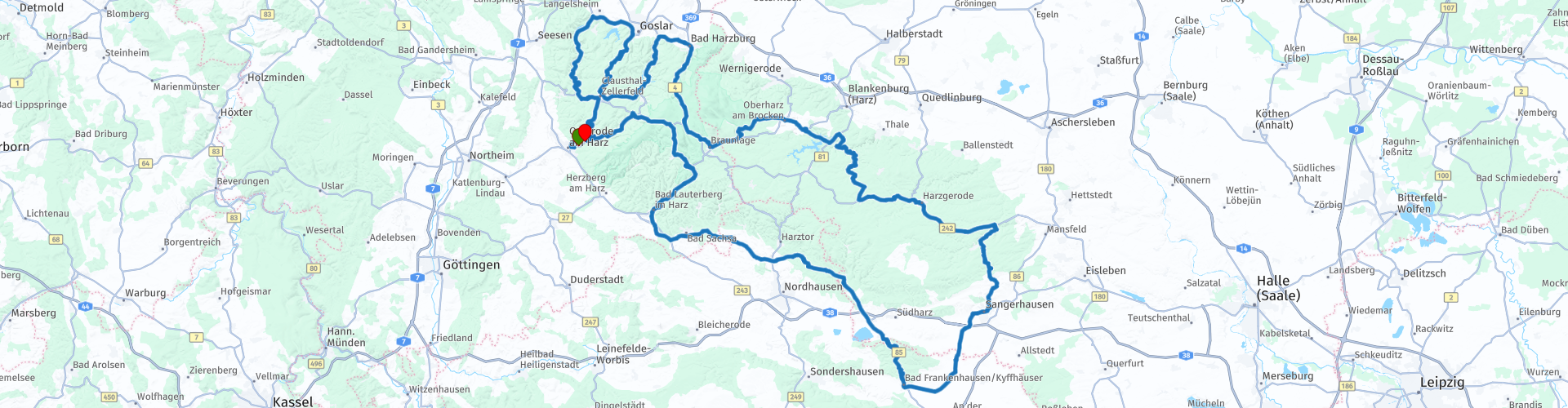
D Harz Osterode Braunlage Kyffhaeuser Osterode

This route was brought to you by:
RouteXpert René Plücken (MRA Master)
Last edit: 20-08-2025
 Route Summary
 Beautiful roads with good asphalt and many beautiful bends and views.
A number of stops are planned along the way.
This route is long and challenging and gets a 5 star rating.
 Share this route


Animation

Verdict


Duration
10h 10m

Mode of travel
Car or motorcycle

Distance
357.04 km

Countries

 RouteXpert Review
 The Harz is the highest low mountain range in Northern Germany. The area is characterized by vast forests, plateaus that are partly used for agriculture, deeply incised valleys with wild rivers, streams and waterfalls and large and small reservoirs. This makes for many beautiful routes to ride. The asphalt is generally of very good quality. The Harz borders Thuringia where you can also make beautiful rides.
This 360km route is a must-ride and worth 5 stars, I rode it in 2018 and 2020.
You will drive through some of the most beautiful parts of the Harz Mountains, there are many bends in this route and driving experience is therefore required. You will pass several mountain lakes and dams. At the Rappbodetalsperre is the longest suspension bridge (Titan RT) in the world for pedestrians.
Cave enthusiasts can also visit the Baumannshöhle, please note that a tour through these dripstone caves takes about 50-60 minutes.
The route also includes the Kyffhäuser 36, a 3.8 kilometre stretch with 36 bends with an average gradient of 10% and is part of an official street circuit, a paradise for motorcyclists.
Pay attention here because people drive quite fast here, but also check by the police. This route is downhill, so if you have time, also drive uphill. At the bottom of the mountain there is a small biker Café, a popular stop for motorcyclists.
You will pass many villages and towns where there are opportunities to eat and drink, but please note that they are often closed between 2:00 PM and 5:00 PM.
Have fun on this ride.


 Links
Links  Usage
Usage Want to download this route?
You can download the route for free without MyRoute-app account. To do so, open the route and click 'save as'. Want to edit this route?
No problem, start by opening the route. Follow the tutorial and create your personal MyRoute-app account. After registration, your trial starts automatically.  Disclaimer
Use of this GPS route is at your own expense and risk. The route has been carefully composed and checked by a MyRoute-app accredited RouteXpert for use on TomTom, Garmin and MyRoute-app Navigation.
Changes may nevertheless have occurred due to changed circumstances, road diversions or seasonal closures. We therefore recommend checking each route before use.
Preferably use the route track in your navigation system. More information about the use of MyRoute-app can be found on the website under 'Community' or 'Academy'.