Round trip from Logrono in the province of La Rioja

This route was brought to you by:
RouteXpert Nick Carthew - (MRA Master)
Last edit: 30-08-2025
 Route Summary
 I have awarded 3 stars*** for this route. The roads, scenery and the attractions are good.
 Share this route


Animation

Verdict


Duration
5h 36m

Mode of travel
Car or motorcycle

Distance
174.90 km

Countries

 RouteXpert Review
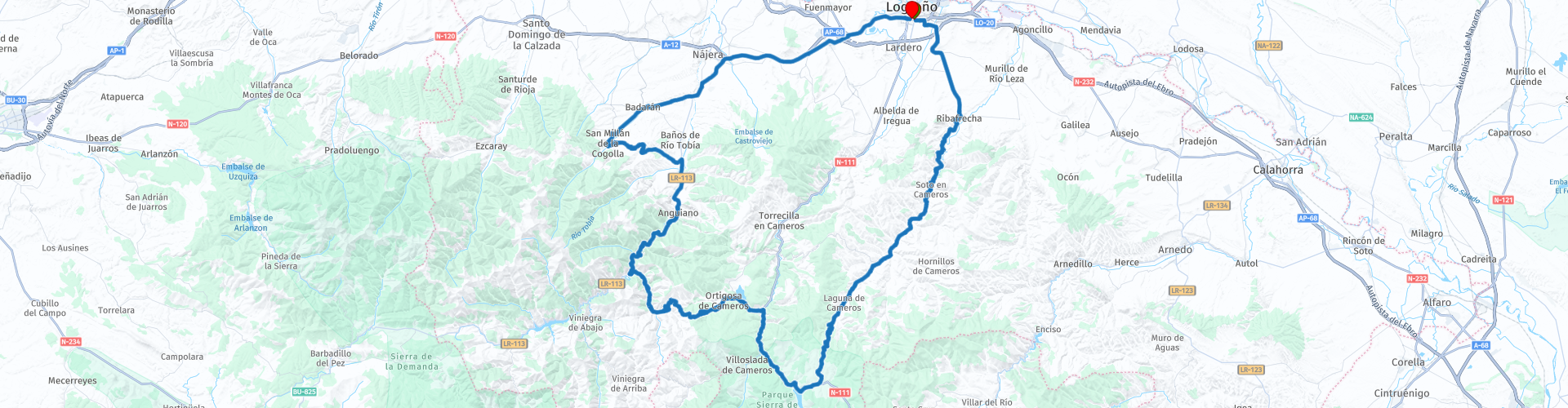
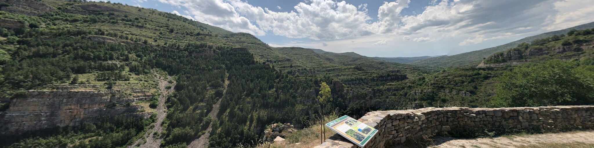
 Using mainly rural and mountain pass roads, this route will take you through some beautiful scenery as you follow the route of the river Leza Canyon. You can see La Carolina Quarry that appears to be eating the mountain as they extract the limestone for aggregates. There are several viewpoints along the Leza Canyon to take photo's from, I have marked a few but the roads are not busy so you can stop pretty much anywhere. Most notable is the Mirador Del Cañón Del Rio Leza (also known as The Mirador del Torrejón). This is located in a Special Protection Area for Birds (ZEPA). From the viewpoint and in the surrounding area many birds can be seen like Tawny Owl, Eagle Owl, Crag Martin, Common Rock Thrush, Blue Rock Thrush, Red-billed Chough, Black Redstart, Common Raven, European Bee-eater, Egyptian Vulture, Griffon Vulture, Short-toed Snake Eagle, Booted Eagle, Golden Eagle, Red Kite and Eurasian Kestrel. The view of the canyon is spectacular and an information board gives you more facts.
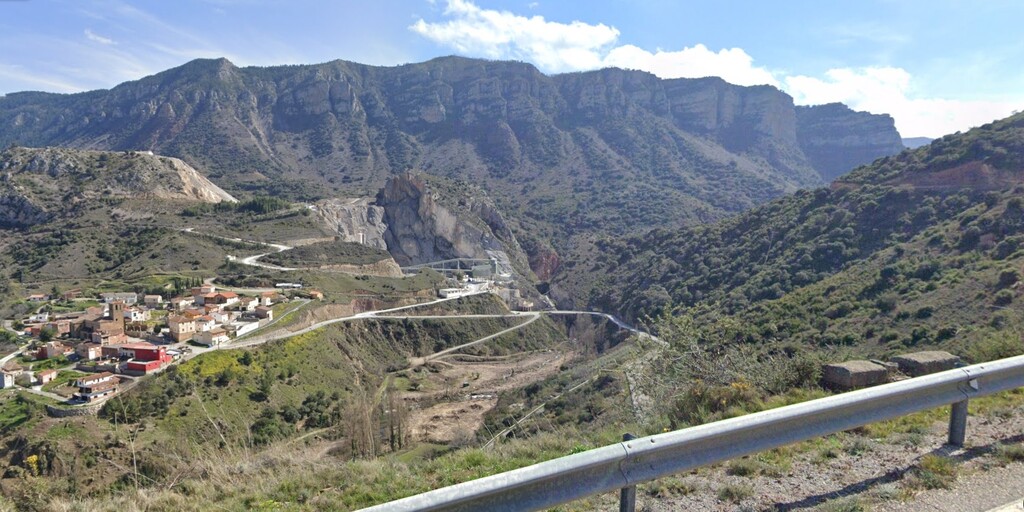
You'll then pass the Terroba Dam holding back the waters of the Rio Leza to create a reservoir, another nice place to stop for a photo.
The top of the climb at Puerto de Sanch Leza 1390 metres also marks the boundary of the Natural Park Sierra Cebollera. This protected area is home to some of the best examples of woodlands in the Iberian mountain range. Mammals include foxes, wild boar, deer, squirrels and wildcats in the forests, and otters and Pyrenean desman in the rivers. There are numerous species of forest birds of prey, such as the goshawk, sparrowhawk, honey buzzard and booted eagle.
At the small village of Villanueva de Cameros you can stop for a coffee or stretch your legs before crossing over the river Iregua.
And then after passing the Gonzalez Lacasa Reservoir, the route starts to climb again by using a series of hairpin bends until you reach the summit of the Peña Hincada at 1412 metres, the highest point on this route, from here, the next few kilometres have great open views of mountains on a twisty (more hairpins) and sometimes a little bumpy road until you reach and cross the river Najerilla.
I have suggested a lunch stop at a small village called Berceo. The restaurant has some good shade and looks out onto the river Cardenas. From here, it is just 35 mins back to the budget hotel at Logrono and from the hotel to the centre of the city is just a 15 min walk. A link to this hotel is below this review.
Enjoy
 Links
Links  Usage
Usage Want to download this route?
You can download the route for free without MyRoute-app account. To do so, open the route and click 'save as'. Want to edit this route?
No problem, start by opening the route. Follow the tutorial and create your personal MyRoute-app account. After registration, your trial starts automatically.  Disclaimer
Use of this GPS route is at your own expense and risk. The route has been carefully composed and checked by a MyRoute-app accredited RouteXpert for use on TomTom, Garmin and MyRoute-app Navigation.
Changes may nevertheless have occurred due to changed circumstances, road diversions or seasonal closures. We therefore recommend checking each route before use.
Preferably use the route track in your navigation system. More information about the use of MyRoute-app can be found on the website under 'Community' or 'Academy'.