Canary Islands round trip Tenerife Costa Adeje

This route was brought to you by:
RouteXpert Sandro Linden
Last edit: 28-05-2022
 Route Summary
  Share this route


Animation

Verdict


Duration
0h 0m

Mode of travel
Car or motorcycle

Distance
0.00 km

Countries

 RouteXpert Review
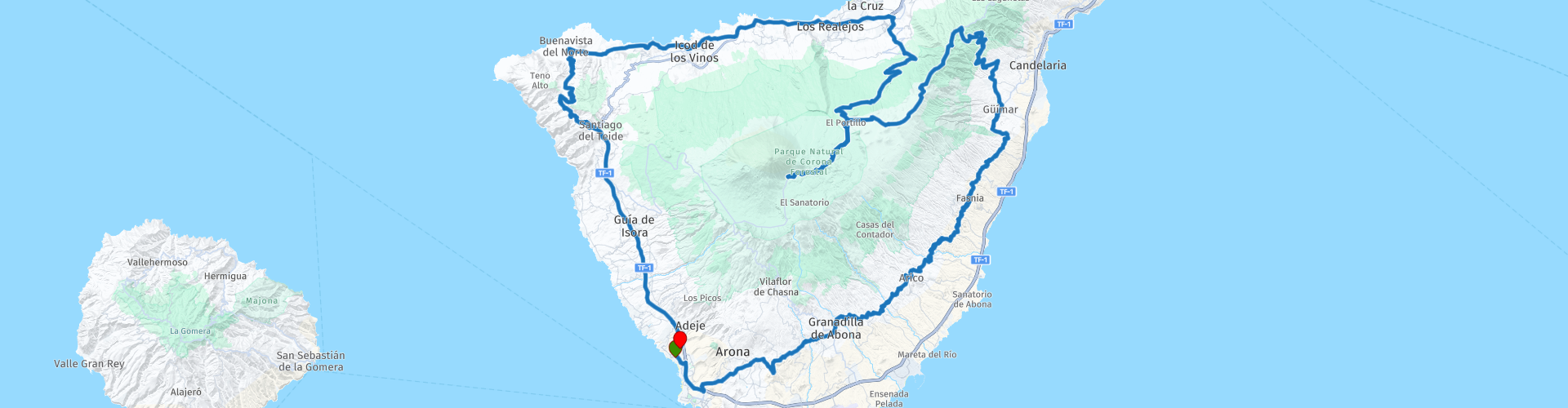
 We start the route at the hotel in Costa Adeje. From here we follow the winding coastal road until we reach the town of Arafo. From now on it is going up steeply because we will have to climb from sea level to around 2,300 M to finally arrive at the Pico del Teide National Park. From this point you can still take the cable car to almost the highest point of the volcano. An absolute must!
We prepare for the descent to the north coast of the island. You will soon notice that the north side is incredibly green in contrast to the rugged and bare south side. Once back at sea level we drive a few kilometers along the busier coastal road until we reach the town of Buenavista del Norte.
From here it goes south again and you come across some fantastic viewpoints including the small village of Masca. From here you have a breathtaking view of the Masca valley and the Atlantic ocean. Absolutely stop for a moment.
We wind a little further south, where we finally reach the highway to get to the last few kilometers to recover from all the curves, to arrive at the hotel again.
You can drive this route all year round and there are plenty of rental options for motorbikes and cars.


 Links
Links  Usage
Usage Want to download this route?
You can download the route for free without MyRoute-app account. To do so, open the route and click 'save as'. Want to edit this route?
No problem, start by opening the route. Follow the tutorial and create your personal MyRoute-app account. After registration, your trial starts automatically.  Disclaimer
Use of this GPS route is at your own expense and risk. The route has been carefully composed and checked by a MyRoute-app accredited RouteXpert for use on TomTom, Garmin and MyRoute-app Navigation.
Changes may nevertheless have occurred due to changed circumstances, road diversions or seasonal closures. We therefore recommend checking each route before use.
Preferably use the route track in your navigation system. More information about the use of MyRoute-app can be found on the website under 'Community' or 'Academy'.