Day 05 Guernica to Villacarriedo

This route was brought to you by:
RouteXpert René Plücken (MRA Master)
Last edit: 17-10-2025
 Route Summary
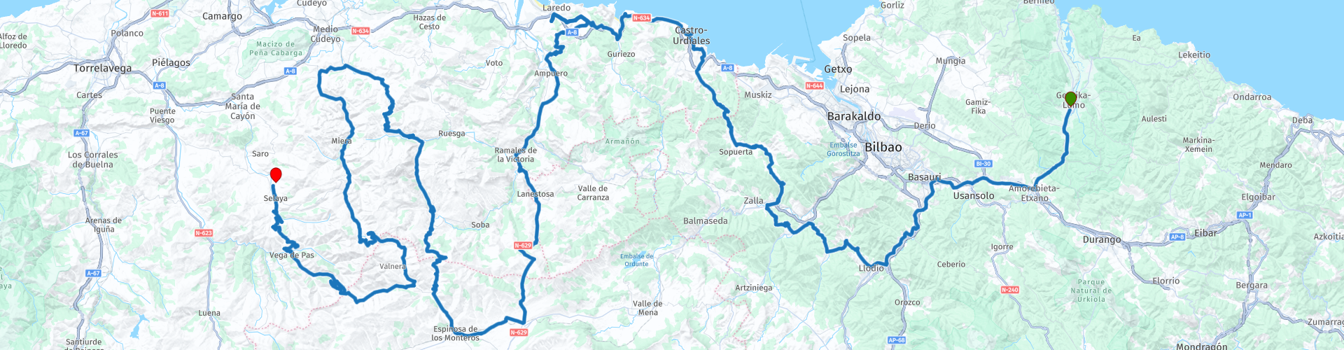
 This ride runs from Guernica to Villacarriedo. It features many challenging passes with beautiful curves and stunning panoramas, including those in the Collados del Asón Natural Park.
I rate this 5 stars because of the beautiful roads and nice different panoramas
 Share this route


Animation

Verdict


Duration
11h 8m

Mode of travel
Car or motorcycle

Distance
320.02 km

Countries

 RouteXpert Review
 There are no scheduled stops for fuel, food, or drinks. Whenever you have the opportunity, stop at one of the points marked with a POI. Along the way, there are several small villages with restaurants and cafes.
Hotels, landmarks, and recommended places to stop and enjoy the view are also marked with a POI. Hotels at the start and finish are also marked with a POI.
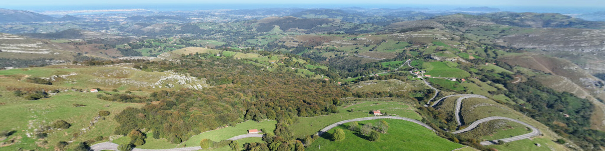
On day 5, we'll drive sections along the coastline, as well as over several passes with numerous viewpoints (Miradors). These are well-marked along the road with signs. There's often a small parking area, so take your time to stop occasionally and enjoy the beautiful panoramas. This is a long drive, so leave early.
The roads on the route are truly excellent and feature many twists and turns. You'll ride through diverse scenery, including beautiful valleys, mountains, and rocky outcrops, along rivers and lakes, so there's plenty to enjoy along the way.
You're driving through Collados del Asón Natural Park, a nature park covering sections of the Asón River in Cantabria, Spain. It was declared a natural park by Cantabria on February 18, 1999.
It is located in the Cantabrian Mountains in southeastern Cantabria, covering an area of 4,740 hectares, of which 4,020 hectares belong to the municipality of Soba and 720 hectares are private land. The altitude ranges from 240 to 1,632 meters above sea level.
It is characterized by limestone cliffs, small beech forests, and unique Cantabrian holm oaks, along with artificial pastures for livestock. This diverse habitat allows for the development of a diverse natural feature of the Cordillera. The park is located in a traditionally uninhabited area, making it so natural and undisturbed.
There are several beautiful passes you can drive over, with many lovely curves, but be aware that the roads can sometimes be very narrow. Several passes are marked with a waypoint, such as:
Puerto de Las Muñecas
Collado del Asón has several viewpoints
Puerto de Alisas
Puerto de las Estacas de Trueba
Pas de La Braguía, several viewpoints.
You'll pass several beautiful and interesting places to stop along the way. Some are marked with a RP, such as:
The beautiful castle Castillo de Santa Ana
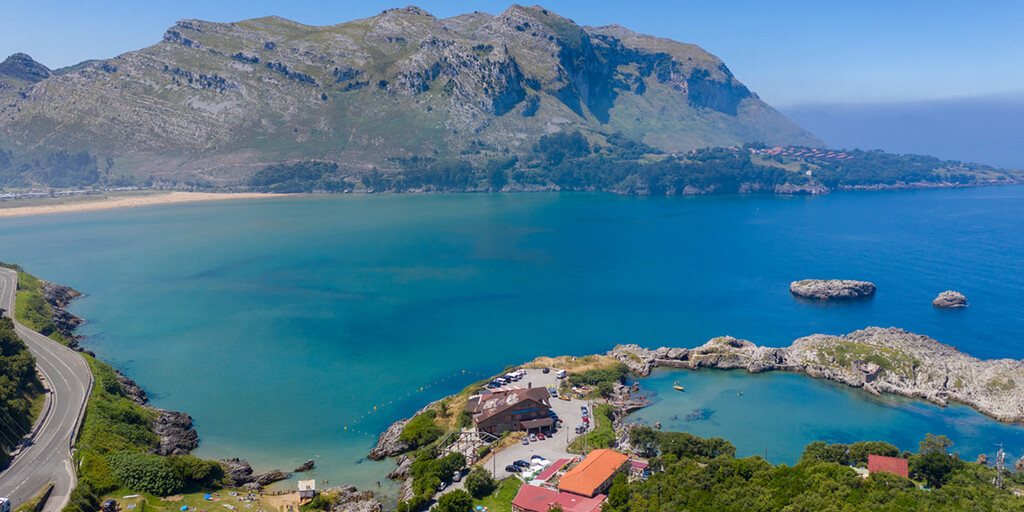
Playa 2a de la Pequena laguna, nice place to have a drink and enjoy the view over the bay.
Puerto de la Sia
Beautiful old stone bridge across the Trueba
 Links
Links  Usage
Usage Want to download this route?
You can download the route for free without MyRoute-app account. To do so, open the route and click 'save as'. Want to edit this route?
No problem, start by opening the route. Follow the tutorial and create your personal MyRoute-app account. After registration, your trial starts automatically.  Disclaimer
Use of this GPS route is at your own expense and risk. The route has been carefully composed and checked by a MyRoute-app accredited RouteXpert for use on TomTom, Garmin and MyRoute-app Navigation.
Changes may nevertheless have occurred due to changed circumstances, road diversions or seasonal closures. We therefore recommend checking each route before use.
Preferably use the route track in your navigation system. More information about the use of MyRoute-app can be found on the website under 'Community' or 'Academy'.