MTG2 04 Bourgogne Tonnerre Noyers Avallon Decize

This route was brought to you by:
RouteXpert René Plücken (MRA Master)
Last edit: 03-09-2025
 Route Summary
 This route comes from the French Motorcycle Tour Guide Part 2 and the original name is "Bourgogne; Route Description 2: Across Burgundy".
In the French Motorcycle Tour Guide, Part 2, a distinction is made between approach routes and tours within a specific area. The approach routes can also be used in conjunction with the routes from the French Motorcycle Tour Guide, Part 1.
The routes have sometimes been slightly modified based on tips Bert Loorbach provides in his description, or because of a different overnight stay, or to meet the minimum 2-hour time limit for the MRA Library. Each route review includes a more detailed description, including overnight options and points of interest along the way, which are also indicated with a point of interest and, if possible, a short description.
This route with its beautiful roads through the green French landscape is worth 4**** stars.
 Share this route


Animation

Verdict


Duration
6h 36m

Mode of travel
Car or motorcycle

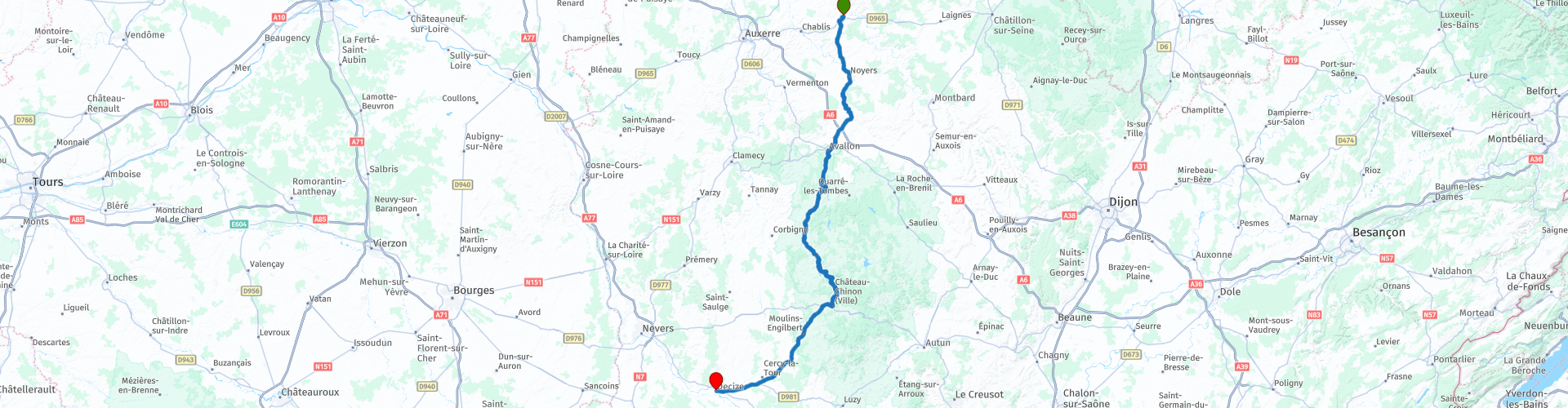
Distance
169.46 km

Countries

 RouteXpert Review
 Burgundy is roughly located within the rectangle formed by Dijon, Auxerre, Nevers, and Macon. It's therefore also a lovely trip for a long weekend or midweek break for those who can't get away for too long but still want to experience the authentic French atmosphere. Secondly, the scenery is stunning. Three-quarters of the Morvan, the heart of Burgundy, is forested, and water is everywhere in the form of streams, rivers, lakes, and reservoirs. Culturally, Burgundy is rich, teeming with Romanesque churches and charming towns, so there's plenty of beauty to stop for sightseeing and photo opportunities along the way.
It's a great place for motorcycle touring; countless small roads lead you through forests, along lakes and rivers, from one charming village to the next. The access routes to Burgundy are described in routes 1 and 2 in this series. This review covers the second of two routes in this beautiful area.
This route is perfect for motorcyclists who want to get a good impression of this area, although it feels more like a "through-tour" due to the generally straight roads. There's plenty to enjoy on this ride, filled with green nature and abundant water. If you're lucky enough to travel in spring, it's also full of flowers. You'll traverse vast forests, sometimes feeling like you're riding through a green tunnel, interspersed with fields where babbling brooks find their way, beautiful blue lakes, and the inviting terraces of charming villages.
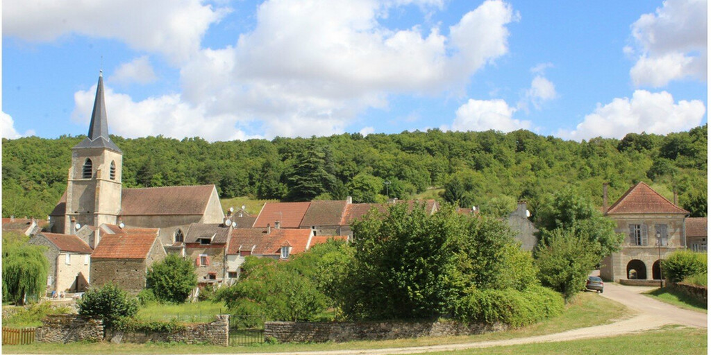
This route is only 167 kilometers, so quite short, and can be combined with approach route 1 in this series by starting in Mesnil-Saint-Père. This review begins at the original starting point, Tonnerre. We take the D944 and head towards Yrouerre. The D944 continues straight to Avallon, but about 500 meters after Yrouerre, we turn off and follow the D86 to Avallon. This short detour is definitely worth it. It takes you along the Serein River through the beautiful medieval village of Noyers. We make a short detour via the lovely town of Civry-sur-Serein and L'Isle-sur-Serein, which are ideal places to stop and stroll before continuing to Avallon.
The next town is Avallon, a walled city built high on a cliff. It's definitely worth stopping here for a stroll through the old streets and along the ramparts. You'll also find buildings with Celtic influences in this village.
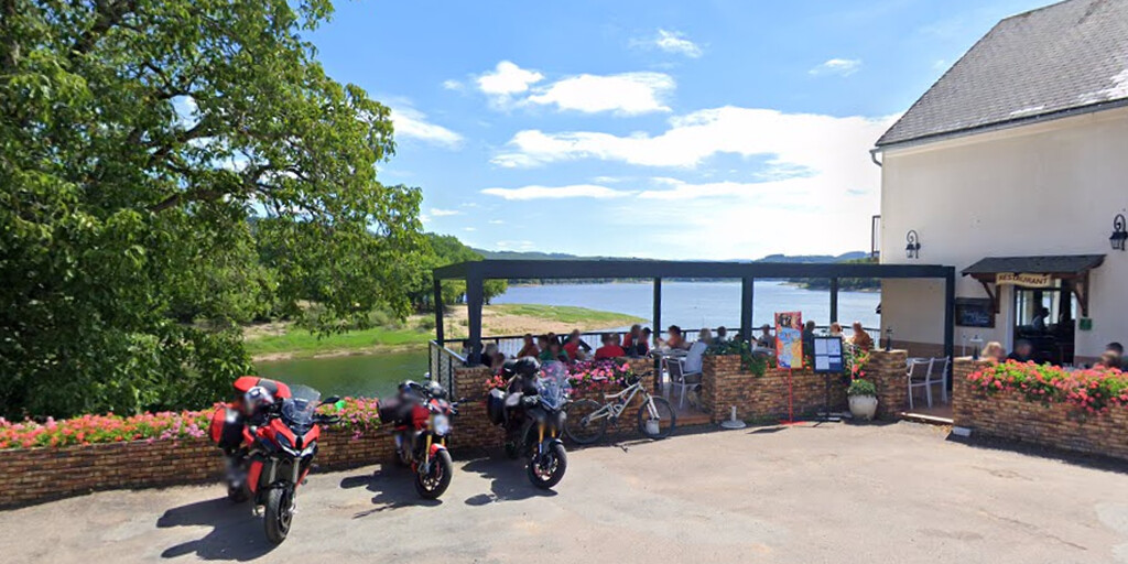
Leaving the city towards Lormes, you first drive downhill and then cycle for a short distance along the Cousin River. This is situated in a beautiful valley. Then you shoot south into the forest. The thirty kilometers to Lormes are a cocktail of winding roads through a green, watery landscape. You'll also be surprised by a beautiful view of Chastellux Castle, which suddenly appears on your right. After Lormes, the landscape opens up a bit, with more meadows and a magnificent panorama of Lake Pannesière-Chaumard. You'll also see numerous streams, flowing capriciously through these meadows at almost the same level as the grass.
Via Château-Chinon and Moutins-Engilbert, we take the D37 through Vandenesse, with its castle dating back to 1465, to the end of the route in Decize. The last stretch is on the N81. This acts as a kind of junction in the lower Burgundy region, opening up all directions from here.
Decize is not only a place from which many roads radiate, it also has a number of bridges, including the most beautiful authentic French stone bridge over the Loire, which is also the end point of this route.
 Links
Links  Usage
Usage Want to download this route?
You can download the route for free without MyRoute-app account. To do so, open the route and click 'save as'. Want to edit this route?
No problem, start by opening the route. Follow the tutorial and create your personal MyRoute-app account. After registration, your trial starts automatically.  Disclaimer
Use of this GPS route is at your own expense and risk. The route has been carefully composed and checked by a MyRoute-app accredited RouteXpert for use on TomTom, Garmin and MyRoute-app Navigation.
Changes may nevertheless have occurred due to changed circumstances, road diversions or seasonal closures. We therefore recommend checking each route before use.
Preferably use the route track in your navigation system. More information about the use of MyRoute-app can be found on the website under 'Community' or 'Academy'.