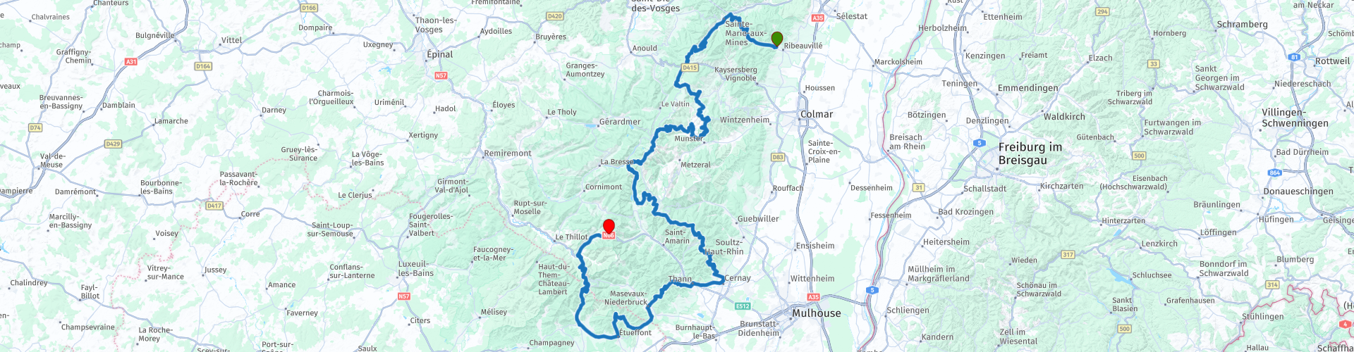
R04 Ribeauville to Urbes

This route was brought to you by:
RouteXpert Hans van de Ven (Mr.MRA)
Last edit: 18-04-2021
 Route Summary
 Starting point: Ribeauville, Au Cheval Blanc
End point: Urbès, Moto-Hotel du Col de Bussang
The route is equalized for Garmin, TomTom and MRA Navigation.
Bon voyage.
 Share this route


Animation

Verdict


Duration
7h 48m

Mode of travel
Car or motorcycle

Distance
232.16 km

Countries

 RouteXpert Review
 This route takes you Ribeauvillé to Urbès, you will pass no less than 11 cols along the way, including the Grand Ballon.
This route is full of curves, from village to village, from col to col, with a few nice stops for a drink and a meal. Also, how could it be otherwise some beautiful viewpoints along the route, where you will stop to take a photo.
During WW1 & WW2 there was also fierce fighting in the Vosges and Alsace, the liberation went a lot more smoothly than in the Ardennes, but given the number of military cemeteries you pass along the way, this already indicates. A visit to the Musee Memorial du Veil and Historial franco-allemand de la Grande Guerre du Hartmannswillerkopf is certainly worthwhile.
I have driven most of this wonderful route, which is why I rate this route with 5 stars. At the top of the Grand Ballon, at 1,425 meters, you have a wide view. The descent consists of spicy hairpin turns.


 Links
Links  Usage
Usage Want to download this route?
You can download the route for free without MyRoute-app account. To do so, open the route and click 'save as'. Want to edit this route?
No problem, start by opening the route. Follow the tutorial and create your personal MyRoute-app account. After registration, your trial starts automatically.  Disclaimer
Use of this GPS route is at your own expense and risk. The route has been carefully composed and checked by a MyRoute-app accredited RouteXpert for use on TomTom, Garmin and MyRoute-app Navigation.
Changes may nevertheless have occurred due to changed circumstances, road diversions or seasonal closures. We therefore recommend checking each route before use.
Preferably use the route track in your navigation system. More information about the use of MyRoute-app can be found on the website under 'Community' or 'Academy'.