MTG2 10 Roundtrip Auvergne Lanobre Condat Riom es Montagnes Lanobre

This route was brought to you by:
RouteXpert René Plücken (MRA Master)
Last edit: 08-09-2025
 Route Summary
 This route comes from the French Motorcycle Tour Guide Part 2 and the original name is "Auvergne Route Description 2: The Cantal Mountains".
In the French Motorcycle Tour Guide, Part 2, a distinction is made between approach routes and tours within a specific area. The approach routes can also be used in conjunction with the routes from the French Motorcycle Tour Guide, Part 1.
The routes have sometimes been slightly modified based on tips Bert Loorbach provides in his description, or because of a different overnight stay, or to meet the minimum 2-hour time limit for the MRA Library. Each route review includes a more detailed description, including overnight options and points of interest along the way, which are also indicated with a point of interest and, if possible, a short description.
This route deserves a 5-star rating. The roads and scenery are beautiful, and there's plenty to see along the way. You can also visit some lovely towns and, of course, the Puy Mary.
 Share this route


Animation

Verdict


Duration
6h 33m

Mode of travel
Car or motorcycle

Distance
227.61 km

Countries

 RouteXpert Review
 In this landscape, where volcanoes dominate, the unique landscape is formed by magma. This is quite different from the Alps or the Pyrenees, which were formed by violent earthquakes.
Motorcycling is a real experience here, and the best time to do it in this area is from June to September. The craters, pristine landscape, and clear air will make you feel like you've stepped back in time. The thrills of twists and turns never end here! There are plenty of campsites in this area, so finding a place to stay shouldn't be a problem.
The review includes links to the other two routes in this area.
This is the review of the second in a series of three routes that wind through the Auvergne. The route has been slightly modified; the original route is a 1-hour and 46-minute drive and starts in Bort-les-Orgues, just south of our starting point, Camping Huttopia Lac de la Siauve on the shores of Bort-les-Orgues Lake. I've also added a section of about 80 kilometers through the volcanic plateau of Le Cézallier, which is also described in the book.
Our first stop, just 5 kilometers away, is the Château de Val, a perfectly preserved castle built in the 15th century. It stands proudly on its own small peninsula jutting out into the lake formed by the construction of the Bort-les-Orgues hydroelectric dam, and its reflection in the still waters reveals the building's elegance.
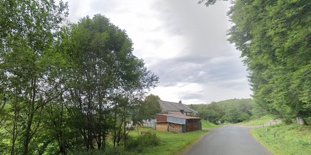
After this short stop, a promising journey begins. We drive along the D49 through a beautiful gorge with wooded slopes, rock faces, lovely bends, and narrow bridges over small rivers. At the village of Champs-sur-Tarentaine-Marchal, we turn right and take the D679 to Coindre. From Sarran, this road follows the contours of the Rhue River, making it a veritable winding route through beautiful nature. We continue to Coindre, where we turn left after the small bridge and continue along the north side of the reservoir to Condat.
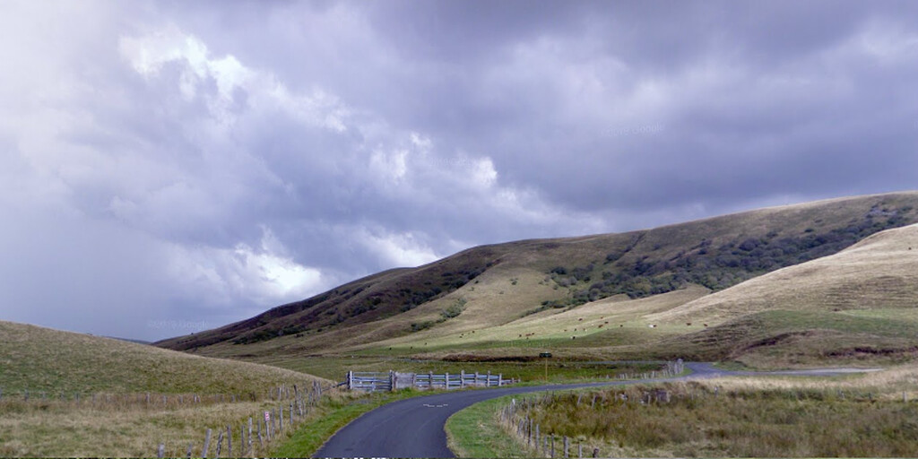
Once in Condat, we find ourselves at the gateway to the volcanic plateau of Le Cézallier, also known as the "Little Scotland of the Auvergne," and in the heart of the Auvergne Volcanoes Regional Natural Park. High above sea level, these plateaus were given their rounded, bumpy shape by glaciers. Rising between the Monts-Dore and the Monts du Cantal, this vast group of granite plateaus is dominated by the Signal du Luguet, with its summit at 1,551 meters. Traditionally, this farmland was home to cows that grazed peacefully on the grass. This desolate area is a plateau at over 1,200 meters, where a basalt layer covers the granite. The area is so flat because the lava flow was so thin, allowing it to spread easily across the landscape. The air is clear, the horizons wide, and there are almost no people.
Anyone captivated by Scotland should definitely consider adding the large 80-kilometer loop through this beautiful green and flat region to their route. In Condat, turn left and take the D536, which becomes the D36, "Col de Chamaroux" to Boutaresse. From there, take the D721 to Anzat-Ie-Leguet, where we join the D23, which winds through the rolling green landscape. We drive the Col de Fortunier, a beautiful narrow road with stunning views.
We take the D21 towards Condat. You can also turn right here onto the D679 via Marcenat to Condat, but the D21, which later becomes the D16, is more scenic. In either case, the route rejoins the original route to Riom-es-Montagnes at La Borie Bass.
Riom-es-Montagnes is situated on a hillside overlooking the Limagne River, and it's recommended to plan a lunch break here so we're fit for the next beautiful leg of this ride. After lunch, we'll take the D3 and D62 to one of the highlights of this route: the Pas de Peyrol, the highest pass in the Massif Central at 1,582 meters, with stunning views of the Cirque de Falgoux. Here you'll also find the Puy Mary, part of the Monts du Cantal. It's a challenging hike from the Peyrol to the summit, which rises to 1,787 meters, but you'll be rewarded with fantastic views of the peaks and valleys.
From here, the original route continues to the finish in Salers. But we'll take the D22 along the Mars River back to Huttopia Lac de la Siauve campsite. This last stretch also offers beautiful winding roads and stunning panoramas.
 Links
Links  Usage
Usage Want to download this route?
You can download the route for free without MyRoute-app account. To do so, open the route and click 'save as'. Want to edit this route?
No problem, start by opening the route. Follow the tutorial and create your personal MyRoute-app account. After registration, your trial starts automatically.  Disclaimer
Use of this GPS route is at your own expense and risk. The route has been carefully composed and checked by a MyRoute-app accredited RouteXpert for use on TomTom, Garmin and MyRoute-app Navigation.
Changes may nevertheless have occurred due to changed circumstances, road diversions or seasonal closures. We therefore recommend checking each route before use.
Preferably use the route track in your navigation system. More information about the use of MyRoute-app can be found on the website under 'Community' or 'Academy'.