Hasta la Vista from Murol

This route was brought to you by:
RouteXpert Jan Koelstra (jan cabrio)
Last edit: 25-03-2025
 Route Summary
 Routes under this umbrella have in common that they all come closer to the Spanish sun, where along the way you will be reunited with (almost) forgotten impressions and memories.
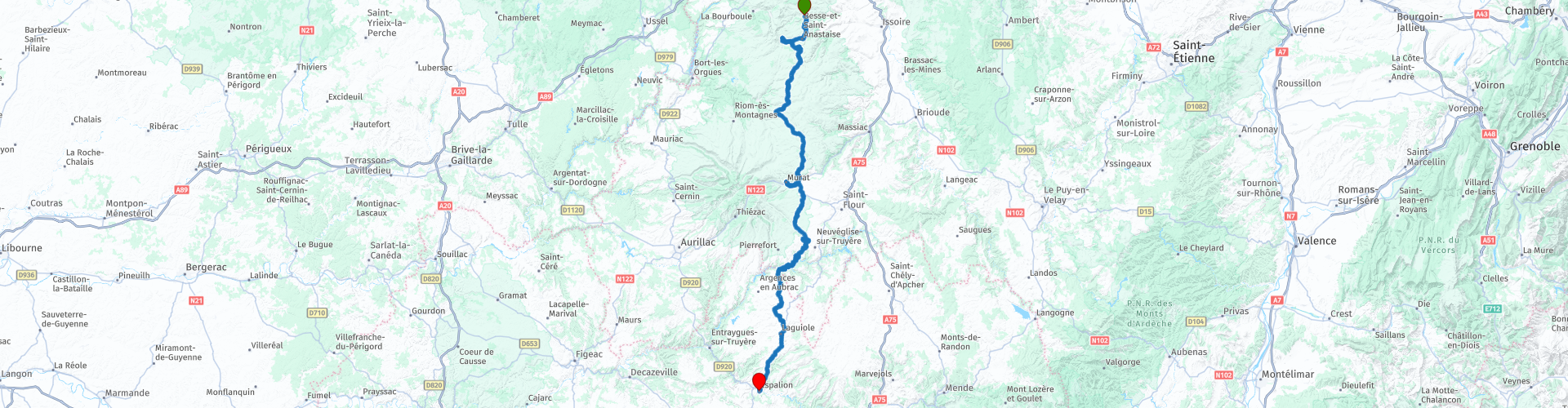
This time the trip goes from Murol to Espalion
The route runs due south through the Auvergne Regional Volcano Park and then through the Aubrac Regional Nature Park.
Afterwards you will have the "deja" feeling back and the gradual transition in building style from brick to natural stone, so you will "experience" Belgium again. And that is certainly worth 5 stars.
 Share this route


Animation

Verdict


Duration
7h 21m

Mode of travel
Car or motorcycle

Distance
200.23 km

Countries

 RouteXpert Review
 Murol, the starting point of this route, is located in the Parc des Volcans d'Auvergne, created in 1977. It is the largest volcanic complex in Europe. This immense area consists of remarkable landscapes, fauna and flora. The Regional Natural Park of the Volcanoes of Auvergne extends from 400 to 1886 m altitude. With 400 hectares, it is the largest regional natural park in metropolitan France.
The characterful medieval village in the Puy-de-Dôme is hidden between the mountains and a large lake, and is therefore also a kind of 'bathing resort'. With its historical heritage, its famous fortress and its location on the shore of Lake Chambon, Murol knows how to charm both history buffs and water rats. A visit to the castle of Murol, a medieval fortress that dominates the village, is definitely not to be missed. There is entertainment at the castle all summer long.
You can refuel in the neighbouring municipality of Besse, which consists of several villages. The largest village is Besse-et-Saint-Anastaise, popularly known as Besse. In contrast to Super-Besse, it is an authentic French village with beautiful monumental buildings and small alleys. This village is located a short distance from the Super Besse ski area. This village also falls under the municipality of Besse. Super-Besse is a real winter sports village and is perfect for ski-in ski-out accommodations.
Near Besse lies the almost round crater lake Lac Pavin. The lake was formed naturally in a volcanic basin. After the last eruption, the crater slowly filled up with water. Now you can sail there with a rowing boat and take beautiful walks around the lake.
Further south in the Auvergne lies a second volcanic field: the Sancy Mountains. Here you will find green hills, but also steep and untouched peaks, wide valleys, vast plains, nature reserves where unique flora and fauna live, fairytale lakes and forests.
The coffee is ready in Allanche, a fortified village built on basalt flows. It offers a panoramic view of the Monts du Sancy and Monts du Cantal from the plateau of Le Cézallier.
The fortified Romanesque church of Saint-Jean Baptiste is one of the few fortified churches in Haute-Auvergne. It was built on a basalt flow forming columns and is surrounded by ramparts.
Winding roads take you along the many streams and valleys with ditto castles. With many views this is a pleasant route. In Murat you come back to the inhabited world.
The history of Murat goes back a long way. The town was already mentioned in the third century AD. In Celtic, the town name means 'steep rock'. The town is built against a slope. But after that mention in the third century, it remains silent in the historical books for a long time, until in the eleventh century it is said that Murat was an influential county, with a castle that had been there 'for a long time'. Lunch is planned here, during which you can take the opportunity to explore the town. In the facades you can clearly recognize the traditional architectural style of the region, with the typical dark volcanic stone. Beautiful buildings from the Renaissance period (16th century) everywhere.
After Murat, the Volcanoes Natural Park becomes the Aubrac Regional Park. The Aubrac plateau, which spans the regions of Occitanie and Auvergne-Rhône-Alpes, is a region with strong traditions and culture. Renowned for its vast plains, its landscapes with endless rolling bends, its cows and its famous 'burons', the barns where the cattle find shelter in inclement weather. Aubrac is also beech forests, streams, lakes and waterfalls, steeper sections and deep gorges. Discover vast deserted plains that change with the seasons. Aubrac lives mainly from agriculture, whether it is breeding Aubrac cows for meat or for milk.
On your way to your destination for today, Espalion, you will first pass through the knife village of Laguiole. In the early 19th century, pocket knives and table knives were made in the village of Laguiole for shepherds and farmers in the region. The 'authentic' knives are still made entirely by hand. The region attracts many tourists who come to visit the knives and workshops. Some workshops offer guided tours where the manufacturing process of the knives is explained. An authentic Laguiole knife is always accompanied by an official certificate when purchased.
Your end point of this route is Espalion. The history of Espalion begins at the height of the Roman Empire. The town originated at an important crossing point over the river Lot. The bridge at this location was part of an important trade route between the modern-day cities of Bordeaux and Lyon. To guard both the trade route and the crossing point, the castle Calmont-d'Olt was built. Until the French Revolution, the town gained wealth thanks to its tanneries. The castle lost its strategic value after the Hundred Years' War and fell into disrepair. Over the centuries, the town has been well preserved. A good example of this is the so-called Pont-Vieux. This old bridge over the river Lot is centuries old and is listed on the UNESCO World Heritage List, as part of the pilgrimage route to Santiago de Compostela.
Nowadays, Espalion is a nice place to visit when you are spending your holiday in the Aveyron department. Although the town is not particularly large, a walk through the historical centre is definitely worth it. For example, you can visit the Pont-Vieux. This bridge dates from the eleventh century AD. Along the river Lot, you can see several old tanneries: a reminder of the past in which the town played an important role in the leather industry. An exploration of this nice town can be perfectly combined with a visit to the nearby castle Calmont d'Olt. From the high rock on which this castle is located, you can enjoy a beautiful view over the town!


 Links
Links  Usage
Usage Want to download this route?
You can download the route for free without MyRoute-app account. To do so, open the route and click 'save as'. Want to edit this route?
No problem, start by opening the route. Follow the tutorial and create your personal MyRoute-app account. After registration, your trial starts automatically.  Disclaimer
Use of this GPS route is at your own expense and risk. The route has been carefully composed and checked by a MyRoute-app accredited RouteXpert for use on TomTom, Garmin and MyRoute-app Navigation.
Changes may nevertheless have occurred due to changed circumstances, road diversions or seasonal closures. We therefore recommend checking each route before use.
Preferably use the route track in your navigation system. More information about the use of MyRoute-app can be found on the website under 'Community' or 'Academy'.

Occitanie
About this region
Occitanie (French pronunciation: [ɔksitani] (listen); Occitan: Occitània [utsiˈtanjɔ]; Catalan: Occitània [uksiˈtaniə]), Occitany or Occitania (), is the southernmost administrative region of metropolitan France excluding Corsica, created on 1 January 2016 from the former regions of Languedoc-Roussillon and Midi-Pyrénées. The Council of State approved Occitanie as the new name of the region on 28 September 2016, coming into effect on 30 September 2016.The modern administrative region is named after the larger cultural and historical region of Occitania, which corresponds with the southern third of France. The region Occitanie as it is today covers a territory similar to that ruled by the Counts of Toulouse in the 12th and 13th centuries. The banner of arms of the Counts of Toulouse, known colloquially as the Occitan cross, is used by the modern region and is also a popular cultural symbol. In 2015, Occitanie had a population of 5,839,867.
Read more on Wikipedia
View region
 Statistics
  78
78Amount of RX reviews (Occitanie)
 27156
27156Amount of visitors (Occitanie)
 3887
3887Amount of downloads (Occitanie)
 Route Collections in this region
 25 Magnificent trails in France
This MRA route collection contains 25 beautiful motorcycle routes in different parts of France, such as the Ardennes, the Alsace, Vercors, the Drôme, the Ardèche, Cote d'Azure, Gorges du Verdon, the Ariège, the Dordogne and Brittany.
The routes have been carefully created by Bert Loorbach, who is an enthusiastic motorcyclist himself. He lived in France for a year and a half, during which time he devoted himself to mapping the unknown and beautiful back roads of France especially for motorcyclists.
The routes are bundled in the Motortourgids France part 1 of Kosmos publishing house and now also available in MyRouteApp.
I have taken over the routes in MRA and sometimes adjusted them slightly to make them even more interesting for the motorcyclist.
View Route Collection
24 Magnificent trails in France
It is clear that France is one of the most beautiful and best touring countries. It offers an incredibly varied landscape with good roads and a pleasant climate. It is not for nothing that you see so many motorcyclists there. My previous collection of 25 routes in France (25 Magnificent routes in France) were based on the route descriptions from the Motortourgids France part 1 made by Bert Loorbach.
This collection of 24 routes comes from Motortourgids France part 2. In this collection, a difference has been made between approach routes and motorcycle tours in a certain area. The approach routes can also be used in combination with the routes from Motortourgids France part 1
The routes are sometimes slightly adjusted based on the tips that Bert Loorbach gives in his description, or because of another place to spend the night, or to reach the minimum length of 2 hours for the MRA Library. For each route, the review contains a more detailed description, including options to stay overnight or places of interest along the way, which are also indicated with a POI and if possible with a short description.
Two or more routes have been created for a number of areas, such as for Burgundy, Auvergne, The Alps, Tarn and Cévennes and Nord-Pas de Calais. These routes can be nicely combined in a multi-day trip.
View Route Collection