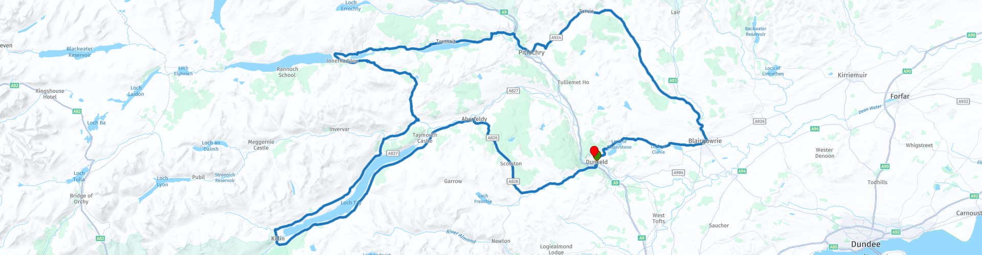
Roundtrip from Dunkeld to Kinloch Rannoch

This route was brought to you by:
RouteXpert Wil van der Helm
Last edit: 30-01-2019
 Route Summary
  Share this route


Animation

Verdict


Duration
3h 53m

Mode of travel
Car or motorcycle

Distance
204.55 km

Countries

 RouteXpert Review
 The rivers Tay, Dochart, Tummel and Ardie.
A tour through the picturesque countryside around rivers of Perthshire. Most roads are easy to ride but some roads are really narrow and carry wild grids along the beautiful hilly landscape of Perth with as big eye catcher the 1083 meter high Schiehallion (the nipple of the virgin).
The ride starts and ends in Dunkeld.
On Rp 4 we find the access road to Bolfrack House and Gardens, a garden that is not too big with a beautiful view over the Tay Valley, where you stretch art for about 45 minutes. Maybe a nice place for a picnic. Coffee is not available there.
At Loch Tay RP 5 you can visit a "Crannog", an old way of life on stilts in the water from prehistoric times. On the other side of the loch, 5 minutes drive back you can go for coffee or lunch.
We follow Loch Tay on the south side to Killin RP 7, here in the bend a special rapids in the river Dochart, nice to stop and walk over the huge boulders. Also here is the old cemetery of the MacNab Clan. Coffee or lunch is also possible in the village.
We continue our way on the north side of Loch Tay and keep miles of sight on the Schiehallion towards Kinloch Rannoch. The last part is a sheep area protected with game grids!
From Kinloch Rannoch we turn back to the east and continue via B847 / B47 along Loch Tummel. Picnic spots are over here. On RP 15 we arrive at Queens View, worth stopping for a while and enjoying a beautiful view over Loch Tummel.
We continue the B8019 at RP 16 you can choose to visit Blair Castle, it is also a large recreational area where you can take some time out. The choice for you.
From Pitlochry we continue east and follow the Ardie river to finally arrive in Dunkeld again.


 Usage
Usage Want to download this route?
You can download the route for free without MyRoute-app account. To do so, open the route and click 'save as'. Want to edit this route?
No problem, start by opening the route. Follow the tutorial and create your personal MyRoute-app account. After registration, your trial starts automatically.  Disclaimer
Use of this GPS route is at your own expense and risk. The route has been carefully composed and checked by a MyRoute-app accredited RouteXpert for use on TomTom, Garmin and MyRoute-app Navigation.
Changes may nevertheless have occurred due to changed circumstances, road diversions or seasonal closures. We therefore recommend checking each route before use.
Preferably use the route track in your navigation system. More information about the use of MyRoute-app can be found on the website under 'Community' or 'Academy'.