07 Kleitoria Elliniko

This route was brought to you by:
RouteXpert Hans van de Ven (Mr.MRA)
Last edit: 18-12-2022
 Route Summary
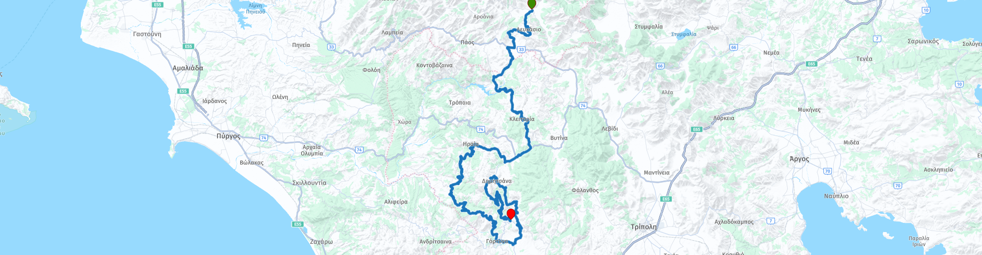
 This seventh route takes you past a centuries-old bridge and a monastery in the mountains.
This route also has a variety of roads, from a very tight road surface to an unpaved path. But you will find that it is not a punishment, you get value for money.
The great surroundings and beautiful views ensure that this route deserves 4 stars.
Starting point: Mont Helmos, Kleitoria
End point: Rocabella, Trikolona
Have a good trip (Καλό ταξίδι)
 Share this route


Animation

Verdict


Duration
9h 20m

Mode of travel
Car or motorcycle

Distance
195.50 km

Countries

 RouteXpert Review
 After about 50 km you arrive in Valtesiniko and you can taste local delicacies. After this stop you wind further south through the beautiful interior. After another short part of the main road, you quickly turn off into the back roads. You pass several villages where you can stop for a photo or a sanitary stop. There are also plenty of opportunities to stop to capture the stunning scenery. After another short stretch (3 km) of dirt road, you will start the loop around your end point.
After about 150 km a stop to refill your tank and to replenish some provisions for the road. Soon a very winding mountain track in a wooded area looms in front of you that will make you love it. Along the way, 2 stops are planned to photograph a monastery built in the rocks and of course to enjoy the great view.
After the last stop it is only about 5 km to the hotel, where you can try again to swim an Olympic record.


 Links
Links  Usage
Usage Want to download this route?
You can download the route for free without MyRoute-app account. To do so, open the route and click 'save as'. Want to edit this route?
No problem, start by opening the route. Follow the tutorial and create your personal MyRoute-app account. After registration, your trial starts automatically.  Disclaimer
Use of this GPS route is at your own expense and risk. The route has been carefully composed and checked by a MyRoute-app accredited RouteXpert for use on TomTom, Garmin and MyRoute-app Navigation.
Changes may nevertheless have occurred due to changed circumstances, road diversions or seasonal closures. We therefore recommend checking each route before use.
Preferably use the route track in your navigation system. More information about the use of MyRoute-app can be found on the website under 'Community' or 'Academy'.

Peloponnese
About this region
The Peloponnese () or Peloponnesus (; Greek: Πελοπόννησος, romanized: Pelopónnēsos, IPA: [peloˈponisos]) is a peninsula and geographic region in southern Greece. It is connected to the central part of the country by the Isthmus of Corinth land bridge which separates the Gulf of Corinth from the Saronic Gulf. During the late Middle Ages and the Ottoman era, the peninsula was known as the Morea (Byzantine Greek: Μωρέας), a name still in colloquial use in its demotic form (Greek: Μωριάς).
The peninsula is divided among three administrative regions: most belongs to the Peloponnese region, with smaller parts belonging to the West Greece and Attica regions.
Read more on Wikipedia
The peninsula is divided among three administrative regions: most belongs to the Peloponnese region, with smaller parts belonging to the West Greece and Attica regions.
View region
 Statistics
  9
9Amount of RX reviews (Peloponnese)
 1625
1625Amount of visitors (Peloponnese)
 114
114Amount of downloads (Peloponnese)