TTT 2009 03 Harlingen Nijeveen

This route was brought to you by:
RouteXpert Hans van de Ven (Mr.MRA)
Last edit: 20-03-2019
 Route Summary
 The 173 ANWB Promoter TankTasTocht (TTT) were scanned by Henry ten Dam and signed by Leon Stolk in Mapsource and later placed as a Track in a .gpx file. These have been made available through the MrGPS website with the approval of the ANWB Promoter so that everyone can enjoy it. The 1st TTT is from 1992, so the route may differ slightly from the original.
I have checked all route points and, where necessary, placed them on the road. Also, if necessary, I have further spaced the start point and end point of the route to avoid navigating directly to the end point, and I added the POI files from the start and end point just like a possible stop.
Finally, I made the route the same for TomTom, Garmin and MyRoute-app Navigation users.
Thanks to Henry, Leon, MrGPS and Promoter.
 Share this route


Animation

Verdict


Duration
3h 8m

Mode of travel
Car or motorcycle

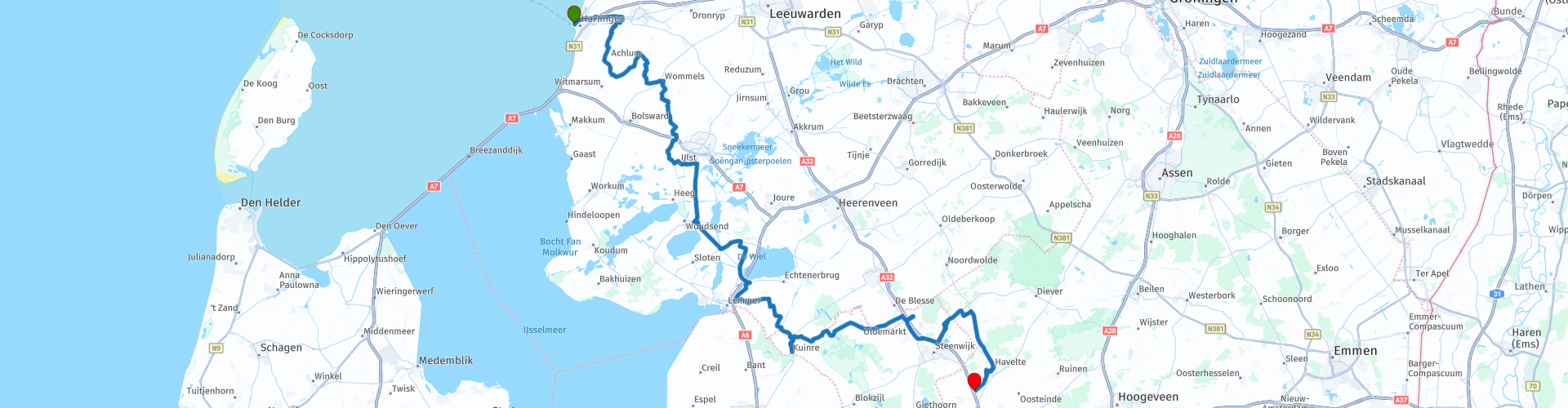
Distance
130.28 km

Countries

 RouteXpert Review
 * Harlingen is a city in the Dutch province of Friesland and the capital of the municipality of the same name. It is located west of Franeker and north of the Afsluitdijk on the Wadden Sea. Harlingen is one of the eleven Frisian cities. (Source: Wikipedia).
After the start you first go to Franeker and then turn to Sneek, where you drive between the Frisian Lakes ** to the lunch location in Bantega. After lunch you will drive along the Worstdijk past De Tjonger or Kuinder ***. Then you go in the direction of Steenwijk and Havelte to end this Tank Bag Tour at the end point in Nijeveen.
** The Frisian Lakes is a tourist area in the southwest and middle of Friesland. There are 30 lakes in the area and especially in the summer, the area attracts many water sports enthusiasts.
The largest and most important Frisian lakes are the Groote Brekken (Grutte Brekken), Sneekermeer (Snitser Mar), Tjeukemeer (Tsjûkemar), Heegermeer (Hegemer Mar), Fluessen (Fluezen) and Slotermeer (Sleattemer Mar). Most Frisian lakes are located in the so-called Southwest corner, but also the lakes at Grouw, Eernewoude and Bergum are usually counted as part of the area. (Source: Wikipedia).
*** The Tjonger or Kuinder is a river that runs from southeast to the south of the province of Friesland. The Tjonger and the Opsterlandse Compagnonsvaart are part of the Turfroute and are 42 km long. (Source: Wikipedia).
Because I have not (yet) driven this route myself, this route gets 3 stars.
Route details:
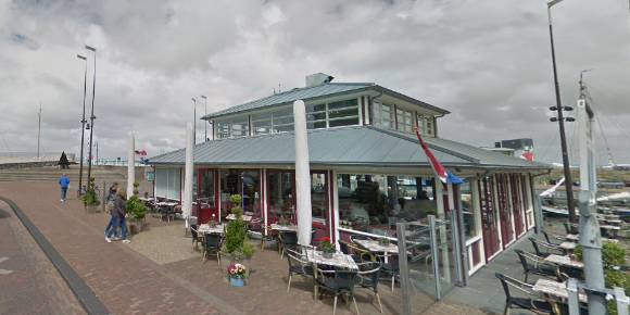
rp 17 - Lunch possibility at t Sluis in Bantega.

 Links
Links  Usage
Usage Want to download this route?
You can download the route for free without MyRoute-app account. To do so, open the route and click 'save as'. Want to edit this route?
No problem, start by opening the route. Follow the tutorial and create your personal MyRoute-app account. After registration, your trial starts automatically.  Disclaimer
Use of this GPS route is at your own expense and risk. The route has been carefully composed and checked by a MyRoute-app accredited RouteXpert for use on TomTom, Garmin and MyRoute-app Navigation.
Changes may nevertheless have occurred due to changed circumstances, road diversions or seasonal closures. We therefore recommend checking each route before use.
Preferably use the route track in your navigation system. More information about the use of MyRoute-app can be found on the website under 'Community' or 'Academy'.