TTT 2012 04 Enkhuizen Watergang

This route was brought to you by:
RouteXpert Hans van de Ven (Mr.MRA)
Last edit: 17-08-2019
 Route Summary
 The 173 ANWB Promoter TankTasTocht (TTT) were scanned by Henry ten Dam and signed by Leon Stolk in Mapsource and later placed as a Track in a .gpx file. These have been made available through the MrGPS website with the approval of the ANWB Promoter so that everyone can enjoy it. The 1st TTT is from 1992, so the route may differ slightly from the original.
I have checked all route points and, where necessary, placed them neatly on the road. I have also, if necessary, set the starting point and end point of the route a little further apart to prevent navigation to the end point directly and added the POI files of the starting point and end point just like a possible stopping point.
Finally, I made the route the same for TomTom, Garmin and MyRoute-app Navigation users.
Thanks to Henry, Leon, MrGPS and Promoter.
 Share this route


Animation

Verdict


Duration
3h 10m

Mode of travel
Car or motorcycle

Distance
128.59 km

Countries

 RouteXpert Review
 * De Goorn is a village in the municipality of Koggenland, in the Dutch province of Noord-Holland. The village has approximately 2800 inhabitants. Together with Avenhorn, the village forms the capital of the municipality of Koggenland, the town hall is in De Goorn. (Source: Wikipedia).
After lunch it will continue towards Monnickendam and you can stop at the Uitdammerdijk for a photo to finally arrive at the end point in Watergang where you can finish this TTT with a cup of coffee at restaurant Dijks.
Because I have not (yet) driven this route myself, this route gets 3 stars.
Route details:
The route has been made the same for TomTom, Garmin and MyRoute-app Navigation users. That has been successful everywhere except in Animals between route points 53 and 54 (Purple), where TomTom and Garmin disagree. Not a big problem, if you drive alone you just follow the instructions of your GPS, if you drive in a group then you follow the driver. From route point 54 the two come together again and your GPS will follow the route correctly again.
Colored route points:
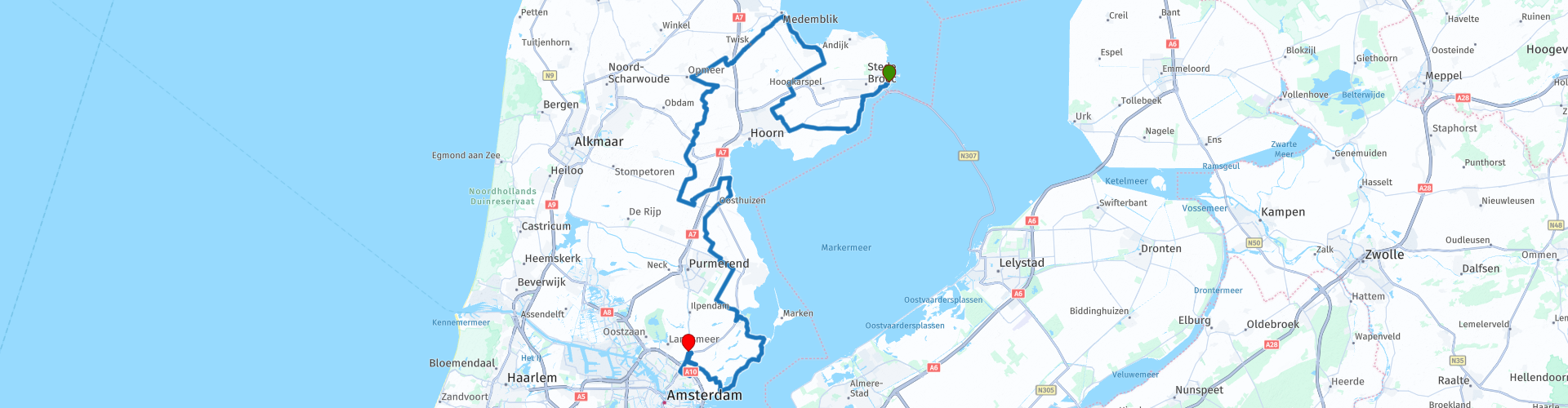
rp 1 - Start at Stationscafe in Enkhuizen
rp 22 - Lunch possibility at Snackbar Daisy, or a little further at: Eetcafé 70
rp 46 - Photo stop on the Uitdammerdijk
rp 53 - Start of the difference between the TomTom and Here map
rp 54 - End of difference between TomTom and Here map
rp 55 - End point at restaurant Dijks in Watergang


 Links
Links  Usage
Usage Want to download this route?
You can download the route for free without MyRoute-app account. To do so, open the route and click 'save as'. Want to edit this route?
No problem, start by opening the route. Follow the tutorial and create your personal MyRoute-app account. After registration, your trial starts automatically.  Disclaimer
Use of this GPS route is at your own expense and risk. The route has been carefully composed and checked by a MyRoute-app accredited RouteXpert for use on TomTom, Garmin and MyRoute-app Navigation.
Changes may nevertheless have occurred due to changed circumstances, road diversions or seasonal closures. We therefore recommend checking each route before use.
Preferably use the route track in your navigation system. More information about the use of MyRoute-app can be found on the website under 'Community' or 'Academy'.