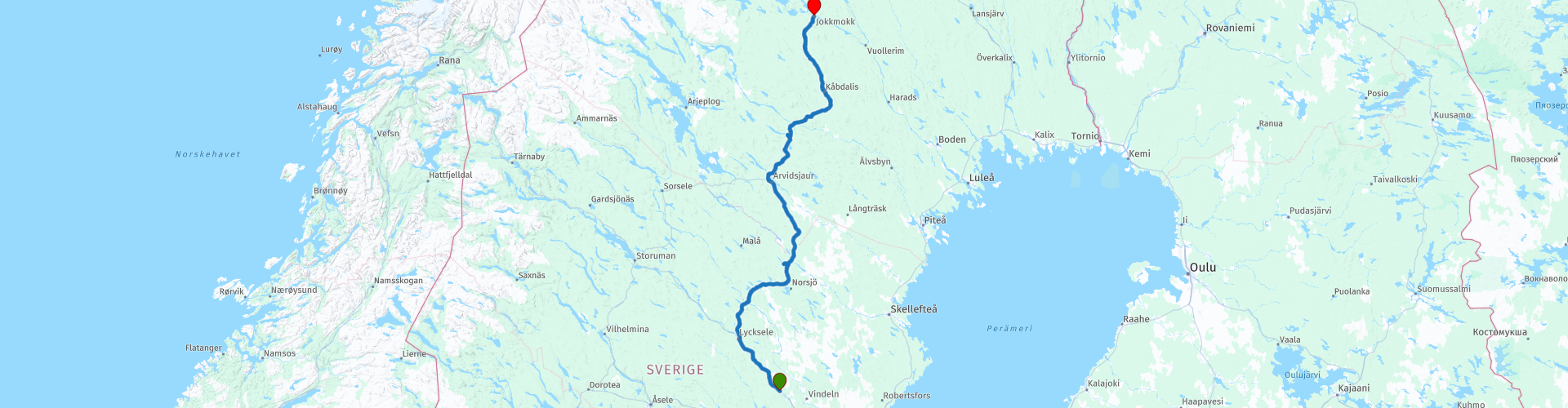
05 Grano to Jokmokk

This route was brought to you by:
RouteXpert Leon Bodegom
Last edit: 20-08-2021
 Route Summary
 This was part 5 of our 2019 tour and introduction to Sweden. There is plenty to see and visit along the way. However, keep in mind the opening times of places to visit. The tourist season is short and in various places the sights were sometimes only opened after Whit Monday. In this part there are several beautiful stops for a visit and even though the number of daylight hours is high in the summer, the days are still short to see everything. The number of possible stopping places is significantly less here in the far north. Use the links in the review to the various websites for the current opening hours. Here in the north, there are fewer and fewer facilities along the route. Observe the tank and places to eat when it suits you, but pay attention to the distances to the next possible stop.
Quiet roads and curves alternate with many forests and green hills. Here in the north, the chances of spotting moose right along the road are very good. Take the wildlife crossing warning here seriously. The main roads are provided with fencing to prevent collisions with animals.
Start: Grano, Beckasin lodges and campground
End: Jokkmokk, Hotel Jokkmokk
I have awarded this route with 3 *** stars because the sloping forest landscape is pleasant and extremely quiet to drive. Enough to enjoy the surroundings. The roads are very good and the various attractions mentioned are a nice break from this journey. They are also often the places for a possible coffee stop.
 Share this route


Animation

Verdict


Duration
9h 12m

Mode of travel
Car or motorcycle

Distance
369.95 km

Countries

 RouteXpert Review
 The locations for a possible coffee stop are increasingly limited here in the north. So bringing something to eat and drink is not a wrong choice. And in this quiet area there are also plenty of places for a picnic. Drive onto a side road and you imagine yourself alone in the world.
After the first 140 Km you will drive under a cable car. Here the route goes to the starting point of the cable car. A piece of industrial heritage and it is for sale. This 13 Km long cable car is built for the transport of minerals from the mine further up the road. This solution was built because the surface was too soft for heavy transport. In the links to this route also a link to a Youtube film about this line. This line has already been used as a tourist attraction, but it is not profitable. Given the current safety requirements, it will not be easy to put this into use. Near this starting point there is also a conference center where something is available.
The route continues to go more northerly and goes directly with the rail connection. The track is then left again and then right again of your route. This track is mainly used for freight transport. You can see entire forests pass by here in the long wagons with tree trunks.
Only in Arvidsjaur is there another opportunity to buy something to eat or drink. The place does not have much to offer, most likely it is in the center where there is a pavilion next to a park. Shortly afterwards there are also some small places such as a Thai, Pizza and a Greek restaurant. But if you drive through Arvidsjaur you come just outside the built-up area at a local museum (Hembygdsmuseet). This is open all year round and they always have coffee, authentic homemade cakes / pastries and something to see too. This is a local exhibition about the life of the Sami, the original inhabitants of this northern region.
There are few roads to the north of Sweden. So this is now more of a route on the main road E45.
At Moskosel the route goes to a railway museum. Here is an exhibition of how the railway was built by hand in the early 1900s. Due to the importance of the connection, this route had to be kept open in winter. You can also see how that was / is done in the museum.
At the next place Kabdalis you will also find a few ski slopes against the hills. The height differences in the predominantly sloping landscape are not spectacular, but enough to make some descents on skis. Because of this, it will be lively with the winter day and this place will have some eateries as well. During our passage there was little to do that was open.
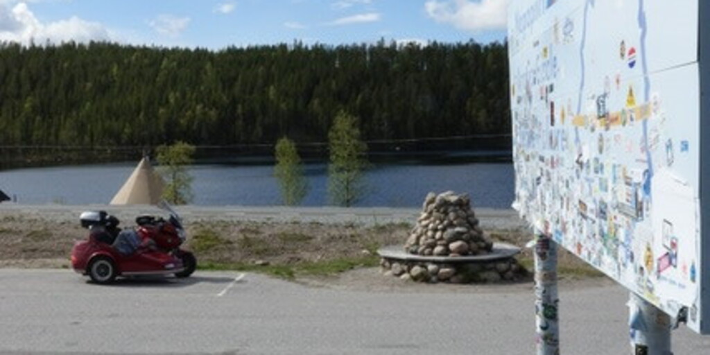
You will pass the Arctic Circle 8 kilometers before the end point. Obviously a photo stop and possibly stick a sticker on the board to leave your mark.
If you arrive in Jokmokk on time, you can still visit the Ajtte museum in this place. Here you will find an exhibition about the Sami, the original inhabitants of this part of Sweden.
For camping enthusiasts, there is also a camping pitch near the final destination. On the other side of Jokmokk as where you enter Jokmokk are the only 2 campsites that you can find in the wider area.
Except for endless cruising on quiet roads, there is also something to see on this route.

 Links
Links  Usage
Usage Want to download this route?
You can download the route for free without MyRoute-app account. To do so, open the route and click 'save as'. Want to edit this route?
No problem, start by opening the route. Follow the tutorial and create your personal MyRoute-app account. After registration, your trial starts automatically.  Disclaimer
Use of this GPS route is at your own expense and risk. The route has been carefully composed and checked by a MyRoute-app accredited RouteXpert for use on TomTom, Garmin and MyRoute-app Navigation.
Changes may nevertheless have occurred due to changed circumstances, road diversions or seasonal closures. We therefore recommend checking each route before use.
Preferably use the route track in your navigation system. More information about the use of MyRoute-app can be found on the website under 'Community' or 'Academy'.

Vasterbottens lan
About this region
Västerbotten County (Swedish: Västerbottens län) is a county or län in the north of Sweden. It borders the counties of Västernorrland, Jämtland, and Norrbotten, as well as the Norwegian county of Nordland and the Gulf of Bothnia. Its capital is Umeå, which combined with the largest town in the northern part Skellefteå house about half of the population, with the two municipalities themselves making up the majority of the populace. The vast wilderness areas make Västerbotten County have a larger land area than Denmark, the Netherlands or Switzerland.
Read more on Wikipedia
View region
 Statistics
  2
2Amount of RX reviews (Vasterbottens lan)
 8967
8967Amount of visitors (Vasterbottens lan)
 64
64Amount of downloads (Vasterbottens lan)