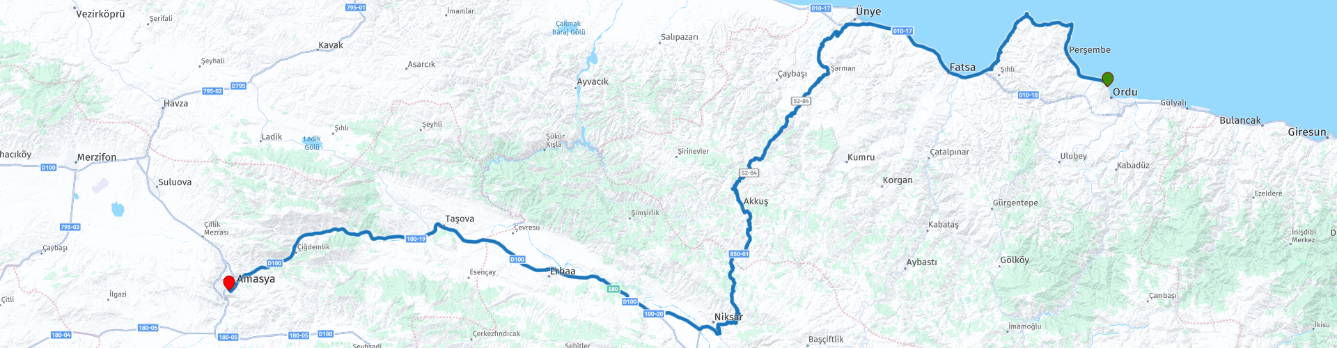
09 Ordu to Amasya

This route was brought to you by:
RouteXpert Yannis Papadiotis (wheelboy)
Last edit: 12-03-2026
 Route Summary
 Turkey isn’t just a country, it’s a rider’s playground. This is the 9th of 12 stage journey takes you from Aegean coastlines through mountains, plains, and fairytale valleys all the way to the Black Sea and back west again.
Each leg has its own flavor, so here’s a deeper look.
Route 9:
From Ordu to Amasya, this route blends Black Sea mythology with inland mountain riding and one of Turkey’s most dramatic city arrivals. Yason Burnu offers legendary coastal scenery, while Ünye Castle adds 2,500 years of layered history. The climb past Akkuş marks the highest point of the day before descending toward Niksar, where a castle detour rewards with sweeping plain views. The ride concludes in Amasya, set spectacularly beneath the Pontic King Rock Tombs along the Yeşilırmak River. Coastal roads, forested elevations, and a historic valley combine seamlessly.
A 4* route delivering scenery, heritage, and strong riding flow in one continuous narrative.
 Share this route


Animation

Verdict


Duration
5h 28m

Mode of travel
Car or motorcycle

Distance
293.26 km

Countries

 RouteXpert Review
 Continuing westward, the route reaches Ünye Castle, a fortress with approximately 2,500 years of layered history. Recently reopened after restoration, the site reveals rock cut tombs, ancient cisterns, and internal tunnels accessed by a modern rail assisted system. Wooden stairways now guide visitors safely to panoramic viewpoints atop the volcanic hill. Entry is free, and the blend of Pontic antiquity and modern accessibility makes it a worthwhile cultural pause.
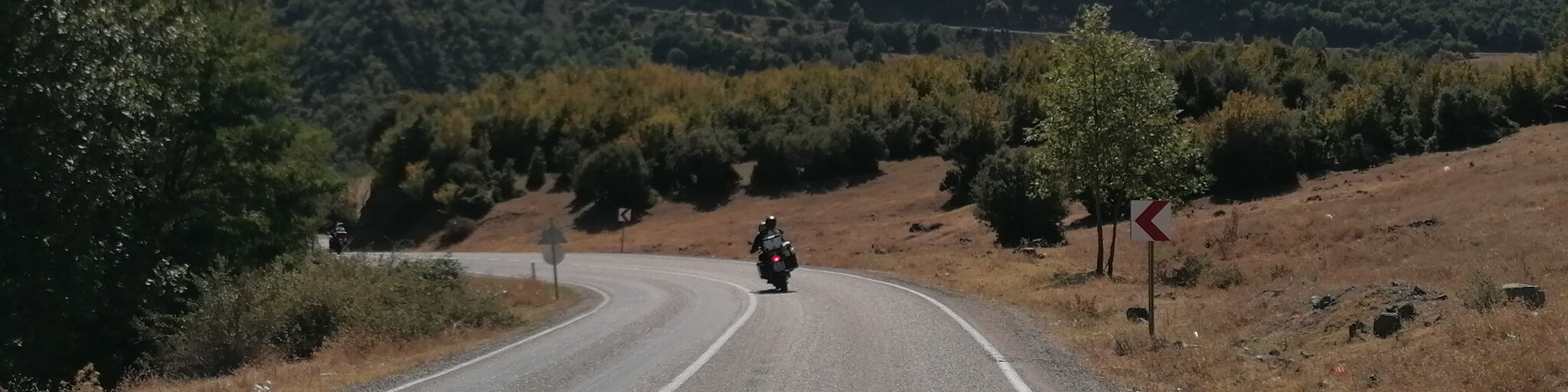
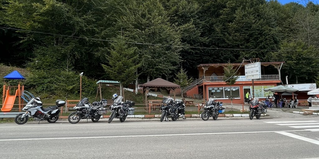
From the coast, the road gradually turns inland and begins its long climb toward Akkus, where the highest point of the day is reached near the village exit. A coffee stop here feels earned. The scenery transitions dramatically: coastal humidity gives way to cooler mountain air, dense forests surround the road, and the Black Sea disappears behind you. The ascent is steady and flowing, offering enjoyable riding without excessive technical demand.
If time allows, a deviation into Niksar Castle adds historical depth. This hilltop fortress, with roots reaching back to Hittite and Roman times, later served as the capital of the Danishmend Emirate. The ruins include sections of the Yağıbasan Madrasa, baths, and mosque remains, all overlooking the fertile Niksar plain. Entry is free, and the panoramic views justify the short detour.
After Niksar you are roughly 200 kilometers after departure, so, a second fuel stop becomes necessary.
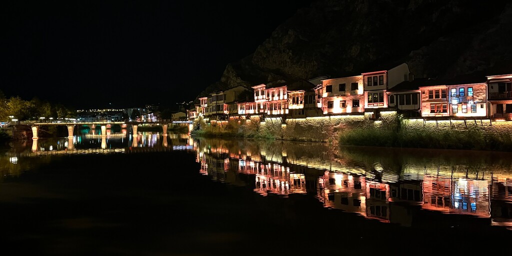
The final leg toward Amasya introduces one of the most visually dramatic arrivals in Anatolia. The city is carved into a narrow valley along the Yeşilırmak River, framed by steep cliffs. Immediately visible are the monumental Pontic King Rock Tombs, carved high into the rock face above the town. After hotel check-in, exploration is effortless. The riverside promenade lined with restored white Ottoman houses provides a picturesque evening walk. Key highlights include Amasya Castle, the Hazeranlar Mansion, the Amasya Archaeological Museum, and the Bayezid II Complex. The city’s identity as a training ground for Ottoman princes and as the birthplace of the geographer Strabo gives it unusual historical depth.
 Links
Links  Usage
Usage Want to download this route?
You can download the route for free without MyRoute-app account. To do so, open the route and click 'save as'. Want to edit this route?
No problem, start by opening the route. Follow the tutorial and create your personal MyRoute-app account. After registration, your trial starts automatically.  Disclaimer
Use of this GPS route is at your own expense and risk. The route has been carefully composed and checked by a MyRoute-app accredited RouteXpert for use on TomTom, Garmin and MyRoute-app Navigation.
Changes may nevertheless have occurred due to changed circumstances, road diversions or seasonal closures. We therefore recommend checking each route before use.
Preferably use the route track in your navigation system. More information about the use of MyRoute-app can be found on the website under 'Community' or 'Academy'.

Ordu
About this region
Ordu (Turkish pronunciation: [ˈoɾdu]) or Altınordu is a port city on the Black Sea coast of Turkey, historically also known as Cotyora or Kotyora (Pontic: Κοτύωρα), and the capital of Ordu Province with a population of 217,640 in the city center.
Read more on Wikipedia
View region
 Statistics
  2
2Amount of RX reviews (Ordu)
 168
168Amount of visitors (Ordu)
 2
2Amount of downloads (Ordu)
 Route Collections in this region
 Riding Across Turkey Route by Route
This route collection offers a complete journey across Turkey, combining iconic landmarks with diverse landscapes.
Starting from the Aegean coast, you explore Ephesus and Pamukkale before heading inland to Lake Salda and Sagalassos. Cappadocia forms a highlight with its unique rock formations and underground cities. The route then crosses central Anatolia’s wide plains toward the rugged east, where quieter roads and dramatic scenery dominate. A major contrast follows along the Black Sea, with green mountains and coastal views. The return west through Bursa and Pergamon adds rich history.
Overall, this is a well balanced itinerary ideal for travelers seeking variety, culture, and scenic driving.
View Route Collection