Daytona to Apalachicola

This route was brought to you by:
RouteXpert Paul Hedges - Adv RouteXpert
Last edit: 16-04-2020
 Route Summary
  Share this route


Animation

Verdict


Duration
5h 40m

Mode of travel
Car or motorcycle

Distance
484.30 km

Countries

 RouteXpert Review
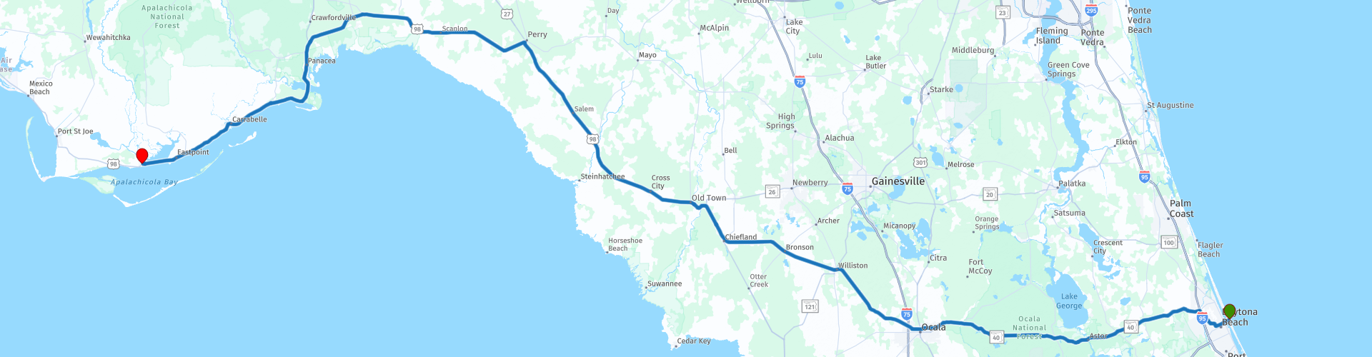
 This epic route starts on the East Coast of Florida on Daytona Beach at the Daytona Beach Main Street Pier as we set out across the state of Florida.
Making your way out of Daytona you connect with FL-40 and follow the Black Bear Scenic Byway. 123 miles along one of Florida’s most distinctive ecosystems known as the Big Scrub. The Big Scrub is the largest continuous sand pine forest created from ancient sand dunes capped with vegetation adapted to a lack of water. This easy riding along free flowing roads which gives time to take in the pine fragranced air and maybe do some bear spotting as you ride through the Ocala National Forest. As you approach the lakes it is time for a coffee and Kern’s Family Kitchen will give a friendly welcome (WP9) Continuing along the scenic route pass through Ocala, known as the horse capitol of the world, before taking Highway 27 heading towards Tallahassee. A wide open road that keeps eating up the miles with easy riding. Arriving in Chiefland the roads slows as the traffic builds and it is time for a fuel break and stretch of the legs(WP12)
The remainder of the days riding is along Route 98 and through USA’s Forgotten Coast. The traffic is light as you are away from the interstate roads and it allows you to take in the feel of ‘old’ Florida without the high rise hotels. You will soon find yourself in Perry and in need of coffee. So a quick stop (WP14) to take a breath and it is back on the road again. The road heads west and when you arrive at Newport you ride the area known as the Big Bend Scenic Byway passing all types of natural scenery from beaches, salt marches, scrub and tidal flats. Small towns will appear and fall behind you as you just take in all that this are has to offer. Follow the road as it nears the coastline and as you ride away from Panacea the waters around you start to dominate the scenery. Crossing Ochlockonee Bay (WP19) the bridge is a mile across so lots of water to be seen everywhere. The road eventually runs alongside the sea so there are chances to stop and take some pictures (WP22) the sea will remain on your left for the rest of the day either in clear view or seen through the trees. Stop in Caravalle at the World’s Smallest Police Station (WP25) for a quick picture. The sea remains on your left as you arrive and cross East Bay (WP27) and the John Gorrie Memorial Bridge into Apalachicola where you stop for the night


 Links
Links  Usage
Usage Want to download this route?
You can download the route for free without MyRoute-app account. To do so, open the route and click 'save as'. Want to edit this route?
No problem, start by opening the route. Follow the tutorial and create your personal MyRoute-app account. After registration, your trial starts automatically.  Disclaimer
Use of this GPS route is at your own expense and risk. The route has been carefully composed and checked by a MyRoute-app accredited RouteXpert for use on TomTom, Garmin and MyRoute-app Navigation.
Changes may nevertheless have occurred due to changed circumstances, road diversions or seasonal closures. We therefore recommend checking each route before use.
Preferably use the route track in your navigation system. More information about the use of MyRoute-app can be found on the website under 'Community' or 'Academy'.