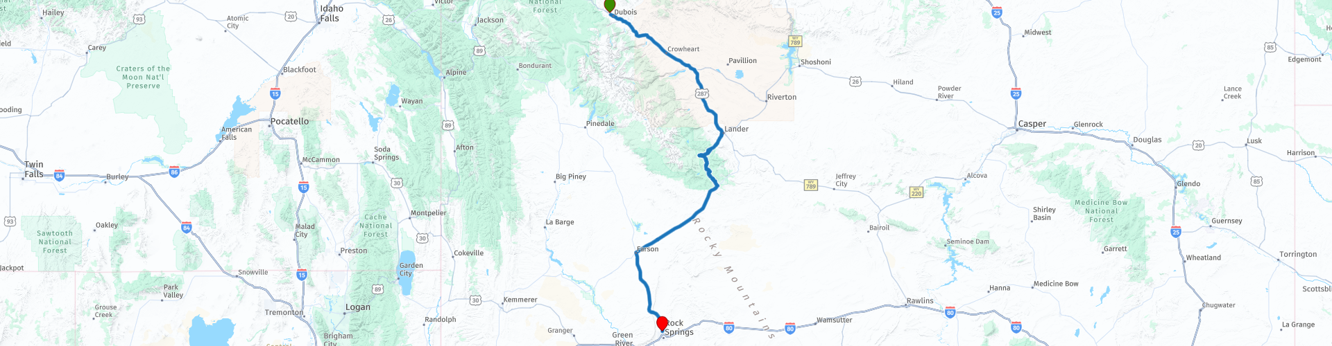
D10 Dubois Rock Springs

This route was brought to you by:
RouteXpert Hans van de Ven (Mr.MRA)
Last edit: 27-12-2019
 Route Summary
 The roads are good and the views wide and beautiful, another day where the photo collection is expanded.
Starting point: Super 8-Dubois.
End point: Best Western Outlaw Inn.
The route has been made the same for TomTom, Garmin and MyRoute-app Navigation users.
Thanks to Richard & Lisa for the information!
 Share this route


Animation

Verdict


Duration
3h 57m

Mode of travel
Car or motorcycle

Distance
323.97 km

Countries

 RouteXpert Review
 If you want to get to know the history of the coal mines, you must visit the Rock Springs Historical Museum, which shows the history of the city and the history of the coal mines and the multicultural heritage that resulted from it.
In the Western Wyoming Community College Campus, you can learn a lot about the region. The halls and surrounding facilities on the campus not only display the history of southwestern Wyoming. You will also become acquainted with artifacts and cultures from all over the world, including 5 life-sized dinosaurs whose fossils have been found in Wyoming. You will also come across the Moai statues of Easter Island and you will encounter some 125 animals from different continents in the Wildlife Museum, which are all set up or copied.
Admission is free everywhere, but keep in mind that the campus is only open during school hours.
After the start in Dubois, after 10 KM you have the opportunity to take some nice pictures at the viewpoint on the Wind River with the table mountain in the background. You regularly pass a river or keep driving along it for a while towards Lander. In Lander you have the possibility to refuel and buy something at a supermarket. Then we drive into Sinks Canyon State Park, this is a public recreation and nature reserve located in the Wind River Mountains, 6 miles southwest of Lander. At the 'Sinks' you should definitely stop for a closer look. The Sinks is a large cave where the flowing river flows in cracks and fissures in the bottom of the cave and disappears under the ground. The river appears again in a gorge in a large lake called "The Rise".
We continue to the Worthen Meadow Reservoir, this is a reservoir in the Shoshone National Forest. The reservoir is fed by Roaring Fork Creek. This environment also provides some beautiful photos.
We drive a bit back to the main road towards Atlantic City, where we reach The Sweetwater River Rest Area, The Sweetwater is a tributary of the North Platte. The river played an important historical role in mass emigration to the western United States in the nineteenth century. The spacious environment of the river is very sparsely populated.
We also stop at the South Pass Overlook, which is located along the National Historic Trail and contains six signs that focus on the early emigration period and the importance of the pass in American history. In Farcon we make a short stop for a drink and then drive along the vast grasslands to the end point in Rock Springs, where you can refuel past the hotel.
In this 4 star route you drive on beautiful good roads, a stop at Sinks Canyon you should definitely do.
History:
Rock Springs was the location of one of the worst ethnic massacres in the history of the United States in the 1880s.
But there is much more to Rock Springs than outrageous headlines. The close-knit community of immigrant miners from 56 countries laid the foundation for the city's culture.


 Links
Links  Usage
Usage Want to download this route?
You can download the route for free without MyRoute-app account. To do so, open the route and click 'save as'. Want to edit this route?
No problem, start by opening the route. Follow the tutorial and create your personal MyRoute-app account. After registration, your trial starts automatically.  Disclaimer
Use of this GPS route is at your own expense and risk. The route has been carefully composed and checked by a MyRoute-app accredited RouteXpert for use on TomTom, Garmin and MyRoute-app Navigation.
Changes may nevertheless have occurred due to changed circumstances, road diversions or seasonal closures. We therefore recommend checking each route before use.
Preferably use the route track in your navigation system. More information about the use of MyRoute-app can be found on the website under 'Community' or 'Academy'.