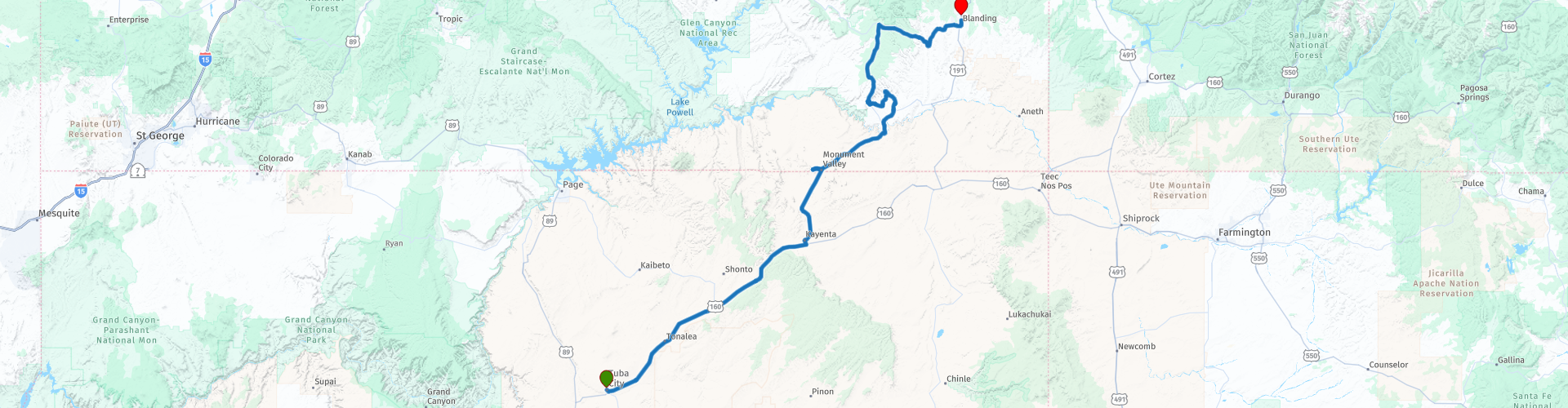
R05 Tuba City Blanding

This route was brought to you by:
RouteXpert Hans van de Ven (Mr.MRA)
Last edit: 02-01-2020
 Route Summary
 You drive north-east on 160 and 163 to Blanding, which is in the state of Utah.
During this journey you will travel through the following states: California, Arizona, Utah & Nevada.
The roads are good, the stop in Monument Valley! And don't forget your camera!
Starting point: Quality Inn Navajo Nation.
End point: Rodeway Inn & Suites.
The route has been made the same for TomTom, Garmin and MyRoute-app Navigation users.
Thanks to Richard & Lisa for the information!
 Share this route


Animation

Verdict


Duration
5h 10m

Mode of travel
Car or motorcycle

Distance
329.77 km

Countries

 RouteXpert Review
 This rock, which by its special shape has become the name giver of the village, is located just east of Mexican Hat. The top gives a view over the area around Mexican Hat and the San Juan River.
The landscape of the Valley of the Gods is characterized by large, red sandstone rock formations in a vast desert landscape. This is reminiscent of the much more famous Monument Valley. The difference is that the Valley of the Gods has not yet been discovered by the general public and you therefore feel you are 'in the middle of nowhere'. After the Valley of the Gods, you drive onto The Moki Dugway, this suddenly unpaved road that goes up with hairpin bends is a real experience! (Not for Campers or caravans). Once at the top you have a phenomenal view of Monument Valley Valley of the Gods at Muley Point. A real must for thrill seekers!
In this 4 star route you mainly drive on good roads, unless you choose to drive through the Valley of the Gods, these 30 KM are unpaved, and also the 4 km over The Moki Dugway are unpaved, but good to drive . Also bring enough water again!
General information:
Monument Valley
Traditionally the home of the Navajo Indians. The area is also a native state of those Indians and is known as the backdrop for many westerns and commercials. The bumps are caused by erosion of the climate and are the hard parts that remain. Most reddish-brown colored rocks are very erratic in shape and are scattered throughout the country. Canyon de Chelly. The Anasazi Indians lived here until 700 years ago. The remaining cliff dwellings are therefore theirs. Now the area is inhabited by Navajo Indians. At the edge of the canyon is a trail to one of the best preserved ruins. It is a half hour walk down and there are beautiful views over the perpendicular walls of the canyon. The Painted Desert, a red and white piece of desert. The red is sandstone, clay with high carbon concentrate or iron oxidation. There is also the petrified forest, the world's largest collection of petrified trees. The tree-shaped lumps are of jasper and agate and 200 million years old. They color beautifully in the sun. It is strictly forbidden to take a piece, no matter how small. The story goes that if you do, it will cause disaster.


 Links
Links  Usage
Usage Want to download this route?
You can download the route for free without MyRoute-app account. To do so, open the route and click 'save as'. Want to edit this route?
No problem, start by opening the route. Follow the tutorial and create your personal MyRoute-app account. After registration, your trial starts automatically.  Disclaimer
Use of this GPS route is at your own expense and risk. The route has been carefully composed and checked by a MyRoute-app accredited RouteXpert for use on TomTom, Garmin and MyRoute-app Navigation.
Changes may nevertheless have occurred due to changed circumstances, road diversions or seasonal closures. We therefore recommend checking each route before use.
Preferably use the route track in your navigation system. More information about the use of MyRoute-app can be found on the website under 'Community' or 'Academy'.